First things: On Sunday I guided a hike up to the top of Mt Scenery; I inadvertently spilled water into my waterproof backpack, where, unbeknownst to me, my digital camera swam unhappily during the descent. So she’s DOA. No pictures, no blog? I’m working through recovery options, but if blogposts get a bit less frequent, well…now you know. Gaaaaaah 😦
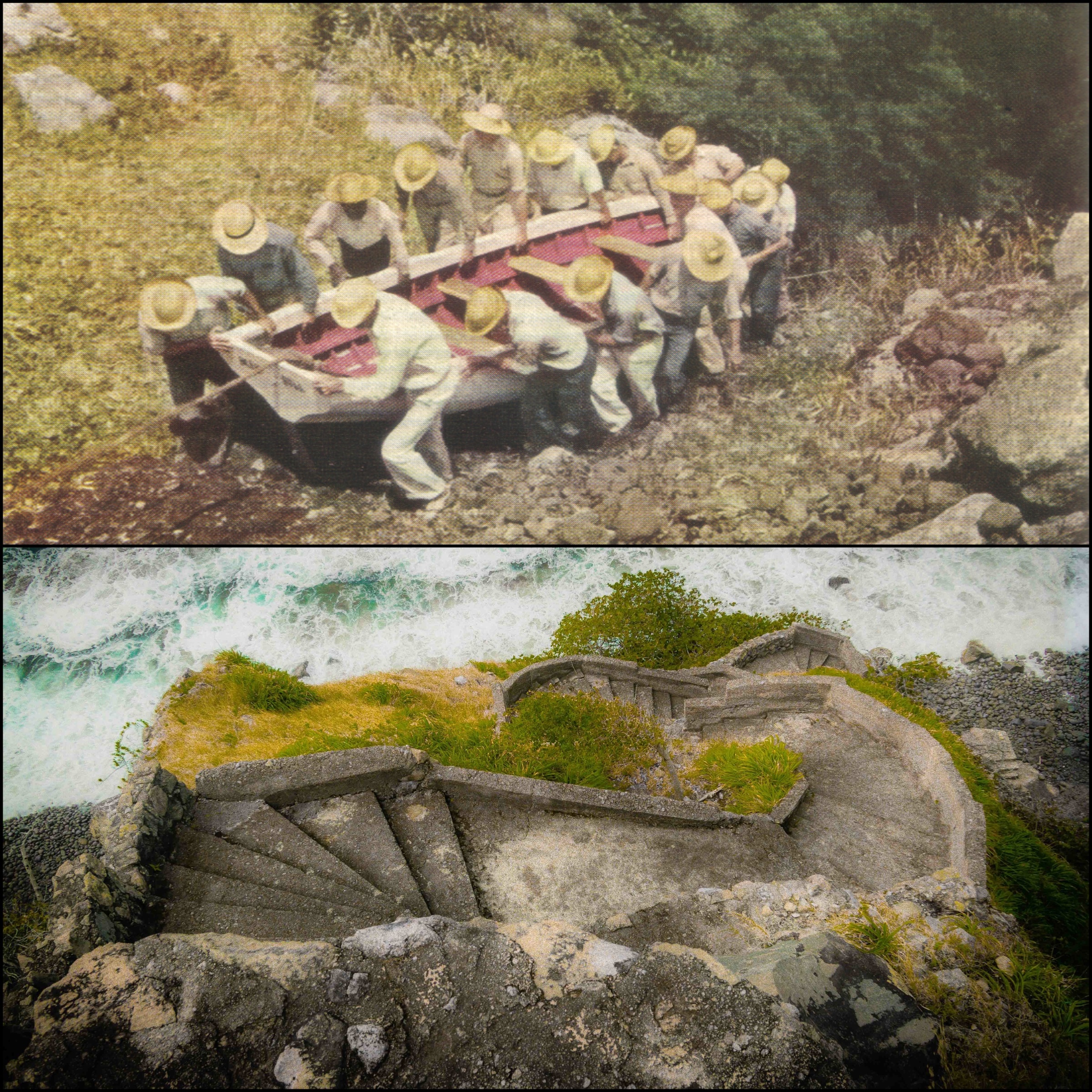
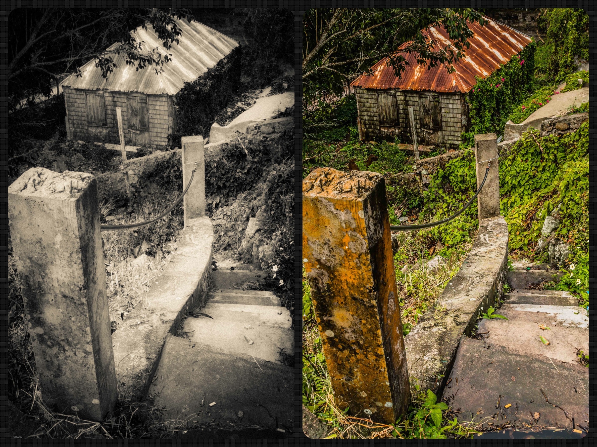
Entrance To The LadderTop: Sabans carry boat up The Ladder in 1940 Bottom: The Ladder today
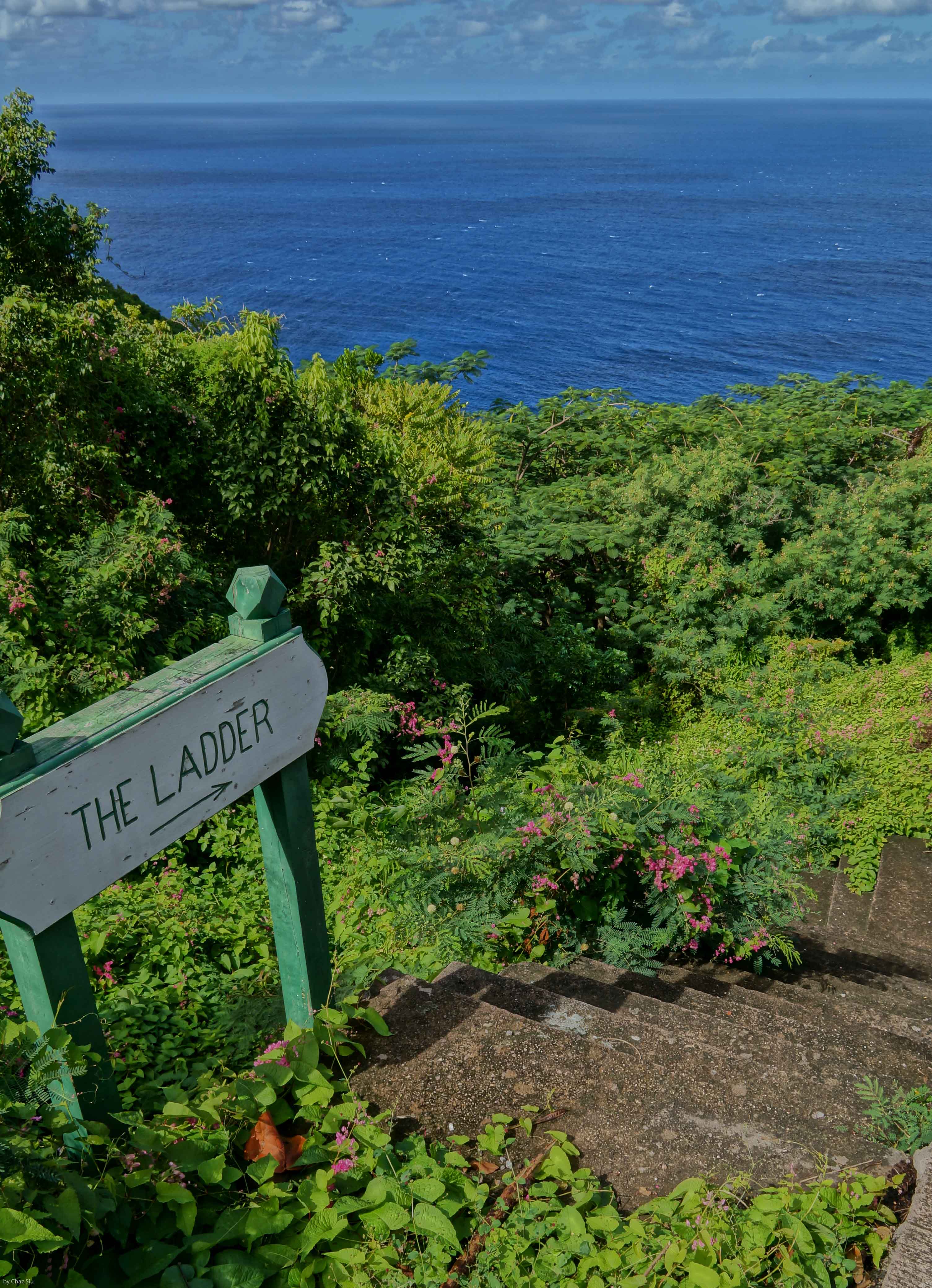
The Ladder
Lets go back in time a bit on Saba…say, . Airport? Nope. Harbor? Uh, no. How about a good old road, maybe? Nada. No, the primary way that Sabans moved goods on and off the island until The Road was completed was The Ladder, 880 stone steps rising 1000 vertical feet out of Ladder Bay to the lee of the island and up to The Bottom. Sabans were famously good sailors. The picture above shows from a 1940 National Geographic article shows Sabans moving their boat up The Ladder. The picture below it is the lower part of The Ladder today, showing the parapet style steps and how vertical they are. Frankly, The Ladder is a strenuous workout today with only a backpack; can’t imagine carrying boats, sacks, and any other basic weighty commodity up and down as part of day to day life: These Sabans are tough folks. I’ve included a
Lower steps of The Ladder.
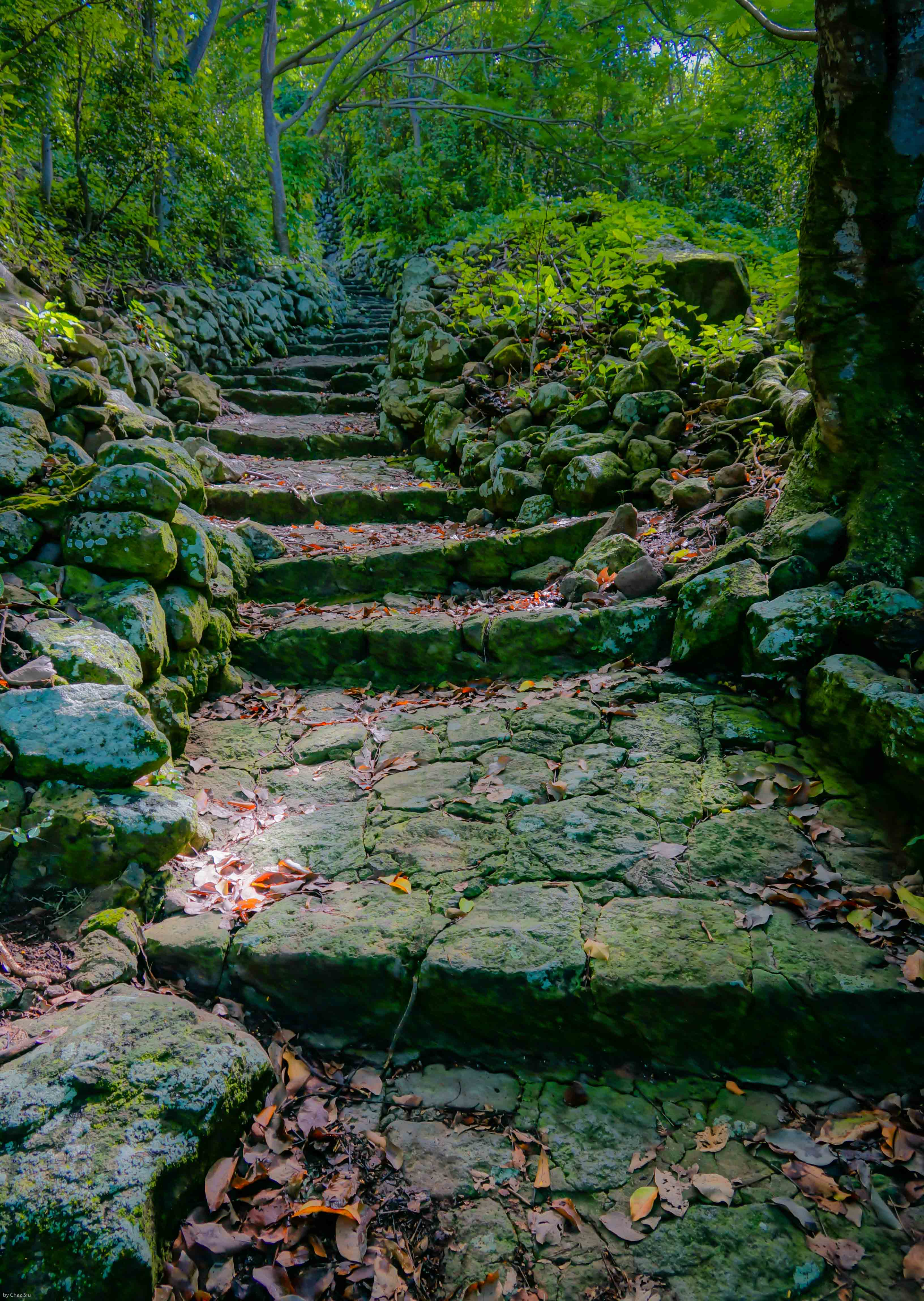
couple more pictures here of The Ladder showing its rise into the forest. It’s still steep enough to avoid if it rains, as the steps become slippy slides of lichen. The swells down at Ladder Bay are typically fierce as you can see, but the early settlers still considered the lee of the island the only place to land your boat safely. Enjoy!
The Ladder and Ladder BayThe Ladder Ascends Into The Bottom
Coming up with clever blogpost taglines that are loosely tied to the subject matter at hand is hard brain work, folks. Ahem…I think a Caesar Salad–hold the croutons–is in order.
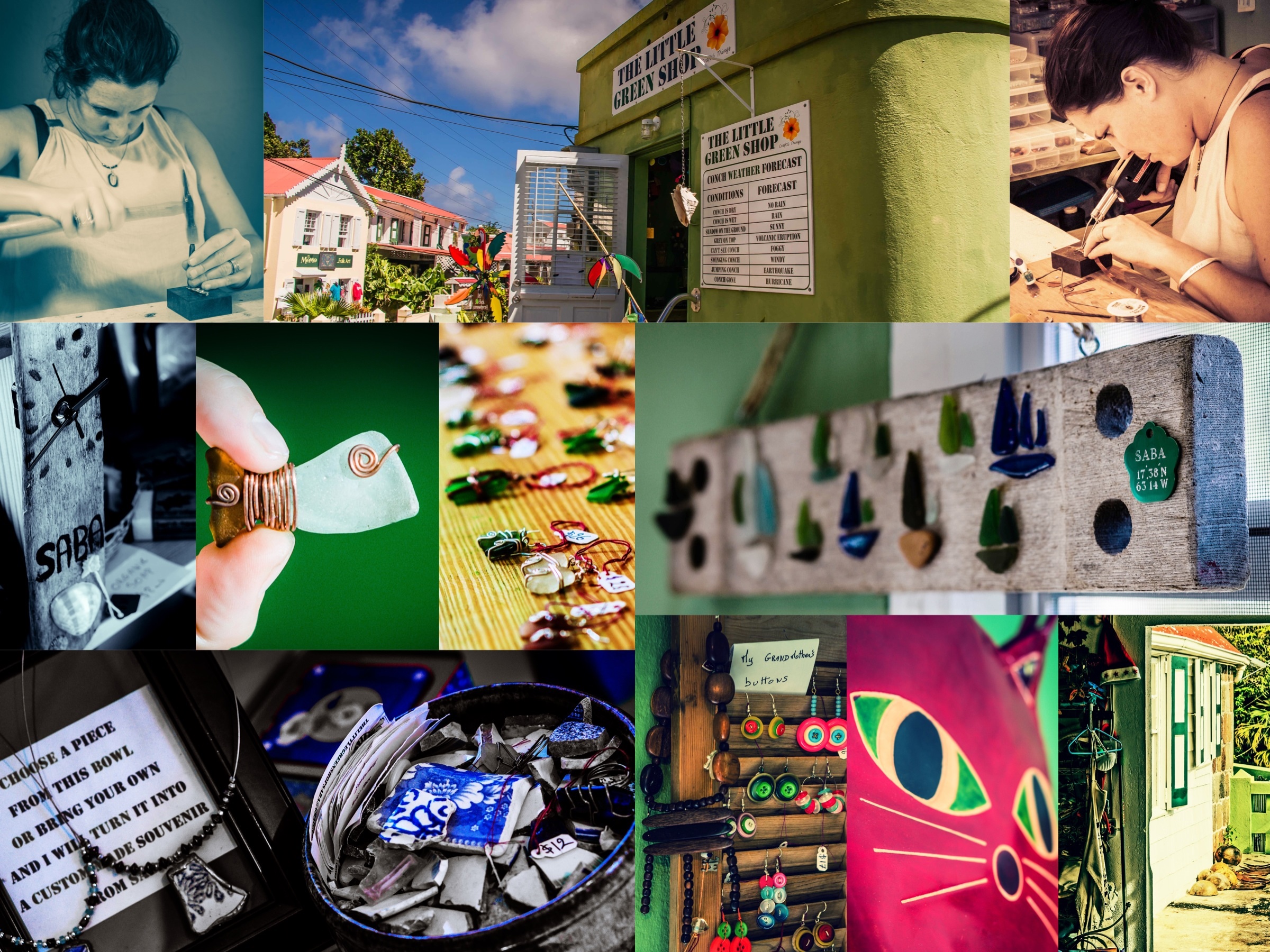
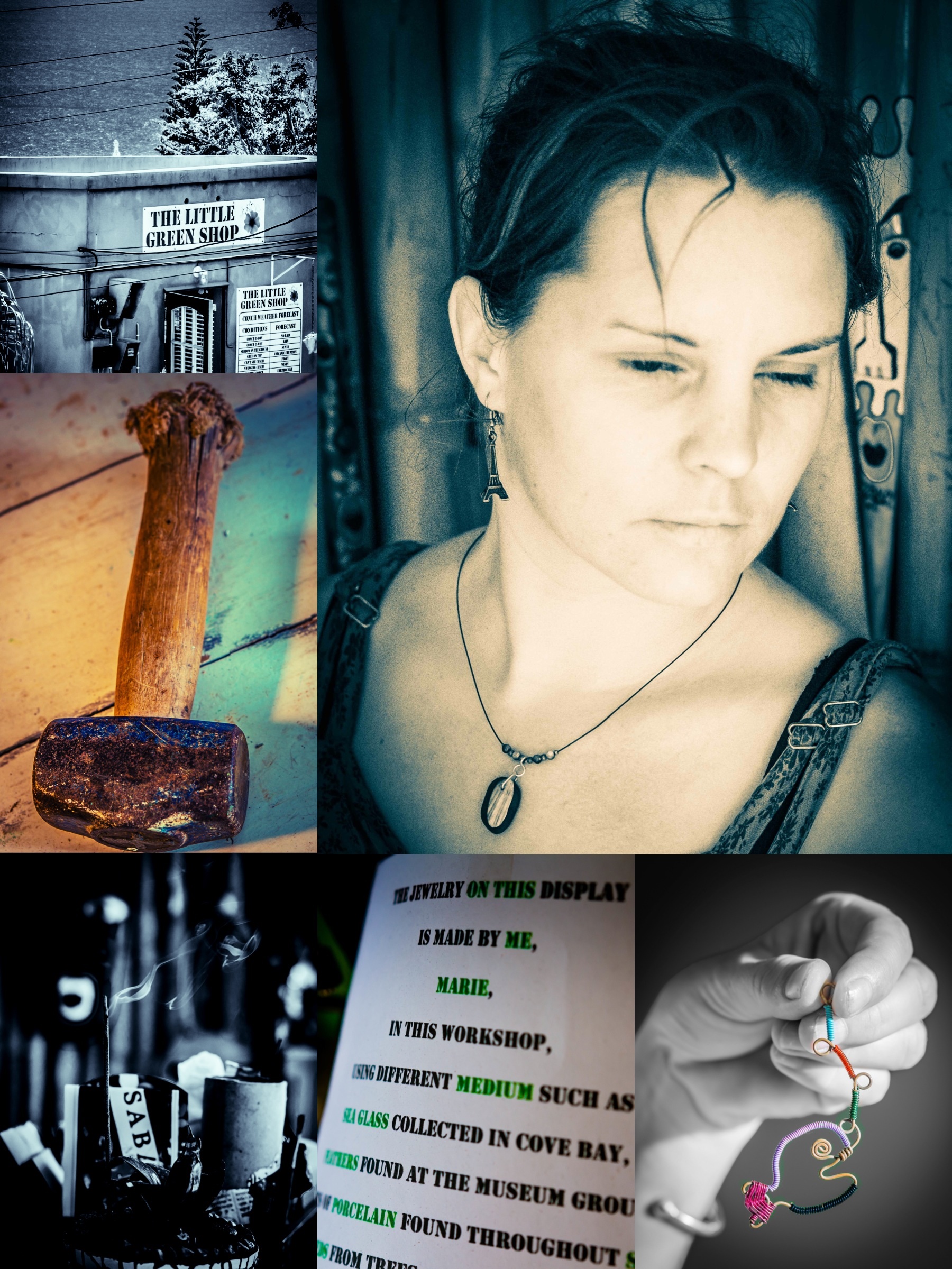
Marie Petit–yeah, that’s really her name–is a free spirit born in Normandy, France, grew up traveling Europe and the world, met her then partner now hubbie Bob from the UK, who was her dive instructor. You might recall Bob from an earlier local profile of the Sunday backgammon players. In any case, Marie also became a dive instructor which led her and Bob to Saba seven years ago. After a back injury a couple years back, Marie searched her Gallic soul for something that would fulfill her creative passions (Shes also a first class chef). The signs were there, though, as Marie met and displayed her wares to Queen Beatrix of the Netherlands on a trip to Saba in 2011. This manifested itself into an arts and crafts pursuit that became The Little Green Shop, which opened this past July.
Marie Petit and The Little Green Shop
As she had no specific background or training in crafting or jewelry, Marie dived headfirst into the creative abyss; she utilizes seeds, plants, porcelain, driftwood, and other items folks bring her from around the island, an army of makeshift needles, hammers, soldering irons, crimps, and other tools that Bob brings in to whip up her objet d’art du jour. It’s the first time I’ve really seen a crafting/jeweler at work on a daily basis, and it reminds me of my own music and writing process; long sojourns and lots of time down paths that ultimately end up getting discarded because they’re just not quite right. Other ephemeral days are creativity volcanoes; everything that comes out of Marie’s pounding, twisting, stamping, and soldering on such days are gems…sometimes literally 😉
I took longer than usual to create the images that I thought captured the free roaming spirit and clever artistic details of Marie and The Little Green Shop; for such a tiny store in the corner, there’s a lot going on here with this hardworking expat who’s making a stamp in her own way in Saba’s day to day art and culture.
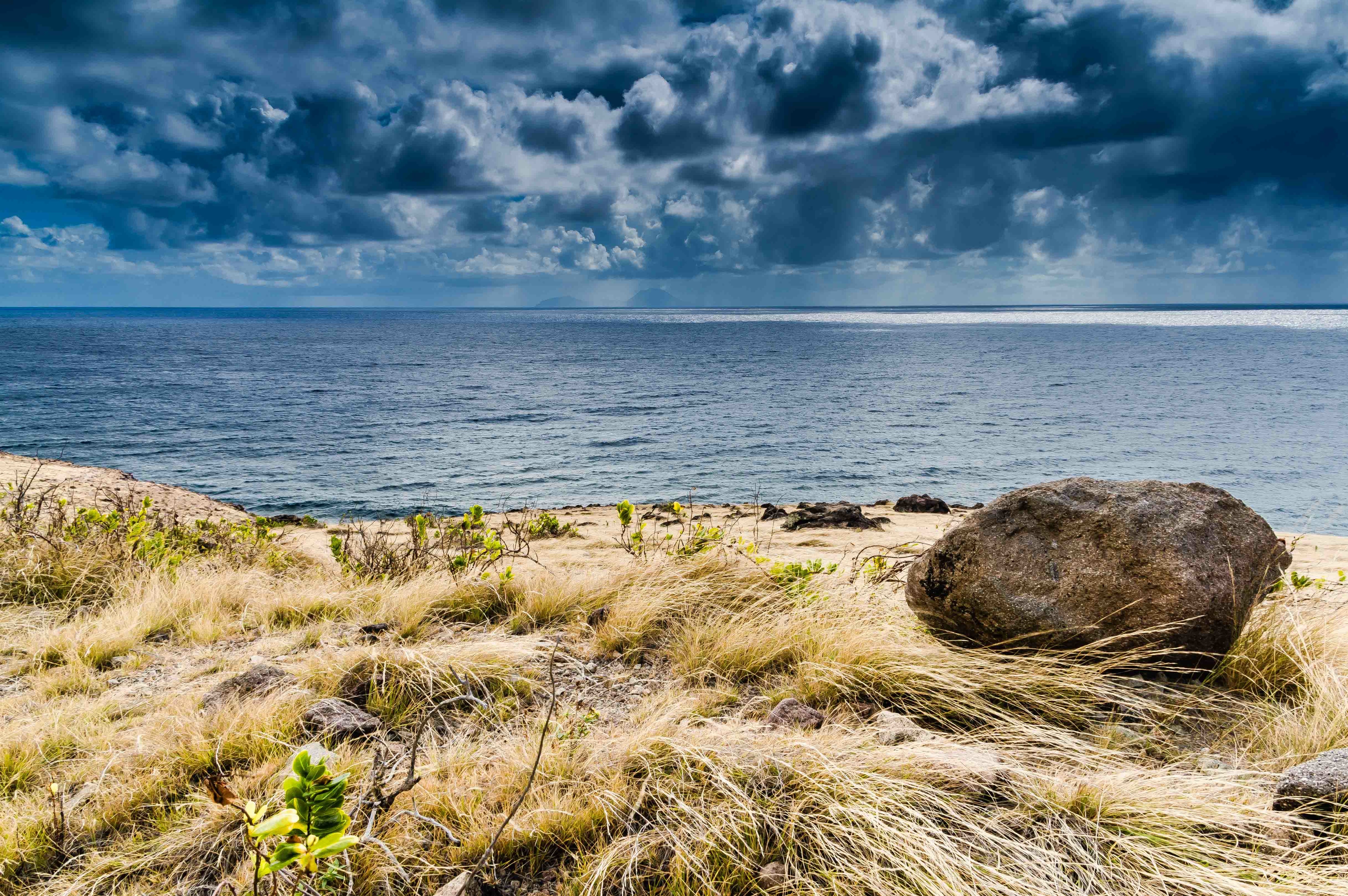
South Coast Cloudscape, Statia, and St. Kitts Views, Saba, Dutch Caribbean
Giles Quarter, Geomorphology, and the Gut Adventure
Pardon my alliterative heading there…two days ago I agreed to guide a French geomorphologist down the Giles Quarter coastline trail and up the Gut to Windwardside. Gut is what the Sabans call the steep, winding ravines that slash downwards all over the volcanic island; many are off trail canopies of thick and ropy shrub and foliage that winds itself around anything on your person and cuts and scratches any exposed skin. But hey…an adventure, right?
We picked up orange hard hats at the Conservation Bureau down in Fort Bay- natural and goat induced rockfall is common on Giles Quarter–then set off down the coastline. Cristian is a gregarious living archetype of the absent minded professor; in the case of our hike, the shiny objects of his interest were various examples of geomorphology/vulcanology on Saba: conglomerate, alluvial stream beds, plants thriving in microclimates in the various Saban ecosystems. Rocks, dirt, plants, and terrain…wahoo.
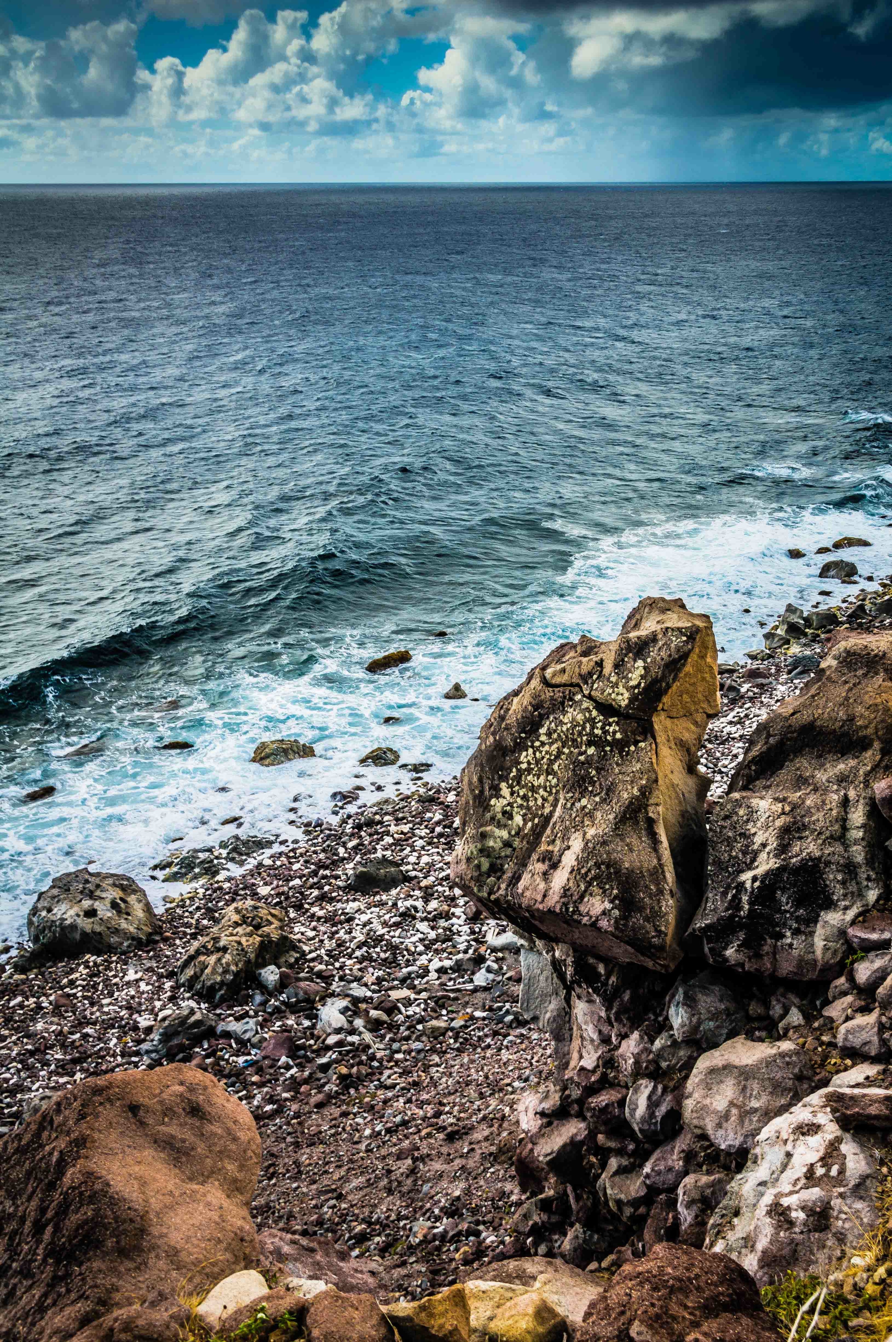
Up close and personal on the Saba south coastline, we could see fields of long yellow grass laid flat by gusty breezes. In the picture, just beyond the long grass, there’s an abrupt 10-20 foot cliff drop off to the rocky Saba shore (shown with the balancing rock photo), with big swells coming in vis a vis the northwest tradewinds.
Balancing Rock, Saba South Coastline
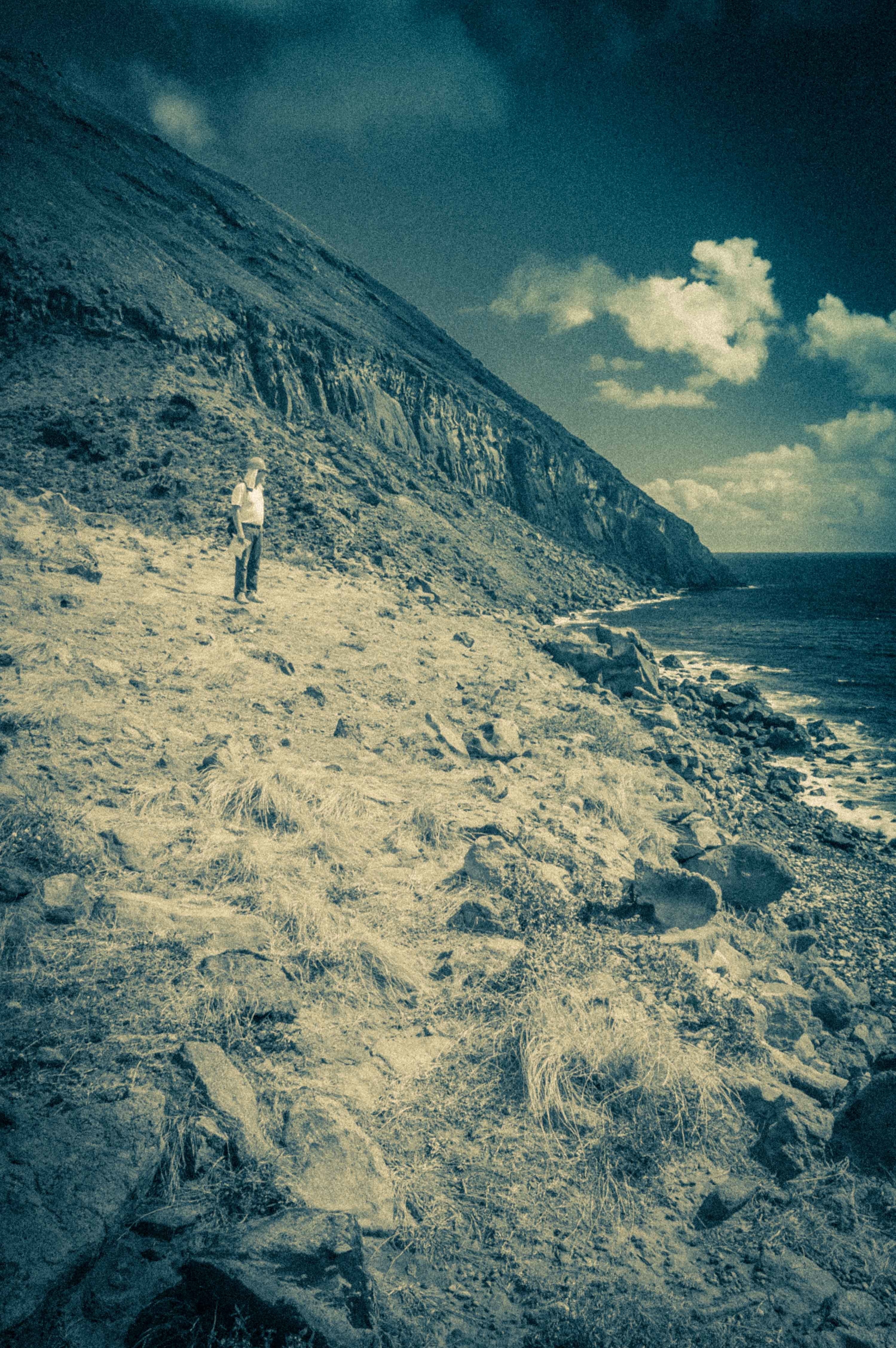
I tried to persuade Cristian to take one of the ridges for our ascent up to The Road, which are relatively scrub free, straightforward ascents, but he really wanted to wade into the Gut that comes right into Windwardside (~1400 feet) to get his “cross section” of the island. Looking up we knew it was going to be a scrub fight, and, when we got up towards the top of the ravine, some fairly vertical cliff and rock scrambling.
Cristian At The Base of the Windwardside Gut
The story ends thusly: it took us 2 hrs to get to the base of the scrub in the Gut, and an additional 2-3 hrs to climb out to the road via separate paths.
At some point, fairly well cut up from scrub, Cristian took off up the left side of the Gut walls while I reasoned it would be safer to brute force my way through the canopy up the low slope of the Gut stream bed. When I hit a impassable rock and scrub wall, I started up the fairly vertical walls, at times swinging from embedded tree root systems across rock walls with very little foothold and pulling myself up past loose rock. A little Tarzanesque, ‘cept I ain’t no king of the jungle. I emerged out at the Captain’s Quarters ruins per plan, a bit tired and having gone through 4.5 liters of water and still feeling like I’d lost weight. Cristian walked up to the Trail Shop about 30 minutes later. He had major abrasions all over his forearms, his neck red from 5 hrs in the sun despite sunblock. I was just dirty, sweaty, and my arms looked like the result of a minor cat fight. We had a beer at Saba Snack, recounting our adventure while he expressed some regret I hadn’t followed him to take pictures of the “marvelous” geomorphology on his route and apologized for getting separated.
I’m all for a little off trail from time to time, but coulda used a machete and some gloves on this one. Easy to see why visitors on Saba could underestimate the effort to work through jungle and scrub when looking at it from above. Think I’ll save my future Saba climbing efforts to the more tried and true trails and ridges. All the effort but less poky scratchy plants and rock climbing sans rope 🙂
Miss Lillian’s Grandmother’s House, St. John’s, Saba, Dutch Caribbean
All In The Family
I met Miss Lillian on one of my many daily blogpost trips to Scout’s Place (most reliable free WiFi of any bar/restaurant on the island). Around Christmas, she was putting up lights on the tree, and I noticed the angel was backwards and not quite on the top branch. In my largesse, I offered to help her straighten the angel out, and promptly snapped that little bugger’s light off. So I promised to buy a replacement angel…which I did, but too late for this Christmas.
Miss Lillian
Miss Lillian is kind of a staple around the island, a big hearted woman with a great sense of humor and an infectious laugh whose primary job is licensed nurse at the local hospital and part time job is Scout’s Place hostess/bartender. Her family goes back generations in St. John’s. I’d wandered past this aging house many times on the way to The Bottom, always curious about it, but I finally snapped some pictures of it on my way to Thais Hill the other day, unable to resist the browning wood shingles, the sides overgrown with clover and flowers that have spawned all through the yard. Look closely in the lower right corner, and you can see pooled water at the top of the steps with tiny fishes darting around in it…how they got there I have no idea, but life always finds a way. In any case, I showed Lillian this picture, as this house is just above where she currently lives in St John’s, sheltered away from the direct weather exposure of St John’s flat. She took a while to recognize it, then said, “Ah, that’s my grandmother’s house.” Turns out after her grandmother passed, the place had bounced around the family; her great uncle was the last to live in it before he passed as well, and to the best of Lillian’s recollection, no one’s occupied the house for the better part of two decades, though it looks like it could’ve even been longer. But then again, Saban weather and tropical moisture ages unoccupied houses quickly. Lillian’s family would like to rebuild it because the location is so good (right next to The Road), but it’s a significant financial effort for the family. I’m posting this picture as a duotych to illustrate the two sides of the coin I see when I look at this place; without being too melodramatic about it, the black and white is sort of a ghostly image with a lot of inferred history, while the vibrant color photo reminds me of how life continues on here in spectacular fashion. Lillian pointed out that the kitchen and stove–no longer visible here, as its overgrown–was separate from the main house.
If you remember or know Miss Lillian from Saba, be sure and comment on this post so I can tell her it was worth posing for the picture. She was a tad reluctant 😉
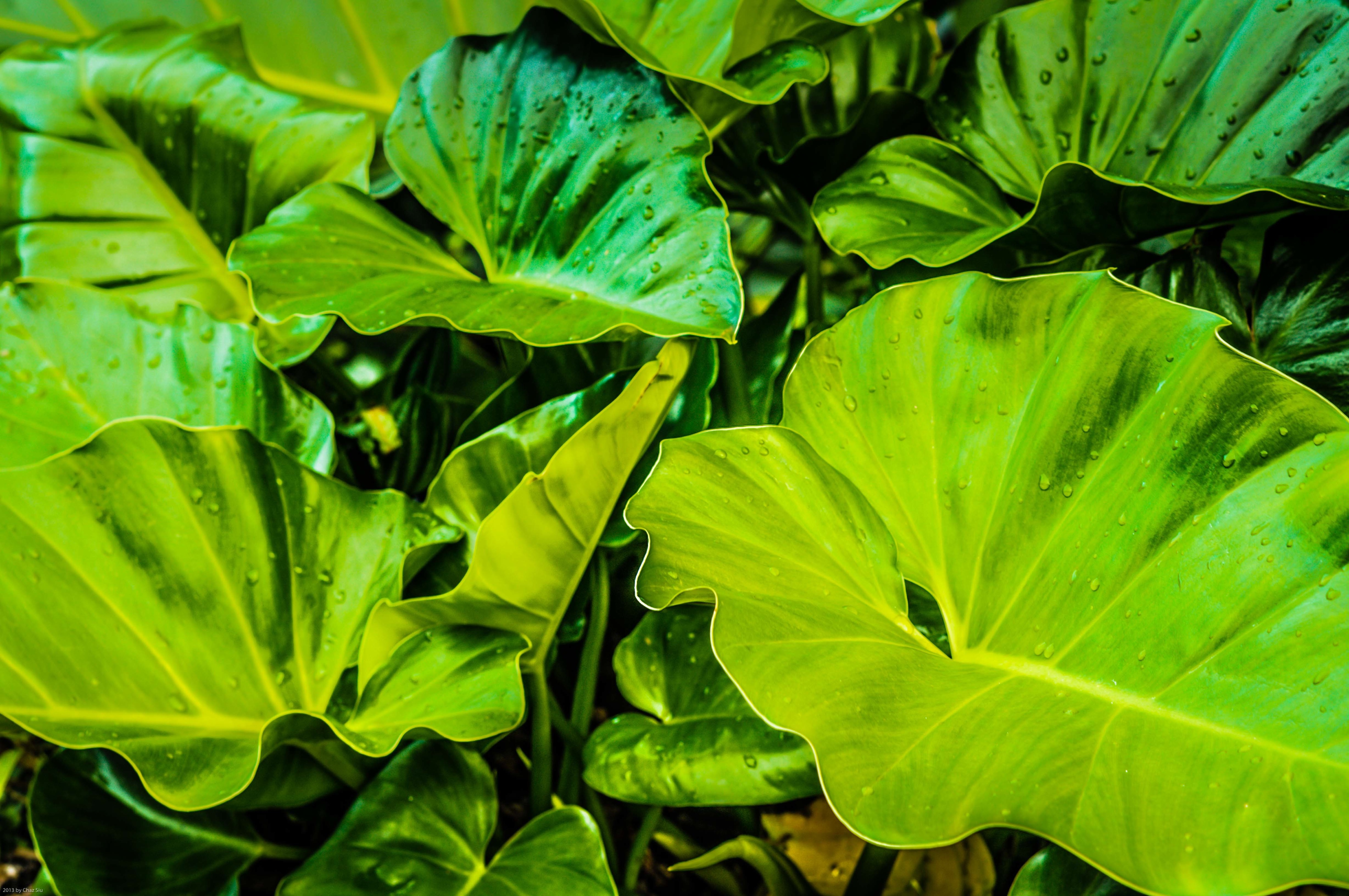
Elephant Ears After A Rain Shower, Saba, Dutch Caribbean
I’m Glad My Ears Aren’t This Big
Rains in the Saban high season are sporadic showers, warm tears of God flung from up high and out of nowhere, for 5-30 minutes at a pop. I love the smell of the rich, dark volcanic earth and how the color pop after a rain. Though elephant ears thrive in all tropical climes ’round the world, I still love how they serve as the king of green flora catch basins for both the rain and for dewdrops in the absence of rain.
Sometimes, it’s just the simple things that get me going in the morning. Or coffee sans sugar; that, too.
Saba Goats: Spawns of The Devil or Furry Island Friends?
No one on Saba is indifferent to the goats that roam the island’s rugged cliffs and shrubbery; everyone has an opinion, and usually a strong one. It happens to be baby season right now for these furry flora munchers, so I see baby kids running under their parents legs everywhere, and they bleat if they get separated (like, for instance, when a large person such as me bumbles down one of the hiking trails after only half the family had crossed). In any case, they are a ubiquitous part of the island, and one of the key features I remembered from back in the 90’s when I first sailed here on the Polynesia Windjammer.
It’s the usual suspects on both sides of the conversation: animal lovers vs the farmers getting their land chewed up, tourism stakeholders who get antsy when small platoons of goats start showing up in greater numbers the streets of the main villages. But the bottom line is that once the goat population crosses a certain threshold, they can clear out fragile plant ecosystems like nobody’s business, so its agreed that every few years or so, the government issues gun licenses to a select few, and authorizes a trimming back of the goat population. It’s very much like the deer population control practiced in the US. However, the wrinkle and complication of all this is tied to the ambiguity of property lines and ownership dating back many generations; if a goat is taken out, it’s very possible the Saban land owner where the goat was dropped will ask to be paid a renumeration. So a lot of planning and coordination has to happen with locals, landowners, government, and the conservation bureau before anything happens.
In any case, this guy in the picture doing his wall balance is quite a bit fatter than most of the goats I see, as they’ve bred themselves down in size over the years they’ve been here. He almost looks like he’s napping, eh?
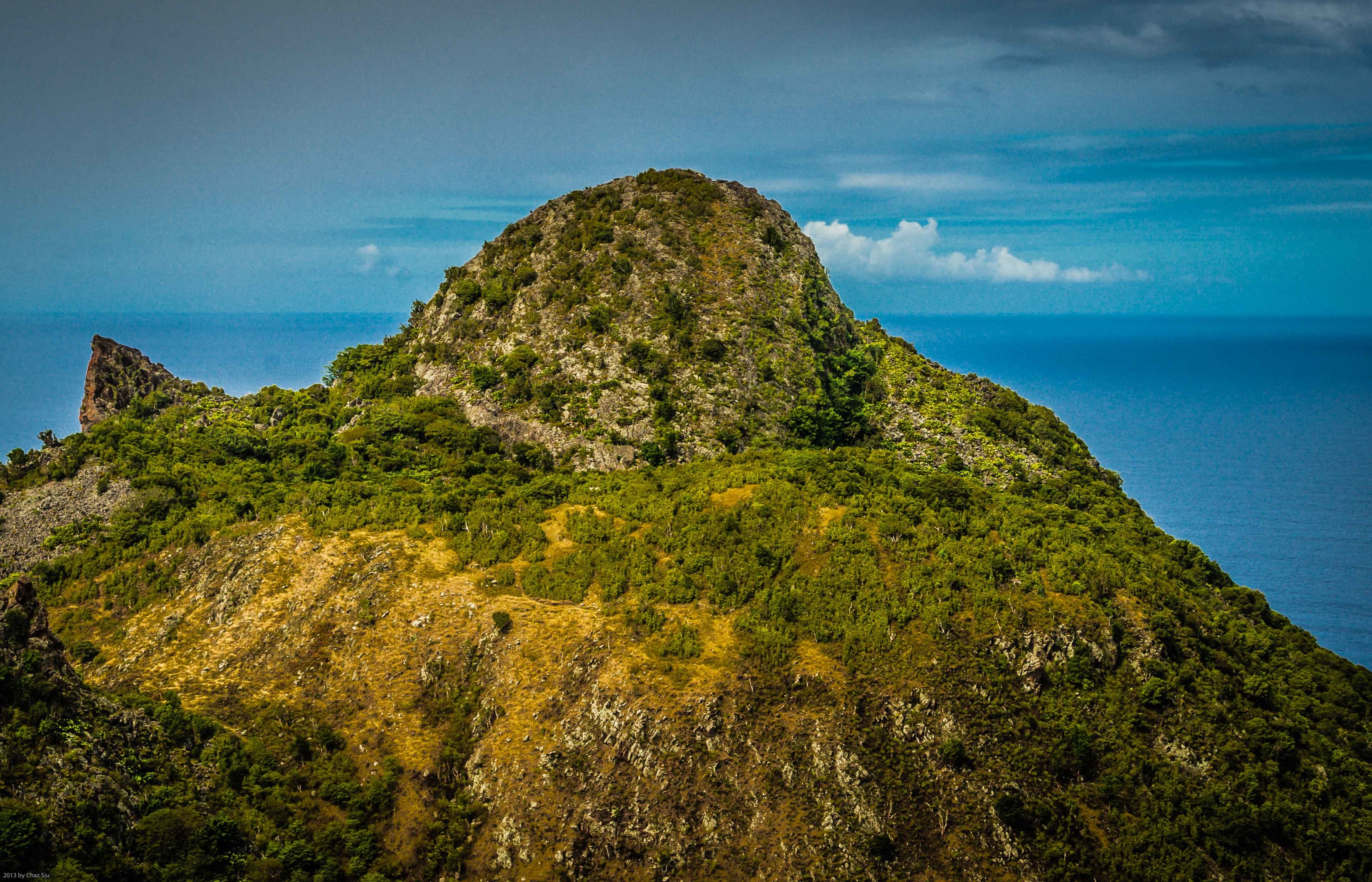
Continuing a three day Thais Hill photo extravaganza; Thais affords you views of all the villages on the Saba except Hell’s Gate. It’s one of two big hills–the other being Paris Hill–that flank The Road’s descent to Fort Bay harbor from The Bottom. I’ve read a lot of literature and websites on Saba and find it interesting that virtually no one mentions the whale atop Paris Hill (in the picture, viewed from Thais Hill), because visitors refer to it a lot. For locals, I suppose this is a consequence of grew-up-here-familiarity, but it is rather cool. If you look closely (or click on the pic to make it full sized), this fella has a shrub eye and blowhole, and even a rudimentary mouth.
Perfectly fitting that he–or is it a she?–is trying to get off the mountain and into those blue waters. Good luck wit’ dat, Mr. Large Fluke.
Today, I did a gorgeous early AM hike down the ridge to Spring Bay and up Kelby’s Ridge with Michael Chammaa, Brigadoon’s chef extraordinaire, and very very fit dude. I’m glad he slowed it up a little for my big Hawaiian self…gotta get back there with camera in hand. A goat even posed for a sun silhouette; missed opportunities! I also think a climb up Paris Hill is calling my name…and soon. So much still to see on this most excellent rugged rock.
Eastern View of Saba’s South Coast From Thais Hill, Dutch Caribbean
So, Uh, How Do I Get Up There?
I’ve traversed all but one of Saba’s official trails now, so I figured its time to start going off trail, beginning with Thais Hill, a big rounded hill with a plateau that divides St John’s and The Bottom, figuring it would give me some decent new views. I stopped by Major’s house on the way there and he and a friend pointed to an alley between houses, a march across a dip of yellow long grass, and then meandering up through the scrub. Though I’ve been told its generally ok to walk where you want on the island, I’m always cautious about walking across someone’s property without permission; leftover from the states I guess.
In any case, it was pretty fun up there…expectations well met. Again, the dramatic Caribbean cloudscapes on the horizon added their drama, and this is a black and white photo looking East over St Johns–Windwardside in the distance–looks like it could’ve been taken in the 40’s. Tres cool, non?
Reclining Girl At Cove Bay Beach, Saba, Dutch Caribbean
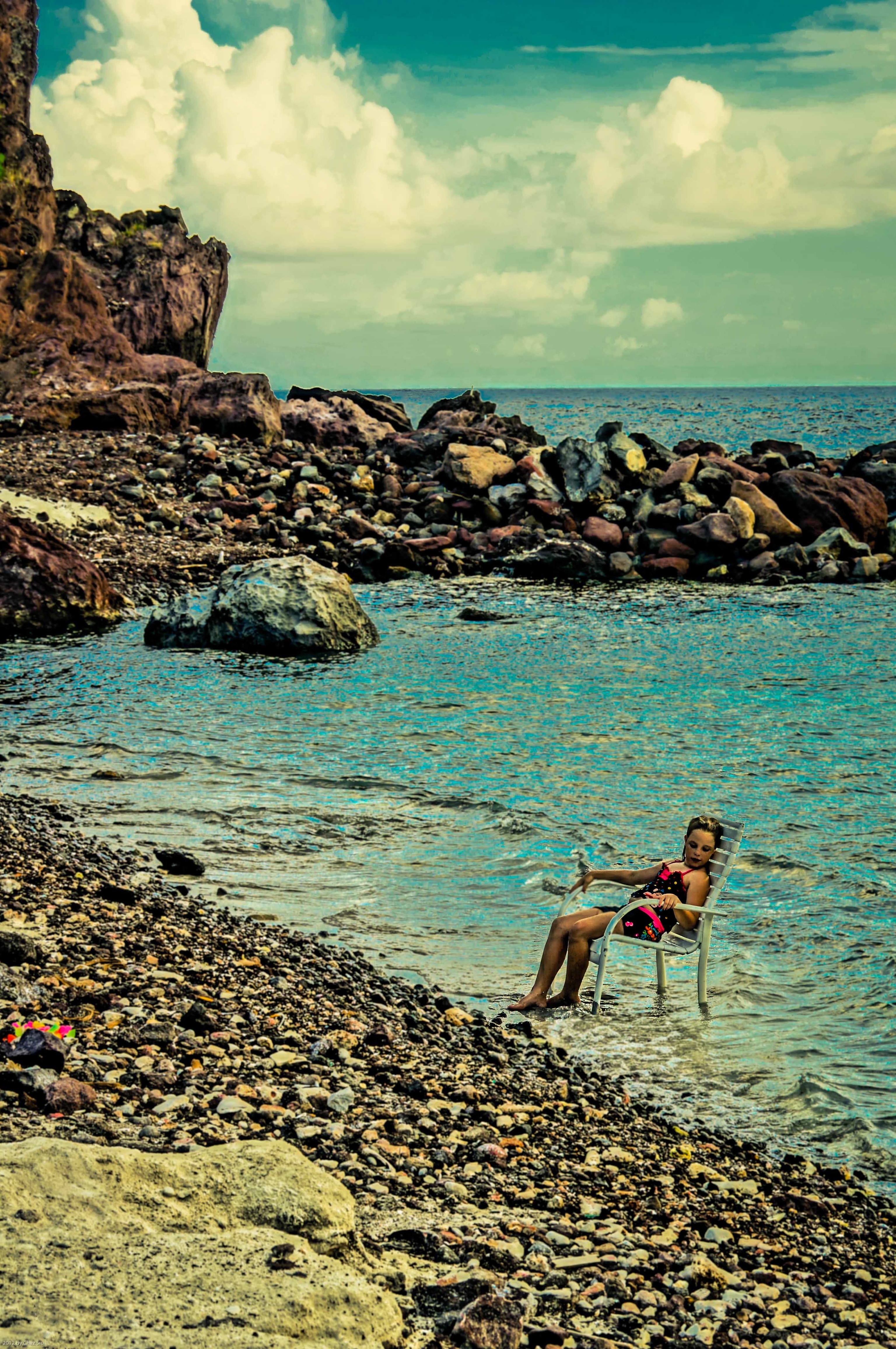
An oft stated semi-myth of Saba is that it has no beaches. In fact, this is a somewhat ambiguous statement, and depends on what might be defined as a “beach”. Down in Cove Bay, just below the airport and around the corner from the tidepools, large rocks have been hauled in to make a small pool-like breakwater, and some degree of artificial sand has also been shipped in, but the relentless weather means that the big rocks all around the sand are always visible. A truer definition of a persistent year round beach is at the Cave of Rum Bay, a picture I shared in an earlier blogpost,but the beach is inaccessible, except by boat (or a long swim around from Wells Bay). Wells Bay itself used to have a reappearing seasonal beach, but the increase in large swells battering the lee of the island over the past several years has locals generally pessimistic about whether that beach will reappear…ever. In the end, Mama Nature will do as she pleases.
In any case, families frolic on the Cove Bay beach area, and this little girl dragged her lawn chair out into the shallow water. She looks kinda winsome in this picture, but she’s probably just curious about some skittering nearby crab.
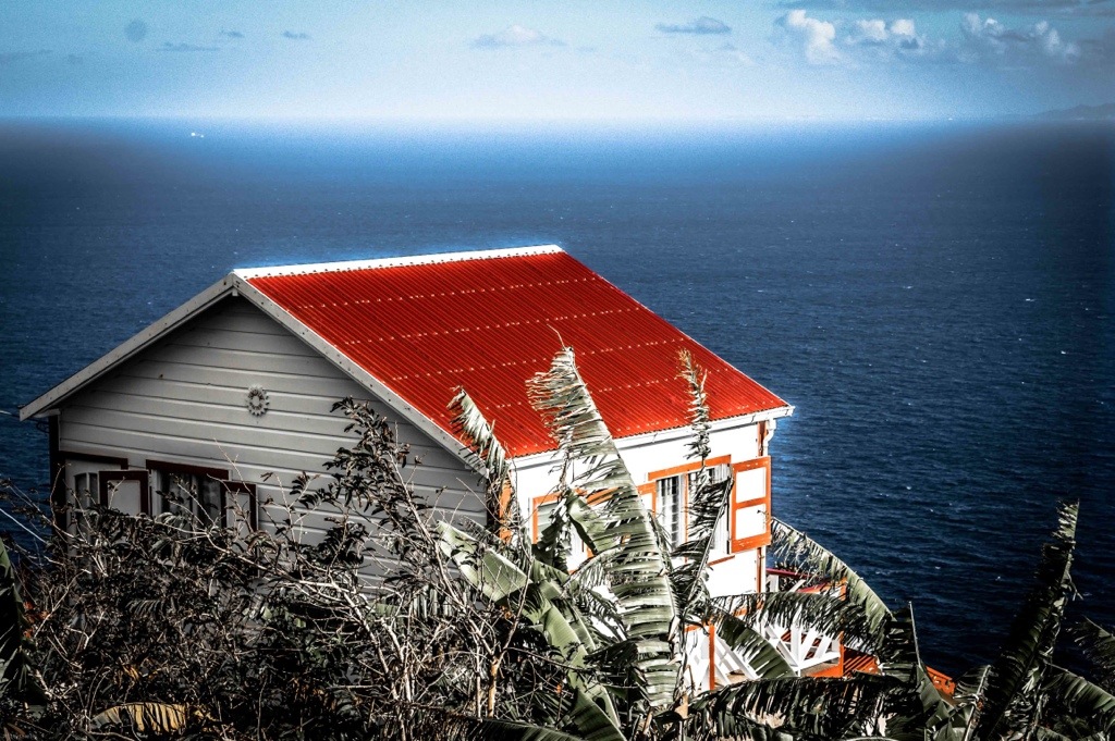
I visited Tricia down in Lower Hell’s Gate and came upon this little house perched quietly on the cliff, fronted by a messy tangle of foliage above the great Caribbean expanse, looking out on a bright, almost nuclear-lit horizon in the wake of good storm, with Statia presiding in the right upper corner. It’s interesting to me how our visual brain discards all the noisy information it sees in a scene like this when you’re looking at it, and all that cluttery detail reappears when you look at what the camera’s eye saw. Post processing for me is really painting the picture as close as I can to what I see in my mind’s eye when I take it. Some purist photographers disregard these processing techniques, but in the end, it’s all about aesthetics to me; you like an image or don’t, for reasons you may or may not understand, or it gives you pause to examine its detail, or you turn the page or click onwards…