
Camera Down!
First things: On Sunday I guided a hike up to the top of Mt Scenery; I inadvertently spilled water into my waterproof backpack, where, unbeknownst to me, my digital camera swam unhappily during the descent. So she’s DOA. No pictures, no blog? I’m working through recovery options, but if blogposts get a bit less frequent, well…now you know. Gaaaaaah 😦
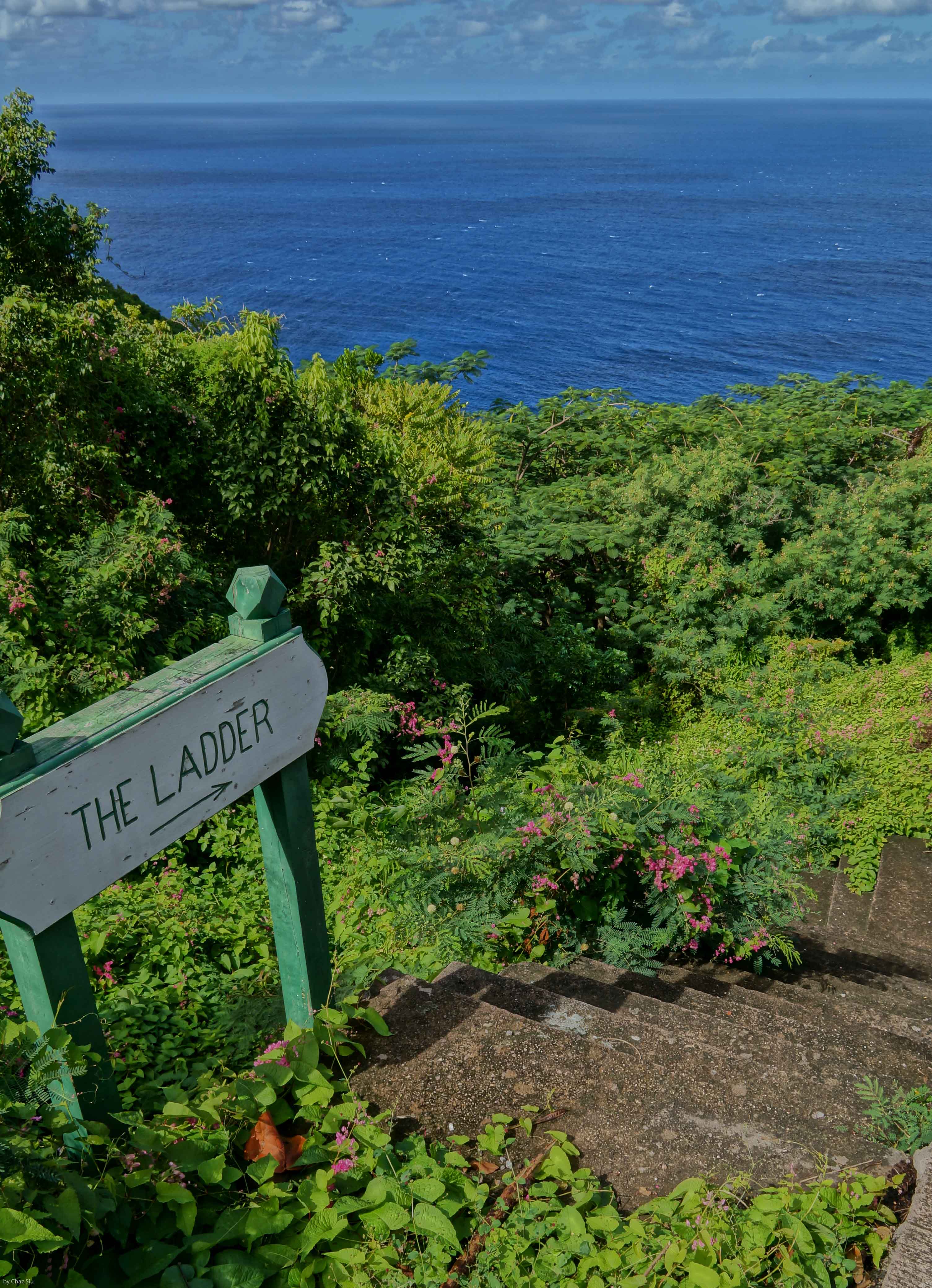
The Ladder
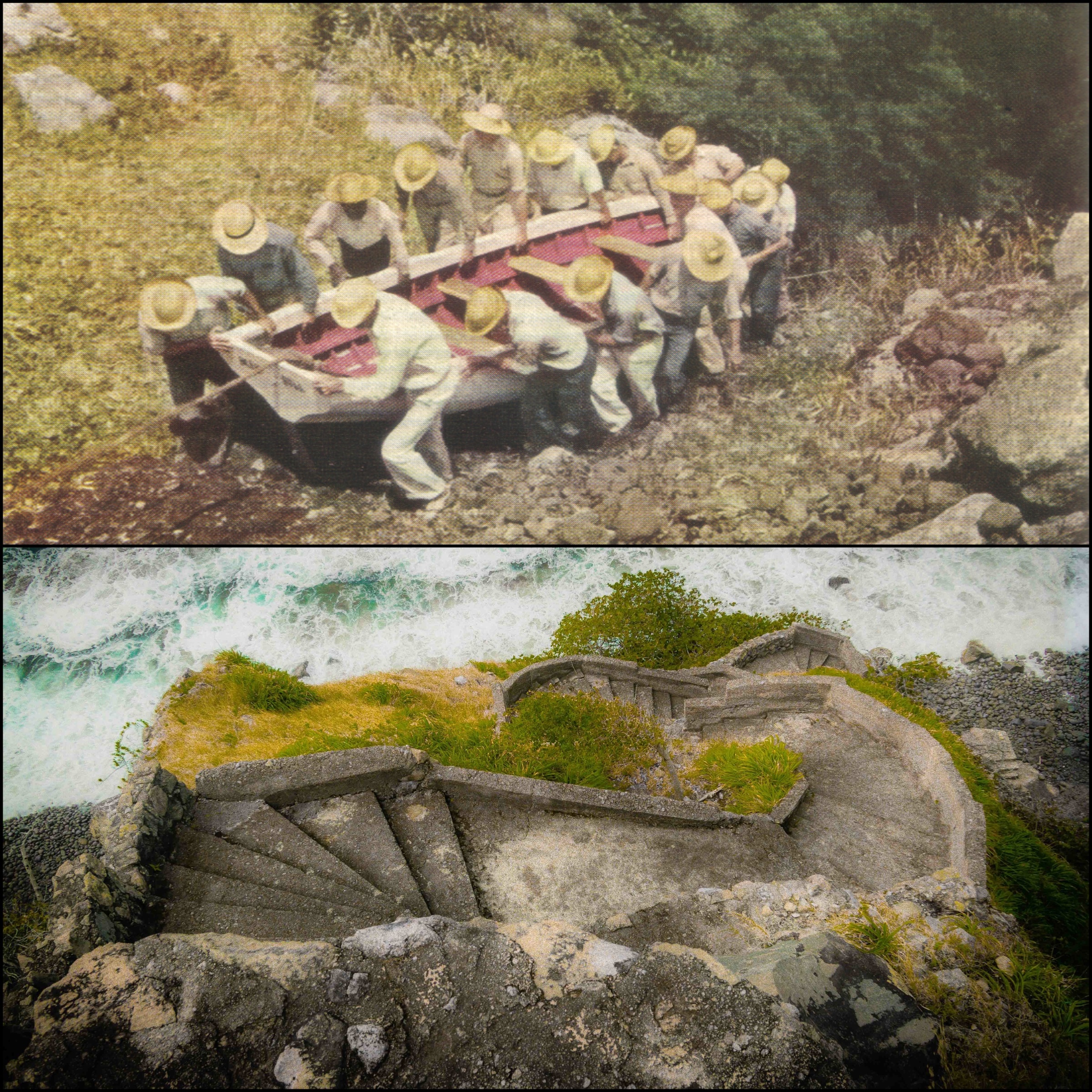
Lets go back in time a bit on Saba…say, . Airport? Nope. Harbor? Uh, no. How about a good old road, maybe? Nada. No, the primary way that Sabans moved goods on and off the island until The Road was completed was The Ladder, 880 stone steps rising 1000 vertical feet out of Ladder Bay to the lee of the island and up to The Bottom. Sabans were famously good sailors. The picture above shows from a 1940 National Geographic article shows Sabans moving their boat up The Ladder. The picture below it is the lower part of The Ladder today, showing the parapet style steps and how vertical they are. Frankly, The Ladder is a strenuous workout today with only a backpack; can’t imagine carrying boats, sacks, and any other basic weighty commodity up and down as part of day to day life: These Sabans are tough folks. I’ve included a

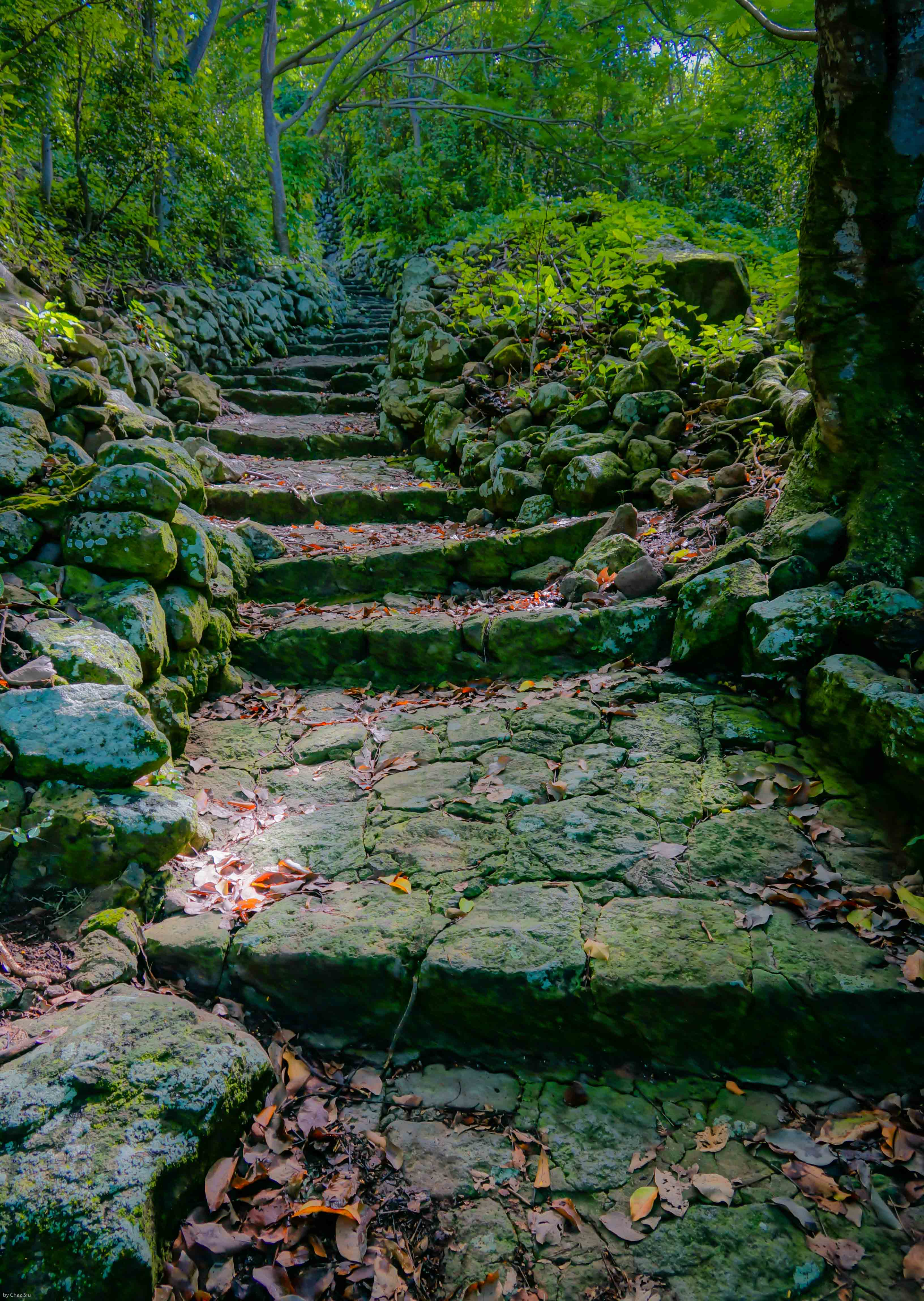
couple more pictures here of The Ladder showing its rise into the forest. It’s still steep enough to avoid if it rains, as the steps become slippy slides of lichen. The swells down at Ladder Bay are typically fierce as you can see, but the early settlers still considered the lee of the island the only place to land your boat safely. Enjoy!


Sorry about the camera!