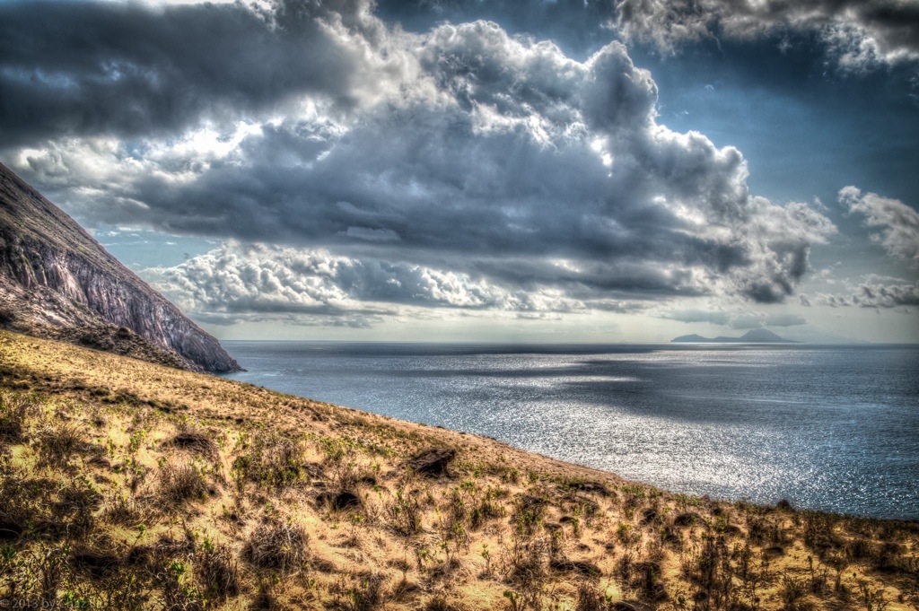
It’s tantalizing and teasing to be in the middle of a draught and extreme water conservation on the island and see storms come within three miles of Saba, and drop all their water offshore. As this picture shows, it may be beautiful to look at, but that doesn’t mean we have to like it. But then again, I did snap the photo, so there’s that consolation.
Road To Fort Bay Winds Down Below Thais Hill, Saba, Dutch Caribbean
“The greatest gift of life on the mountain is time. Time to think or not think, read or not read, scribble or not scribble — to sleep and cook and walk in the woods, to sit and stare at the shapes of the hills. I produce nothing but words; I consumer nothing but food, a little propane, a little firewood. By being utterly useless in the calculations of the culture at large I become useful, at last, to myself.”
― Philip Connors
Though this quote is in reference to hiking and camping on the mountain, I still think it sums up the essence of my coming here, particularly that last bit. I love the city I live in, but equally do I love this rugged rock, the peace and tranquility of its folks and its setting, above and below the water. People ask me if I miss the city, and my general answer is no, I’m focused on wringing out every bit of distraction free relaxation until the day I leave, and on the plane, I’ll get excited about where I’m going; I’m so much better at living in the moment at this stage in life, no apologies or regrets.
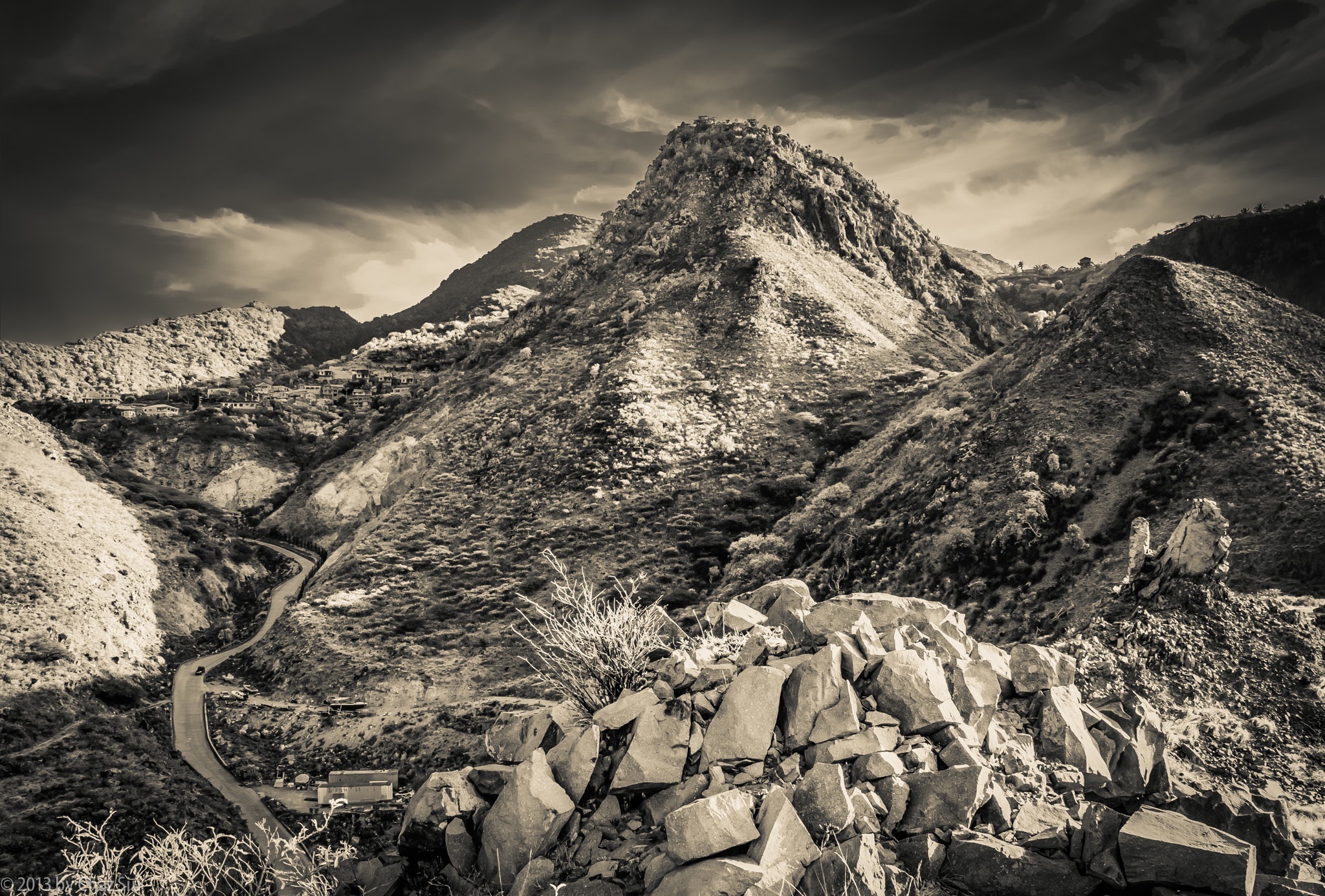
When you walk down the steep and sidewinder curves of The Road down to Fort Bay, you can take a mild detour to climb onto the hill above the harbor, across from Bunker Hill. Rather than looking towards the sea, where the Dutch Navy frigate was bringing in 60,000 liters of relief water to the hospital, the government building, and the old folks home due to our current drought, I looked back up at Thais Hill, which looms over the road, and up to the edge of the St John’s Flat, close to where I live. Never a shortage of new angles, and this one really shows off the rugged nature of this auld rock, forever subject to the wear and tear of weather, the thin wisps of stratus clouds high aloft and skimming the atmosphere. Not bad, Saba, not bad at all.
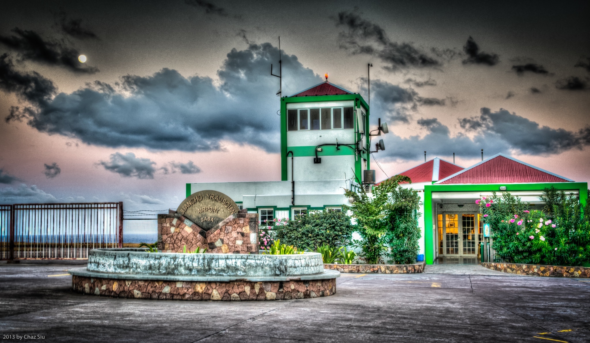
Moonlit Sunset Over The Airport, Saba, Dutch Caribbean
A Short History On Saba’s Airport
From Wikipedia: [Saba] airport’s risky reputation arises from the airport’s physical position: it is flanked on one side by high hills; and on the runway’s other side and both ends, cliffs drop into the sea. Additionally, the runway at the airport is extremely short (400m ); this creates the possibility that an airplane could under/overshoot the runway during landing or takeoff and end up in the sea or dashed on the rocky cliffs.
For those of you who saw the video blog a couple weeks ago with the plane taking off, the description above may amplify the concern about landing or taking off in Saba, but the airport’s had no fatalities or crashes in its 50 years of operation. This is the second or third incarnation of the airport, as the first couple terminal buildings blew down in hurricanes, most recently Hurricane Lenny in 1999. Flat Point was cleared of rocks by Saban folks in 1959 for a landing by pilot Remy F De Haenan to prove Saba could support aircraft, and it officially opened in 1963. Due to its length, it only supports a couple commercial short takeoff and landing (STOL) aircraft and helicopters, of course. The airport is named for Juancho E. Yrausquin, a prominent Dutch politician for the Antilles in the 1950’s.
There are normally only 4 WinAir flights a day, except during major holidays, when the students from the university fly out and they ramp it up considerably (10-12), but the net of it is, the sound of planes over Saba is generally rare, except at 7am, 10am, 1pm, and 5pm. Moreover, I can’t recall having ever heard a jet overhead. This contributes the the general peace and quiet on this isle I cherish.
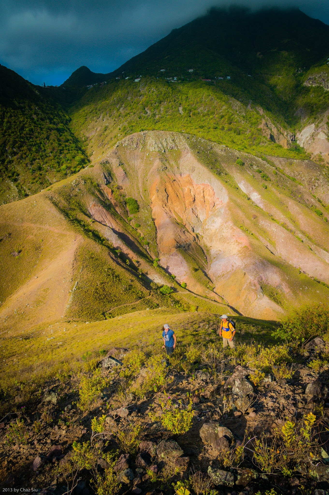
Old Booby Hill stands off on its own between the Windwardside Level and Spring Bay. It’s an absolutely wonderful diversion off trail hike from the Spring Bay trail saddle, and a mere 20 minutes of scrambling up low scrub nets you fantastic views of Saba’s south coast that you can’t see without an airplane or being on a boat offshore: a full view of Hell’s Gate all the way from the airport up to Mt Scenery, as well as the rugged sea cliffs directly below The Level. I rambled up the summit earlier this week with UK Bob the builder and his artsy crafty French wife Marie. This picture captures just a smidgeon of the many grand views from the Old Booby Hill summit, as well as the short, but steep little climb to get there. I recommend this hike strongly, as a surprising number of locals and long term expats have never done this fulfilling side excursion in the many years they’ve been here. It was Bob and Marie’s first time in the seven years they’ve been here.
By the way, New Booby Hill (simply called Booby Hill) is on the way to The Level, and has many expansive homes with fantastic views.
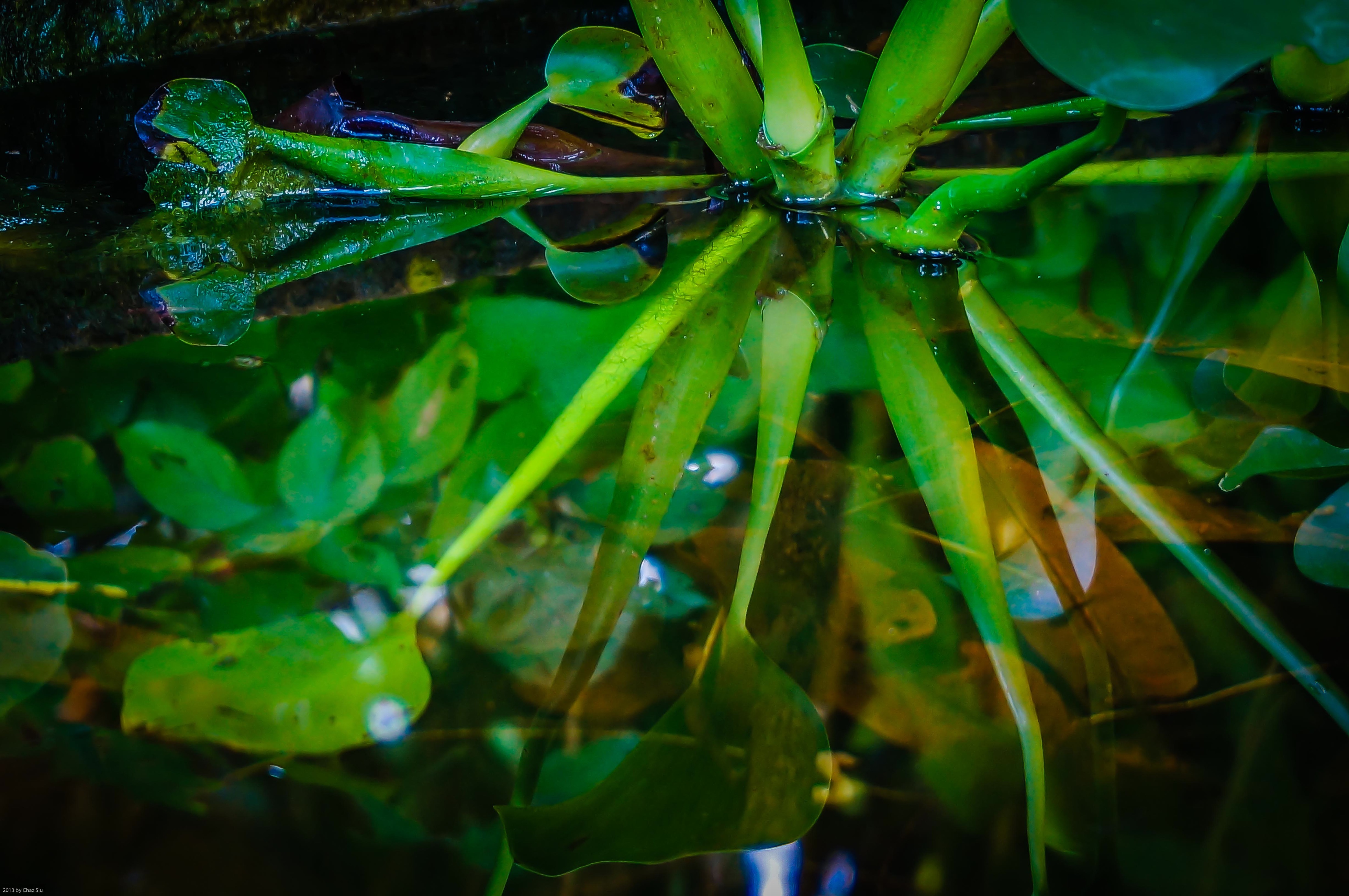
As you meander down below Windwardside proper and edge upon the remains of Captain’s Quarters below the hill, there is a square concrete catch basin on your right, just below weathered beams and frames that stand by themselves, undaunted by the years that’ve passed since Hurricane Georges in 1998. I don’t know what it was when the building was there, but the basin has taken on a pond life of its own, guppies darting about, lily like plants and their water reflections, colorful pink coral vine and other beautiful flowers growing wild around it. Every time I go by it, I just put my face up close and watch it for a while, life among the ruins.
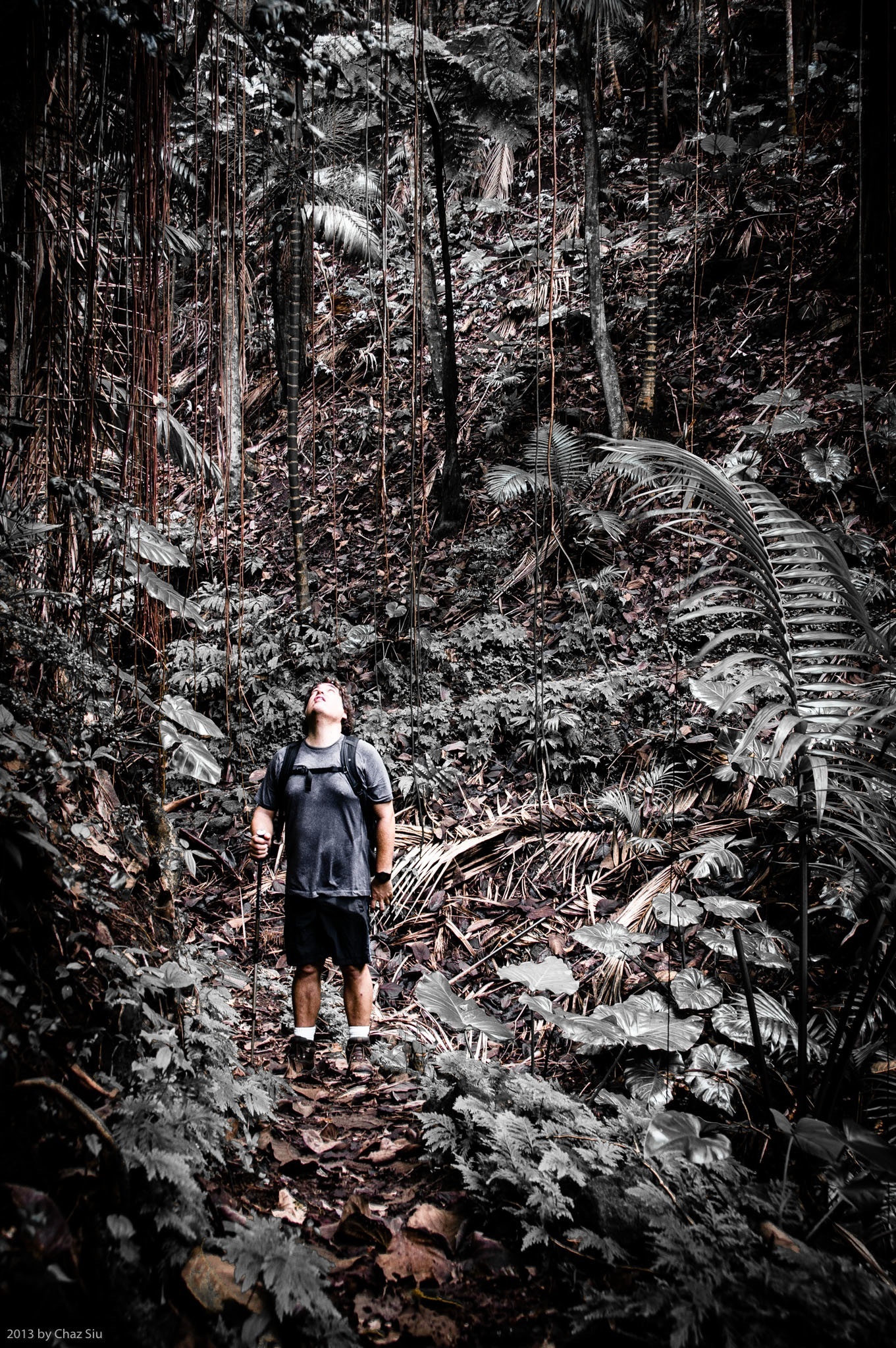
Michael Siu On The Sandy Cruz Trail, Saba, Dutch Caribbean
The Joy of Hiking The Rainforest
The locals and expats who live on the island of Saba often cite the Sandy Cruz trail as their favorite. Sandy Cruz traverses the north side of the island across several guts, and does so almost entirely under the cooling canopy of rainforest flora, excepting one short breakout strip that has a 180 degree vantage point to the wide Caribbean.
The other thing about hiking the trails of Saba other than Mt Scenery is that they are more often than not lightly traveled; its possible to spend a couple hours out and see no one, just the chirping of tropical birds, the wind in the giant leaves, the chatter of occasional rain onto the canopy above. On Sandy Cruz, there’s very few biting insects as well and it tends to be cooler, so it’s all the benefits of a jungle atmosphere to love without the mosquito kill slaps to the neck.
If you’ve read my Saba blogposts, I rarely have people as part of my landscape photos, but I caught my visiting brother Michael looking up as we were crossing one particular gut; reminding me not concentrate so hard on the trail that I forget to look up in the rainforest. Some gorgeous interplay of giant ferns, elephant ears and some of the amazing trees on Saba make for a beautiful canopy. You also get a sense of scale in this wet, wonderful wilderness.
In post processing for this picture,I desaturated the overwhelming green of the rainforest to get the red browns of the trail and the swinging vines to pop out around my brother. Michael is an exceptional photographer himself–check out his photos here–and we both dug the result, so here it is for your viewing pleasure.
Novel Update
Forty pages in and a plot line bubble sheet that resembles the doodle drawings of an asylum patient, the book effort continues to form as I forge forward each morning, getting my 500-1000 words in before heading outside for the day. I try not to re-read what I’ve written too much so as to avoid the infinite editing loop and/or get discouraged…this is still the precious draft period, so gotta get it all out of the muse first.
Have a glorious day, folks! It’s back to the ocean depths for my bro and I today.
My brother has arrived on Saba isle for a brief visit and brought a rescue camera so I can continue to bring you my shots of this lovely Caribbean paradise. Three cheers for him!
Today, some stunning cumulonimbus clouds stack like cotton candy above Peak Hill In Windwardside, with a view to the top of the Wash Gut that I climbed up with the scientist last week
First things: On Sunday I guided a hike up to the top of Mt Scenery; I inadvertently spilled water into my waterproof backpack, where, unbeknownst to me, my digital camera swam unhappily during the descent. So she’s DOA. No pictures, no blog? I’m working through recovery options, but if blogposts get a bit less frequent, well…now you know. Gaaaaaah 😦
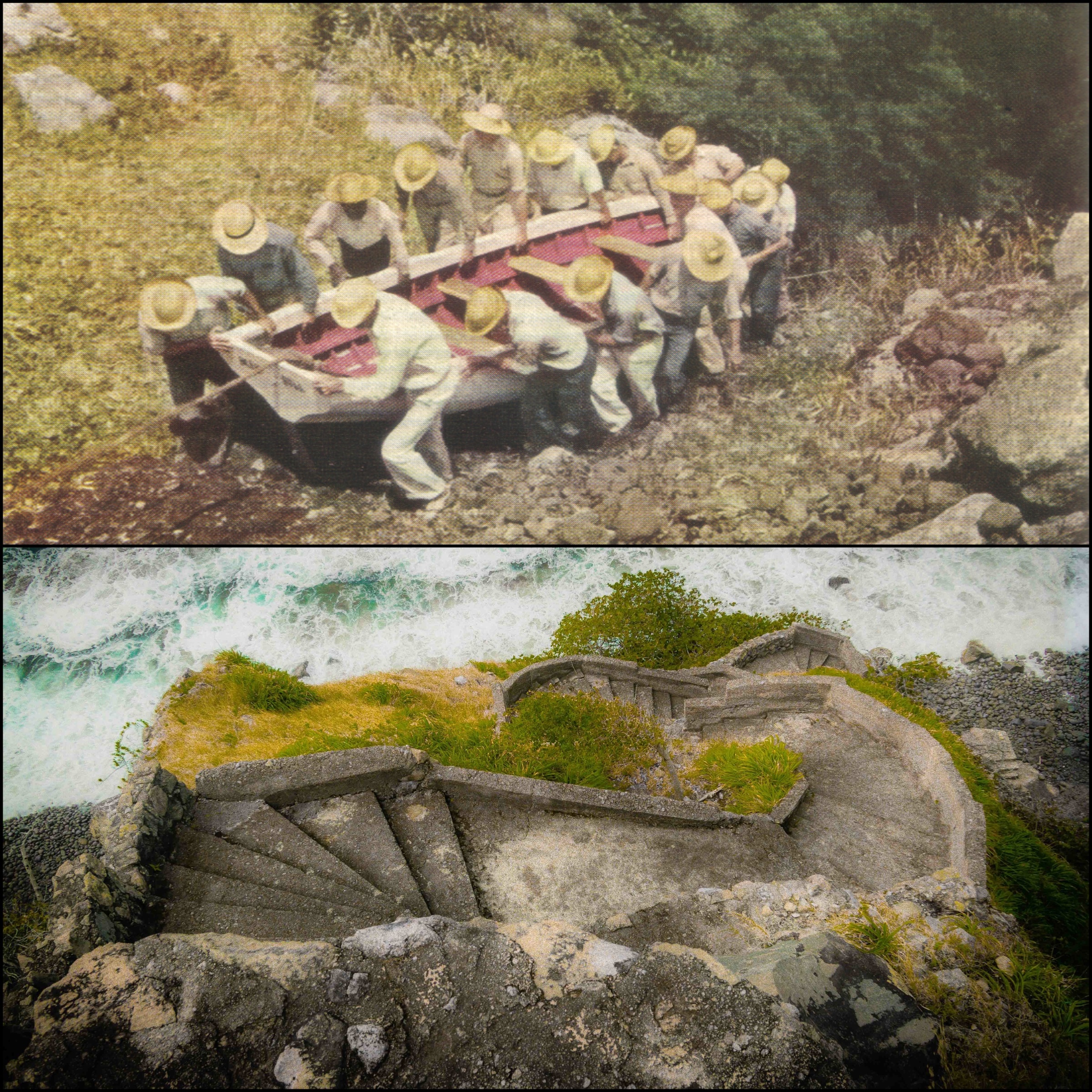
Entrance To The LadderTop: Sabans carry boat up The Ladder in 1940 Bottom: The Ladder today
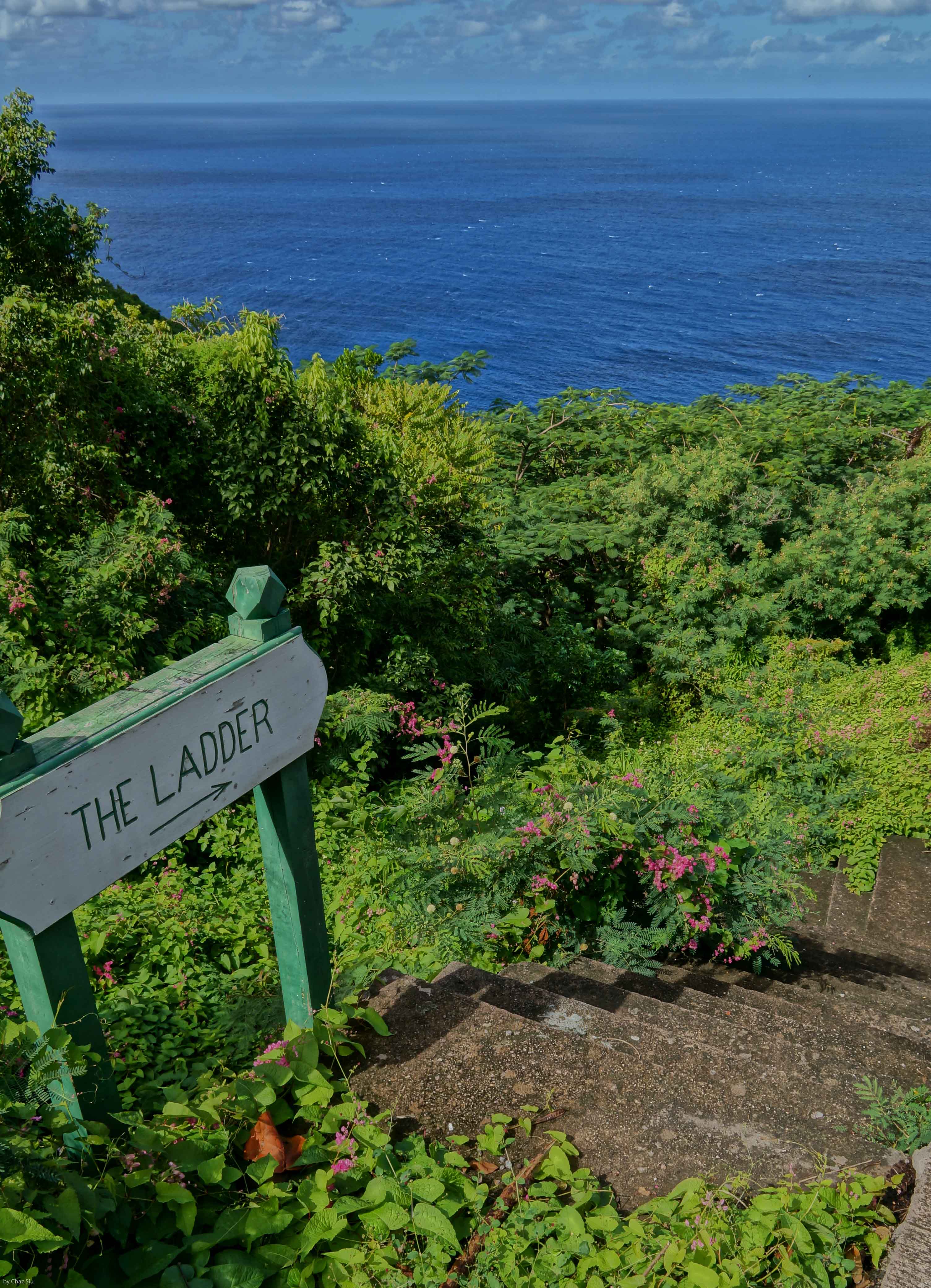
The Ladder
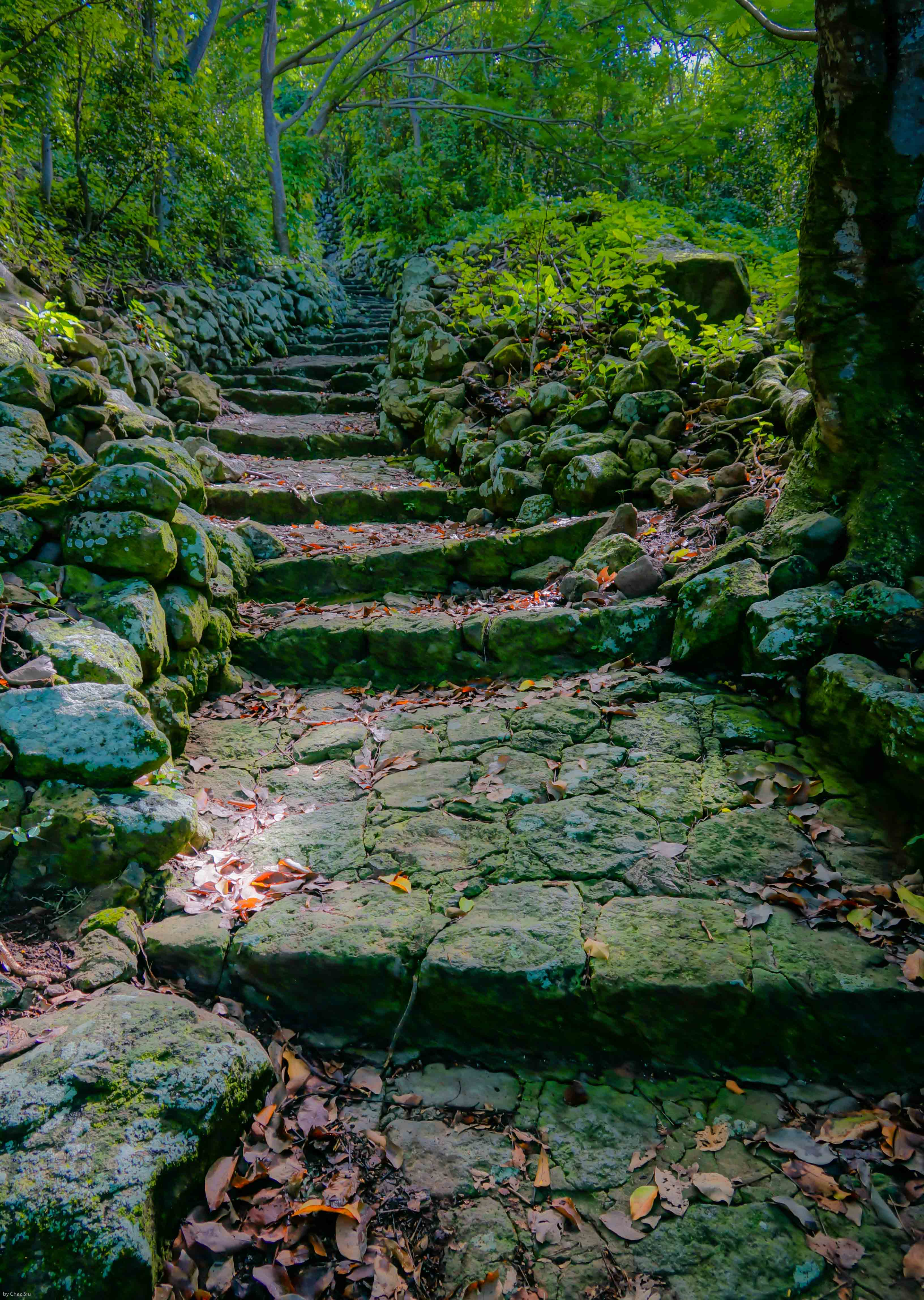
Lets go back in time a bit on Saba…say, . Airport? Nope. Harbor? Uh, no. How about a good old road, maybe? Nada. No, the primary way that Sabans moved goods on and off the island until The Road was completed was The Ladder, 880 stone steps rising 1000 vertical feet out of Ladder Bay to the lee of the island and up to The Bottom. Sabans were famously good sailors. The picture above shows from a 1940 National Geographic article shows Sabans moving their boat up The Ladder. The picture below it is the lower part of The Ladder today, showing the parapet style steps and how vertical they are. Frankly, The Ladder is a strenuous workout today with only a backpack; can’t imagine carrying boats, sacks, and any other basic weighty commodity up and down as part of day to day life: These Sabans are tough folks. I’ve included a
Lower steps of The Ladder.
couple more pictures here of The Ladder showing its rise into the forest. It’s still steep enough to avoid if it rains, as the steps become slippy slides of lichen. The swells down at Ladder Bay are typically fierce as you can see, but the early settlers still considered the lee of the island the only place to land your boat safely. Enjoy!
The Ladder and Ladder BayThe Ladder Ascends Into The Bottom