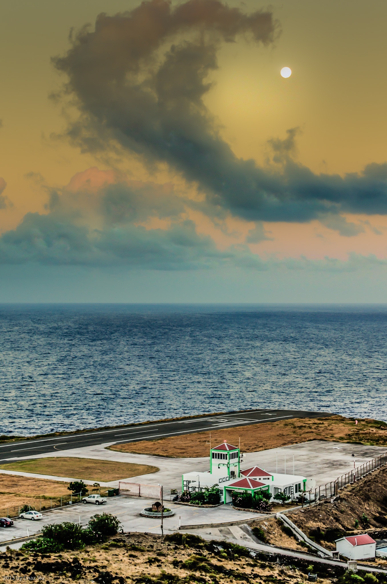
Moon Sunset Over Flat Point, Saba, Dutch Caribbean
La Luna Bella
Rambling down the twists and turns of Hell’s Gate to a perfect Sunday Cove Bay BBQ hosted by Tanner (chef at Shearwater Resort) and his gal Patricia, the moon swapped roles and let the clouds be the crescent over Saba’s airport, and this delightful sunset was the brief result. It only lasted maybe 30-60 seconds before the clouds broke up and hid Mister Moon. But hey, right time, right place.
Cheers to all who’ve watched the Saba video yesterday; proved to be a most popular blogpost indeed. More to come. Au revoir ’til tomorrow!
The countryside around St. John’s in this expansive panorama of a Saban afternoon looks almost pastoral with the foothills below a foggy Mt Scenery, the St John’s flat, Windwardside and the island of Statia on the far horizon. Where are those sheepherders? Ah, thats Basque country I’m thinking of… Beauty like this is status quo on Saba…amazing,eh? And the clouds ALWAYS cooperate in the drama as well.
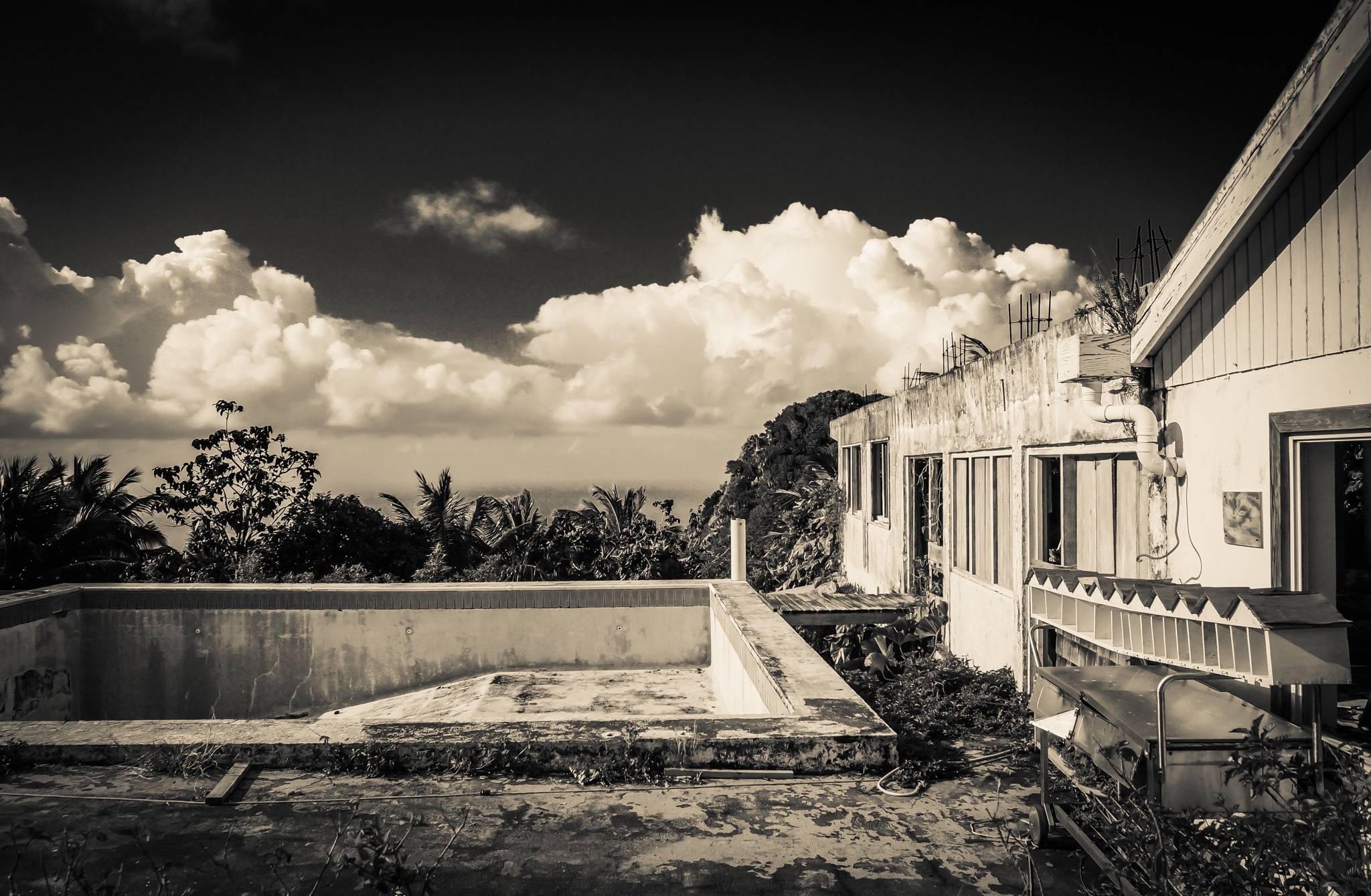
Clouds Over Captain’s Quarters, Windwardside, Saba, Dutch Caribbean
Yes, I know. I’ve posted a lot of photos of the Captain’s Quarters ruins, but dang, it sure is beautiful. I took an infrared on CQ here, and dialed back the high white intensity to get the reflective photo you see here. Those mailboxes on the right are fascinating, as they have the old names from before Hurricane Georges still labeled: Sea Saba, Franklin’s, Juliana’s, et Al.
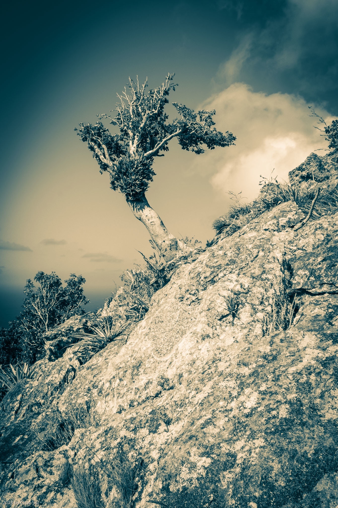
South Coast From Paris Hill, Saba, Dutch Caribbean
Hilltop Pastorale
I talked to Chef Michael from Brigadoon, and indicated I’d like to take another crack at climbing the monolithic whale tail on Paris Hill. Hoping he can come with me, as he’s done it several times before, and it’ll help me to see how before I tackle it. We’ll see. In the meantime, here’s a sample of the gorgeous south coast views of Saba from Paris Hill. I’d like to especially thank the foreground yucca for acting like a mini-sunrise accent to the picture when only minutes before, that seemingly innocent sunny plant’s serrated edges had ripped a variety of tiny holes in my calves when I came over the ridge to the summit. Flora dualism or have I finally reached a point where I’m anthropomorphizing Saba’s durable vegetation as a lame cover for poor hiking skills? I’ll leave that opinion to you, dear readers. Cheers and have a great day!
You may recall an earlier blogpost of the whale on Paris Hill, above the village of The Bottom. Today’s hike was to summit the hill and get up close and personal to said whale, but it proved to be anything but trivial. Indeed the hike up to the base of the whale was literally 12 minutes, but then it was a sheer, steep boulder scramble up sawtooth yucca and other cactus, that ended up taking an hour and a half. This rock climbing was easily comparable to the off trail route to Hot Springs (a no access trail) that Chef Michael from Brigadoon took me on a few weeks ago. Lots of route calculating as far as where my feet were going and where I was going to get handholds on the volcanic rock. In the end, it was worth it, as I snapped lots of pictures from the dramatic views up there. I managed to make it to the tail, called Tent Rock, but I just didn’t have the huevos to haul my fat butt up that sheer red face with 1400 foot dropoffs to the cliffs and bay below. Maybe another day. The yucca and cacti took a bloody chunk out of my legs on the way down; I’ll wear long pants next time I’m up here.
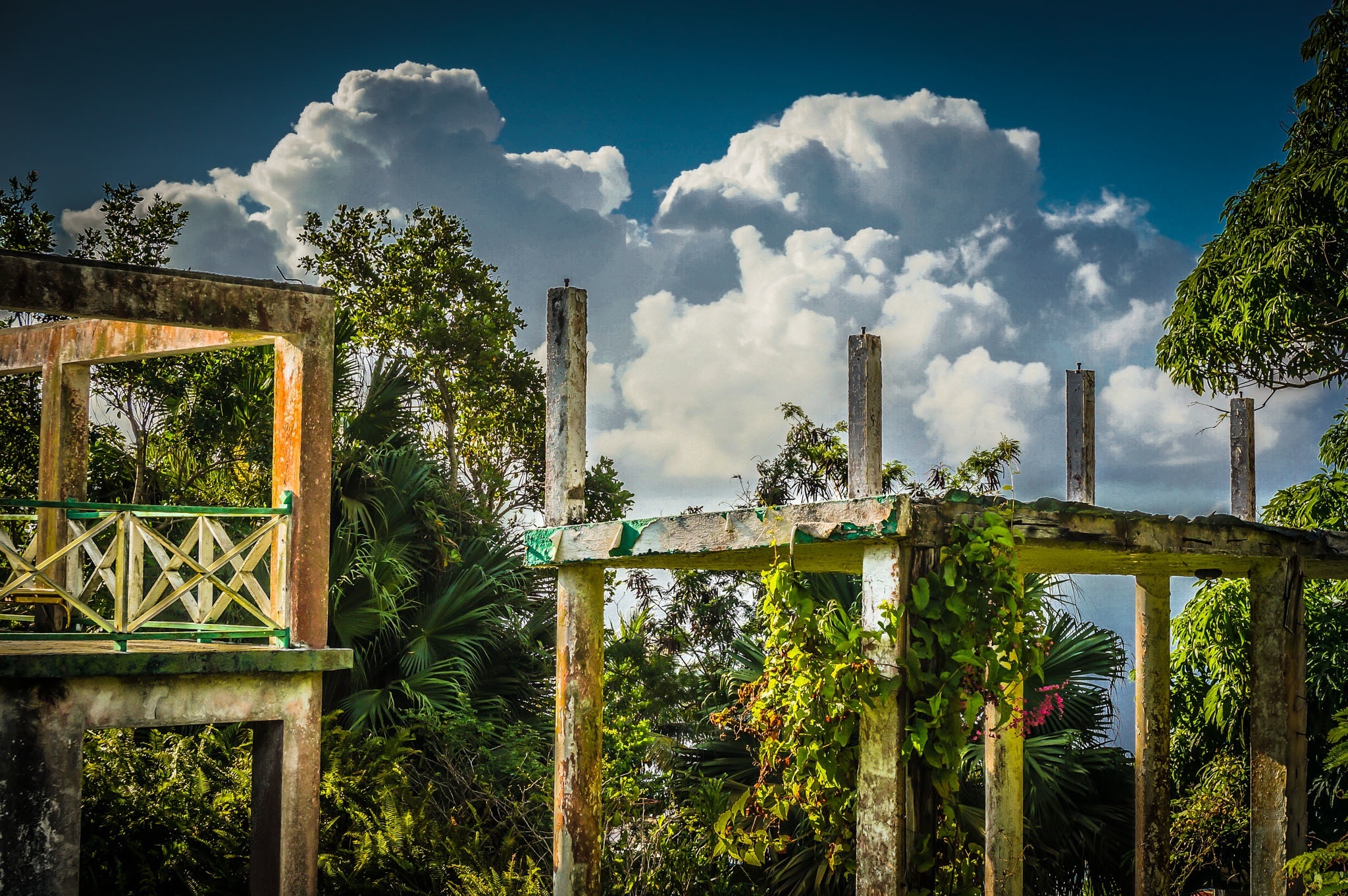
Clouds Billow Over The Structural Remains of Captain’s Quarters Hotel, Saba, Dutch Caribbean
Views like this, though they hold sad memories for some, inspire me to write, because the earth and sky still create magical art together every day here on Saba. The novel continues to move forward, no slower or faster than my muse will allow, and I’m ok with that. Que sera sera, amigos y amigas!
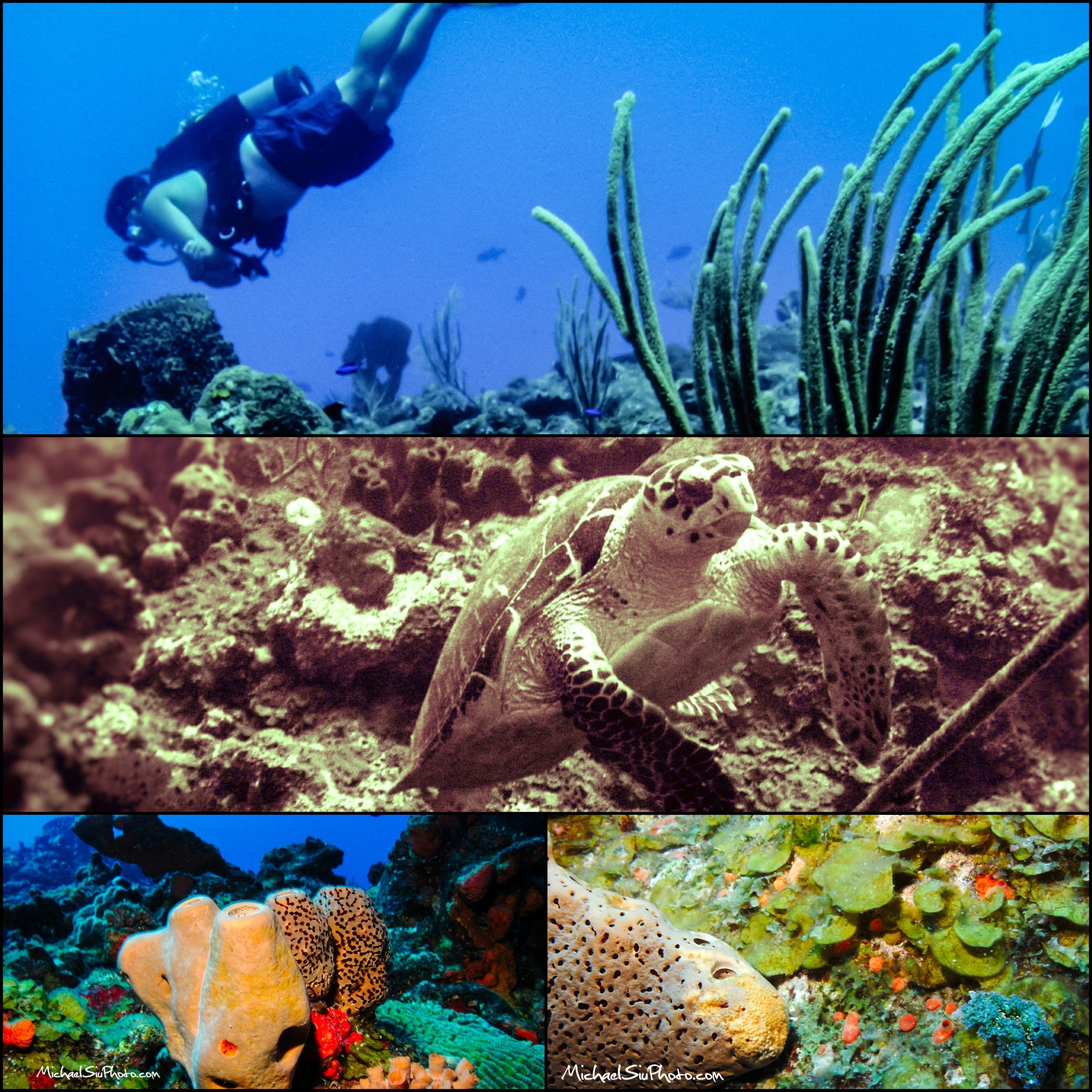
Yep. That’s me above, skin diving in the beautiful Saba pinnacles and Tent Reef. My brother Michael snapped all of these photos. We have lots more Saba dive photos to come from even better underwater photographers, but this will suffice for now, eh? Under the water or above it, Saba rocks!
Brother Michael leaves Monday, so after doing a final pair of dives for him with our Sea Saba friends Aaron and Vicky, we spent a quiet Saturday evening at the Vineyard Cottage…aka home…resting up for Mt Scenery tomorrow morning, his final hike of the island. It’s been quick and delightfully fun in the way that all vacations are, and I’m thinking he’ll leave with a little of the fondness I have for Saba and its friendly culture and of course, dynamic vistas above and below the water.
The picture today is an 8am sunrise picture over Core Gut along the Spring Bay trail ridge descent. Lens flare murks up the foreground cactus a bit, but not so much I didn’t think it worth sharing…hope you agree. ‘Til tomorrow, have yourselves a great day!
Waves Crash Ashore At Spring Bay, Saba, Dutch Caribbean
Yo Ho Ho, And A Hallmark Gift Card In A Bottle of Rum
Waves smashing into every Saban shore, its craggy rocks, its vast ocean square and flat to the distant horizon. If I was a pirate, Saba would be my first choice, too; no wonder Columbus took a quick gander, mistook the perpetual fog on Mt Scenery for a smoking volcano, and headed straight for Statia without landing here.
What’re YOU doing for Valentine’s Day, that most treasured of love and courtship holidays? I’m listening to angsty friends complain about its commerciality, that it’s an invented holiday for card company profits, but not only has it been around since the Middle Ages as a celebration of love, but I think they’re missing the point. Certainly, you should celebrate your significant other all throughout the year, but everyone’s so endlessly busy in day to day life, why not have a holiday just to slow you down a bit and have a good excuse to take some missing quality time together, eh?
Sappy? Maybe, but If V-Day is wrong, I don’t wanna be right. Bless all of you and give your loved one a smooch and a hug today, just because you can.
South Coast Cloudscape, Statia, and St. Kitts Views, Saba, Dutch Caribbean
Giles Quarter, Geomorphology, and the Gut Adventure
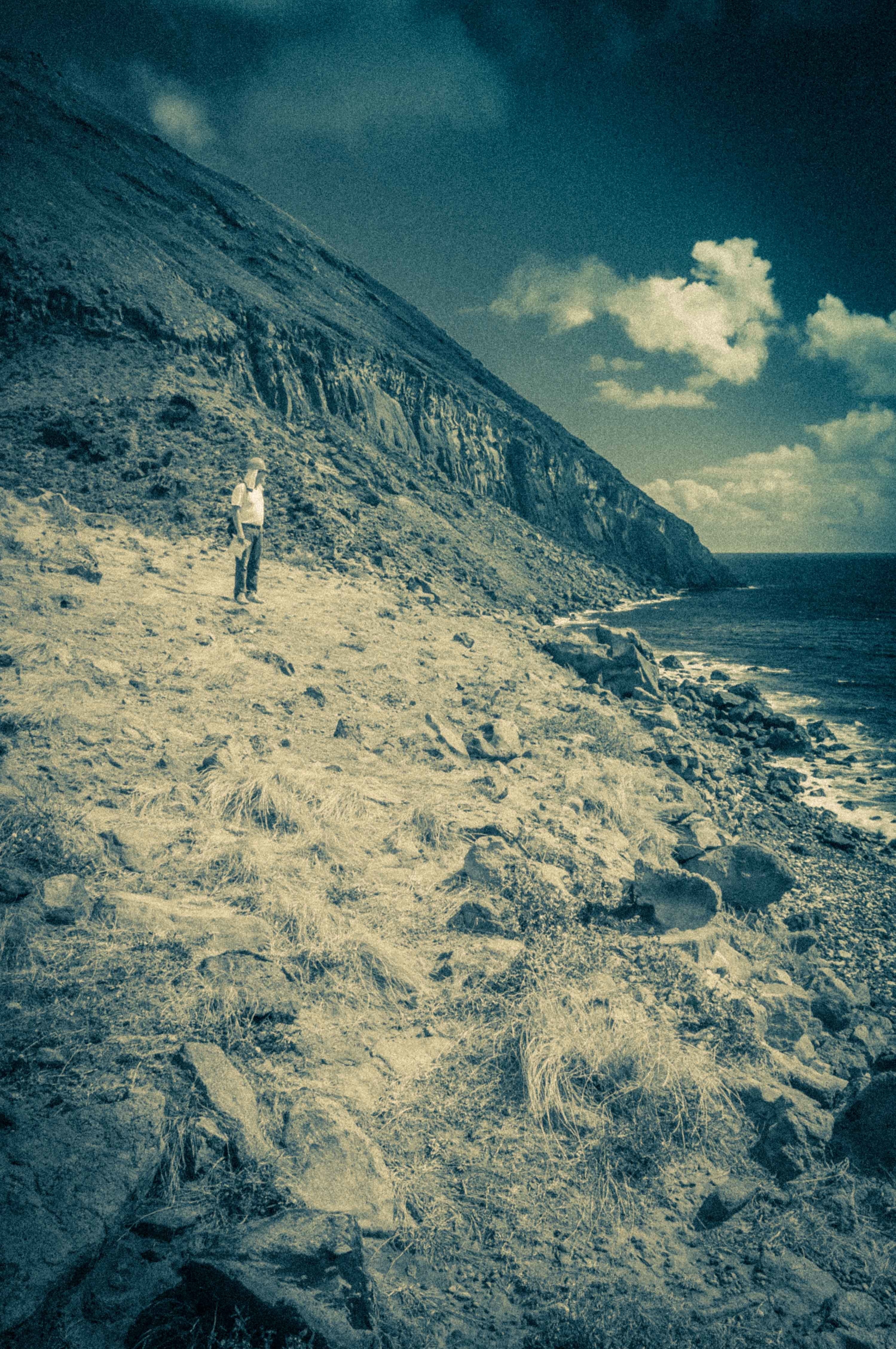
Pardon my alliterative heading there…two days ago I agreed to guide a French geomorphologist down the Giles Quarter coastline trail and up the Gut to Windwardside. Gut is what the Sabans call the steep, winding ravines that slash downwards all over the volcanic island; many are off trail canopies of thick and ropy shrub and foliage that winds itself around anything on your person and cuts and scratches any exposed skin. But hey…an adventure, right?
We picked up orange hard hats at the Conservation Bureau down in Fort Bay- natural and goat induced rockfall is common on Giles Quarter–then set off down the coastline. Cristian is a gregarious living archetype of the absent minded professor; in the case of our hike, the shiny objects of his interest were various examples of geomorphology/vulcanology on Saba: conglomerate, alluvial stream beds, plants thriving in microclimates in the various Saban ecosystems. Rocks, dirt, plants, and terrain…wahoo.
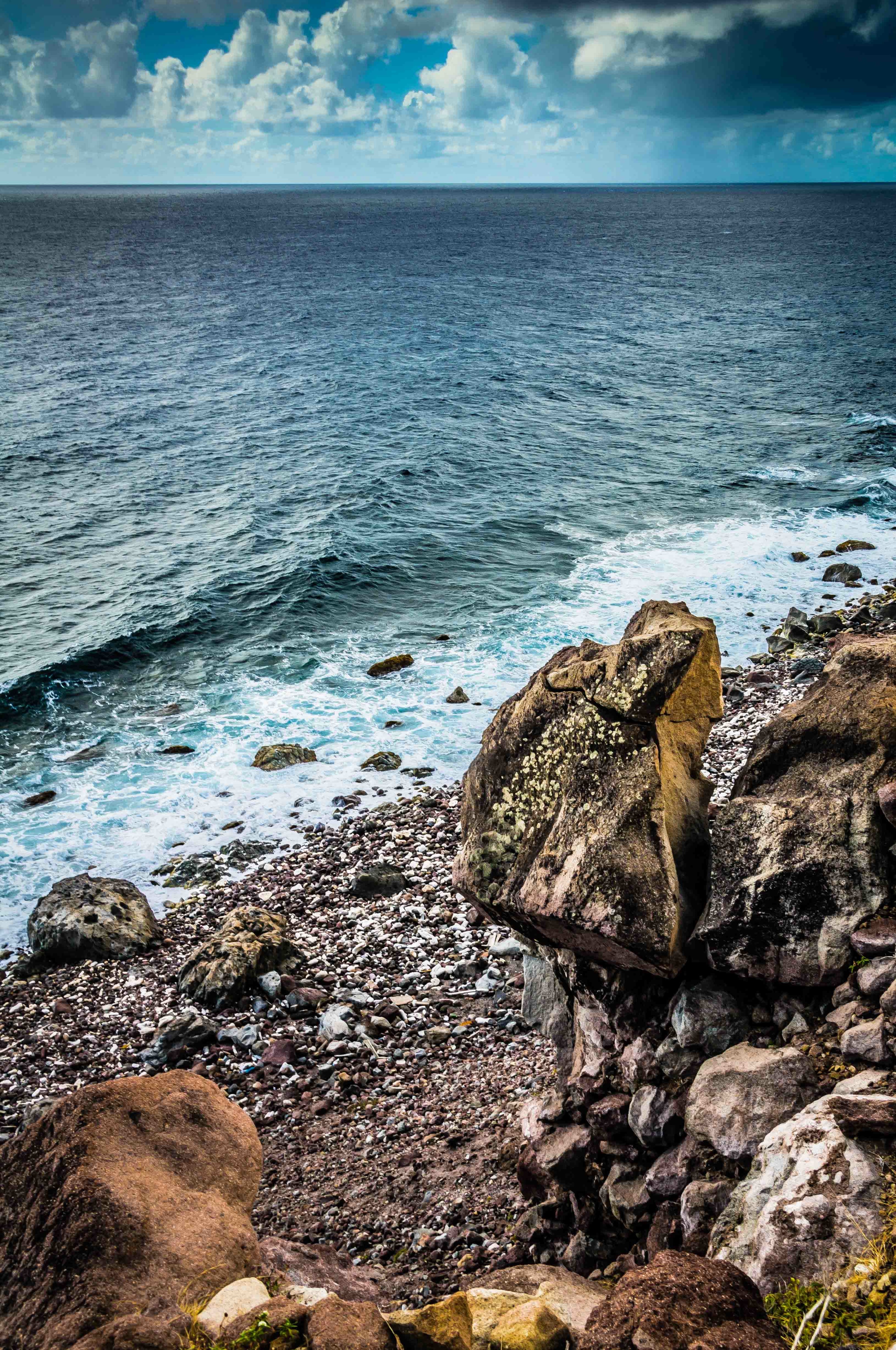
Up close and personal on the Saba south coastline, we could see fields of long yellow grass laid flat by gusty breezes. In the picture, just beyond the long grass, there’s an abrupt 10-20 foot cliff drop off to the rocky Saba shore (shown with the balancing rock photo), with big swells coming in vis a vis the northwest tradewinds.
Balancing Rock, Saba South Coastline
I tried to persuade Cristian to take one of the ridges for our ascent up to The Road, which are relatively scrub free, straightforward ascents, but he really wanted to wade into the Gut that comes right into Windwardside (~1400 feet) to get his “cross section” of the island. Looking up we knew it was going to be a scrub fight, and, when we got up towards the top of the ravine, some fairly vertical cliff and rock scrambling.
Cristian At The Base of the Windwardside Gut
The story ends thusly: it took us 2 hrs to get to the base of the scrub in the Gut, and an additional 2-3 hrs to climb out to the road via separate paths.
At some point, fairly well cut up from scrub, Cristian took off up the left side of the Gut walls while I reasoned it would be safer to brute force my way through the canopy up the low slope of the Gut stream bed. When I hit a impassable rock and scrub wall, I started up the fairly vertical walls, at times swinging from embedded tree root systems across rock walls with very little foothold and pulling myself up past loose rock. A little Tarzanesque, ‘cept I ain’t no king of the jungle. I emerged out at the Captain’s Quarters ruins per plan, a bit tired and having gone through 4.5 liters of water and still feeling like I’d lost weight. Cristian walked up to the Trail Shop about 30 minutes later. He had major abrasions all over his forearms, his neck red from 5 hrs in the sun despite sunblock. I was just dirty, sweaty, and my arms looked like the result of a minor cat fight. We had a beer at Saba Snack, recounting our adventure while he expressed some regret I hadn’t followed him to take pictures of the “marvelous” geomorphology on his route and apologized for getting separated.
I’m all for a little off trail from time to time, but coulda used a machete and some gloves on this one. Easy to see why visitors on Saba could underestimate the effort to work through jungle and scrub when looking at it from above. Think I’ll save my future Saba climbing efforts to the more tried and true trails and ridges. All the effort but less poky scratchy plants and rock climbing sans rope 🙂