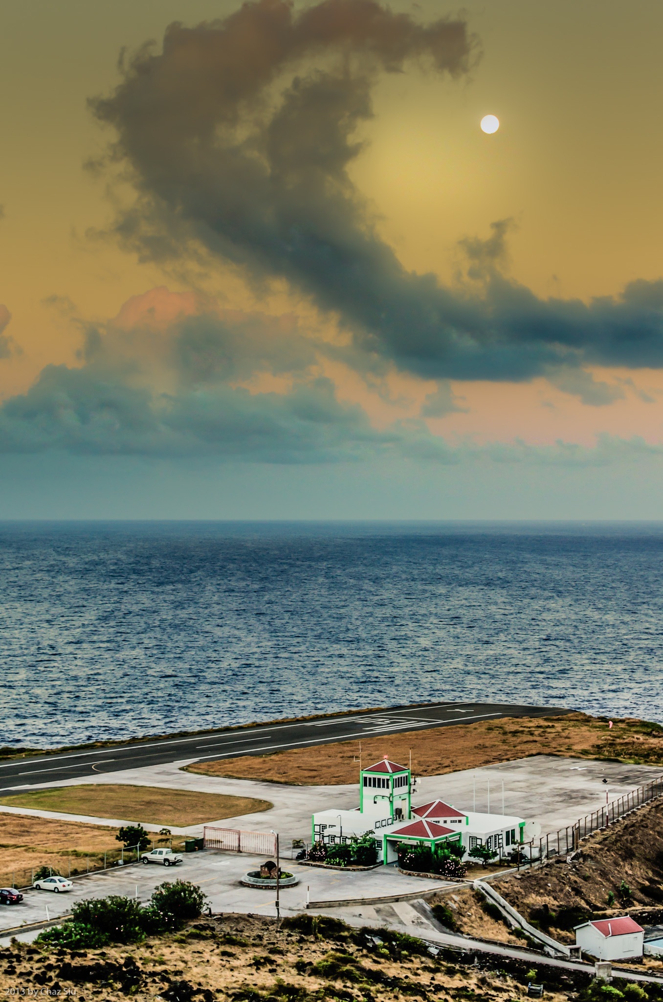
Moon Sunset Over Flat Point, Saba, Dutch Caribbean
La Luna Bella
Rambling down the twists and turns of Hell’s Gate to a perfect Sunday Cove Bay BBQ hosted by Tanner (chef at Shearwater Resort) and his gal Patricia, the moon swapped roles and let the clouds be the crescent over Saba’s airport, and this delightful sunset was the brief result. It only lasted maybe 30-60 seconds before the clouds broke up and hid Mister Moon. But hey, right time, right place.
Cheers to all who’ve watched the Saba video yesterday; proved to be a most popular blogpost indeed. More to come. Au revoir ’til tomorrow!
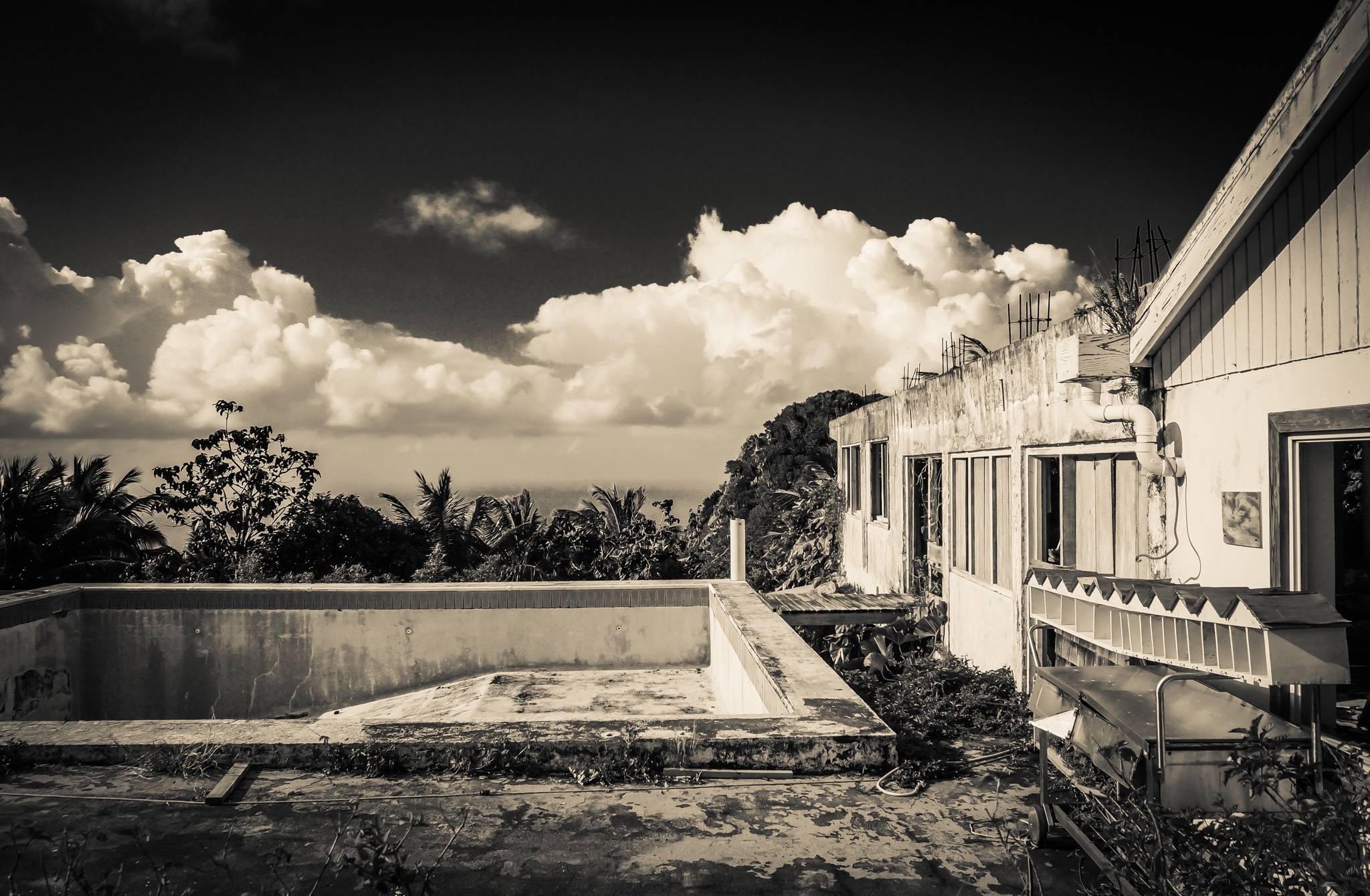
Clouds Over Captain’s Quarters, Windwardside, Saba, Dutch Caribbean
Yes, I know. I’ve posted a lot of photos of the Captain’s Quarters ruins, but dang, it sure is beautiful. I took an infrared on CQ here, and dialed back the high white intensity to get the reflective photo you see here. Those mailboxes on the right are fascinating, as they have the old names from before Hurricane Georges still labeled: Sea Saba, Franklin’s, Juliana’s, et Al.
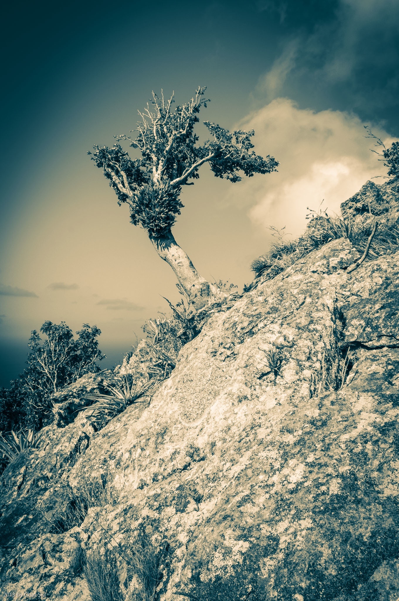
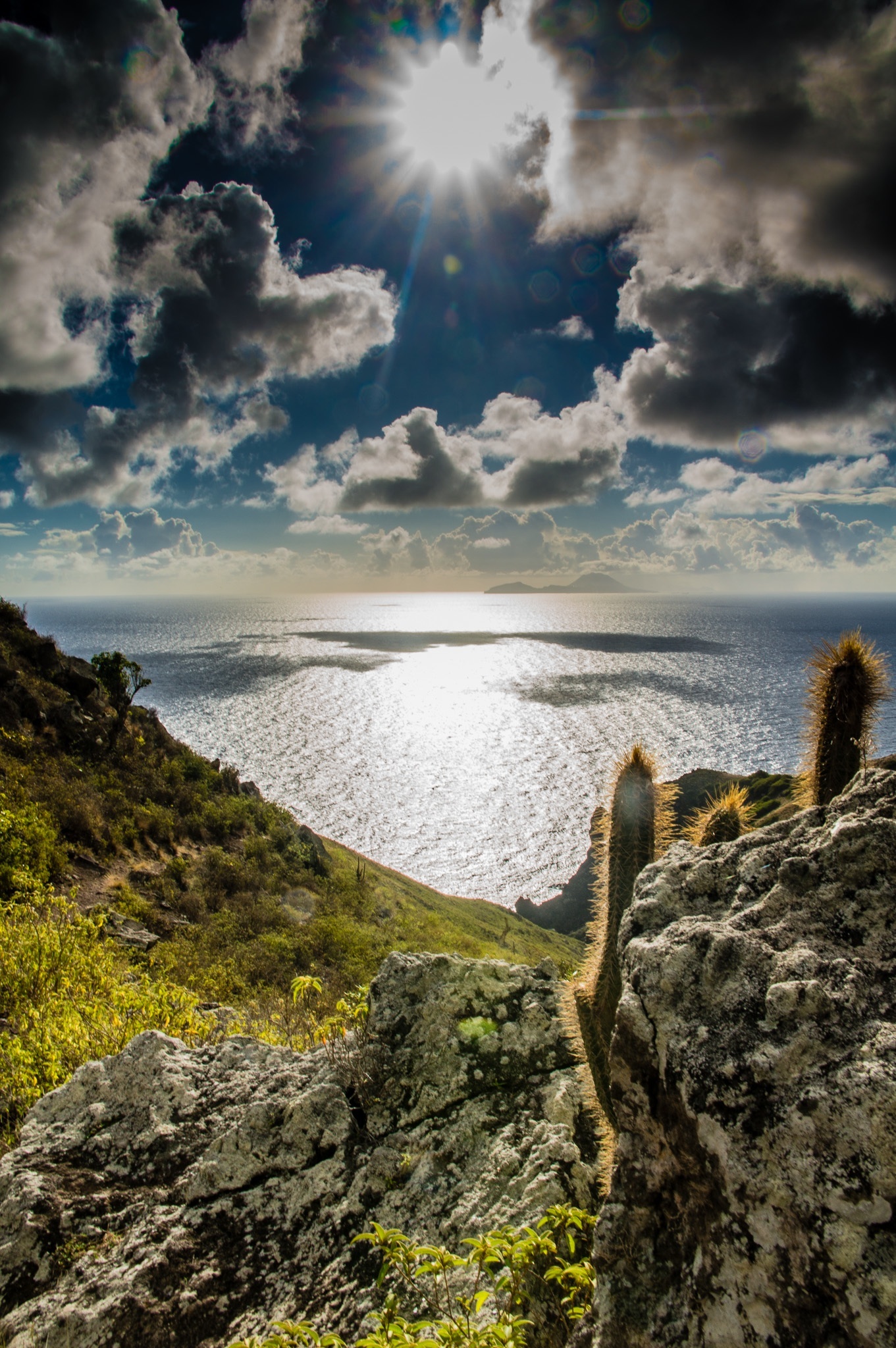
South Coast From Paris Hill, Saba, Dutch Caribbean
Hilltop Pastorale
I talked to Chef Michael from Brigadoon, and indicated I’d like to take another crack at climbing the monolithic whale tail on Paris Hill. Hoping he can come with me, as he’s done it several times before, and it’ll help me to see how before I tackle it. We’ll see. In the meantime, here’s a sample of the gorgeous south coast views of Saba from Paris Hill. I’d like to especially thank the foreground yucca for acting like a mini-sunrise accent to the picture when only minutes before, that seemingly innocent sunny plant’s serrated edges had ripped a variety of tiny holes in my calves when I came over the ridge to the summit. Flora dualism or have I finally reached a point where I’m anthropomorphizing Saba’s durable vegetation as a lame cover for poor hiking skills? I’ll leave that opinion to you, dear readers. Cheers and have a great day!
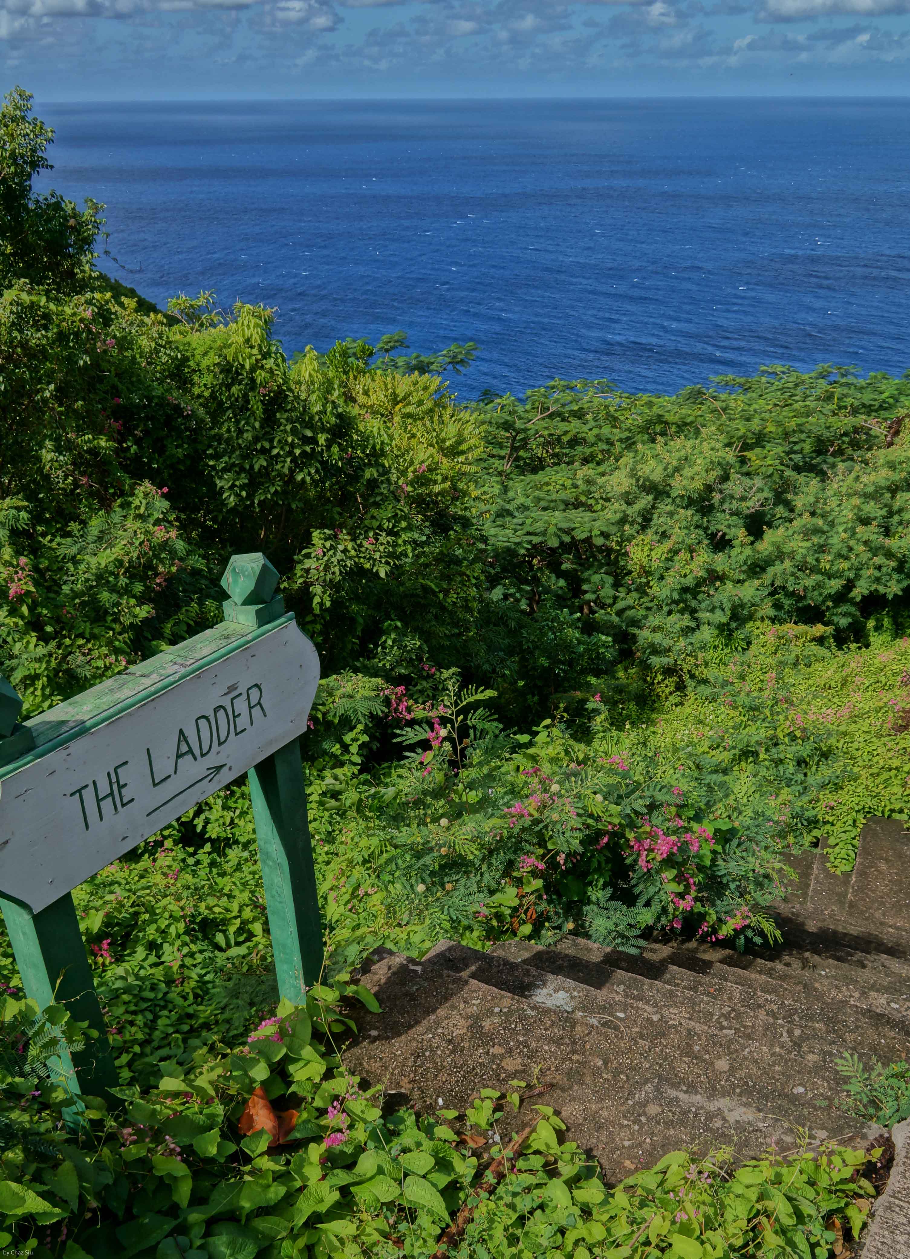
You may recall an earlier blogpost of the whale on Paris Hill, above the village of The Bottom. Today’s hike was to summit the hill and get up close and personal to said whale, but it proved to be anything but trivial. Indeed the hike up to the base of the whale was literally 12 minutes, but then it was a sheer, steep boulder scramble up sawtooth yucca and other cactus, that ended up taking an hour and a half. This rock climbing was easily comparable to the off trail route to Hot Springs (a no access trail) that Chef Michael from Brigadoon took me on a few weeks ago. Lots of route calculating as far as where my feet were going and where I was going to get handholds on the volcanic rock. In the end, it was worth it, as I snapped lots of pictures from the dramatic views up there. I managed to make it to the tail, called Tent Rock, but I just didn’t have the huevos to haul my fat butt up that sheer red face with 1400 foot dropoffs to the cliffs and bay below. Maybe another day. The yucca and cacti took a bloody chunk out of my legs on the way down; I’ll wear long pants next time I’m up here.
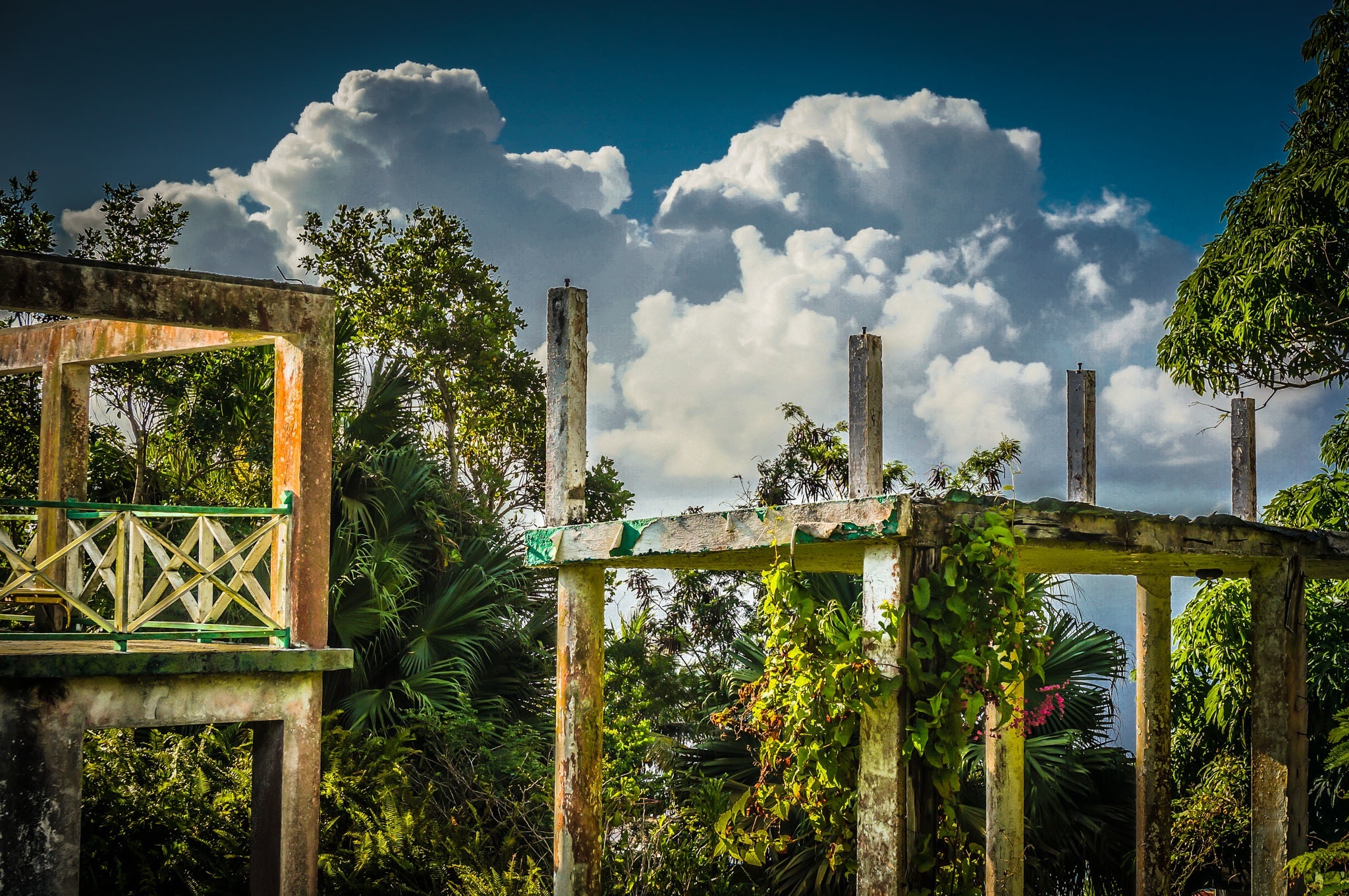
Clouds Billow Over The Structural Remains of Captain’s Quarters Hotel, Saba, Dutch Caribbean
Views like this, though they hold sad memories for some, inspire me to write, because the earth and sky still create magical art together every day here on Saba. The novel continues to move forward, no slower or faster than my muse will allow, and I’m ok with that. Que sera sera, amigos y amigas!
Brother Michael leaves Monday, so after doing a final pair of dives for him with our Sea Saba friends Aaron and Vicky, we spent a quiet Saturday evening at the Vineyard Cottage…aka home…resting up for Mt Scenery tomorrow morning, his final hike of the island. It’s been quick and delightfully fun in the way that all vacations are, and I’m thinking he’ll leave with a little of the fondness I have for Saba and its friendly culture and of course, dynamic vistas above and below the water.
The picture today is an 8am sunrise picture over Core Gut along the Spring Bay trail ridge descent. Lens flare murks up the foreground cactus a bit, but not so much I didn’t think it worth sharing…hope you agree. ‘Til tomorrow, have yourselves a great day!
First things: On Sunday I guided a hike up to the top of Mt Scenery; I inadvertently spilled water into my waterproof backpack, where, unbeknownst to me, my digital camera swam unhappily during the descent. So she’s DOA. No pictures, no blog? I’m working through recovery options, but if blogposts get a bit less frequent, well…now you know. Gaaaaaah 😦
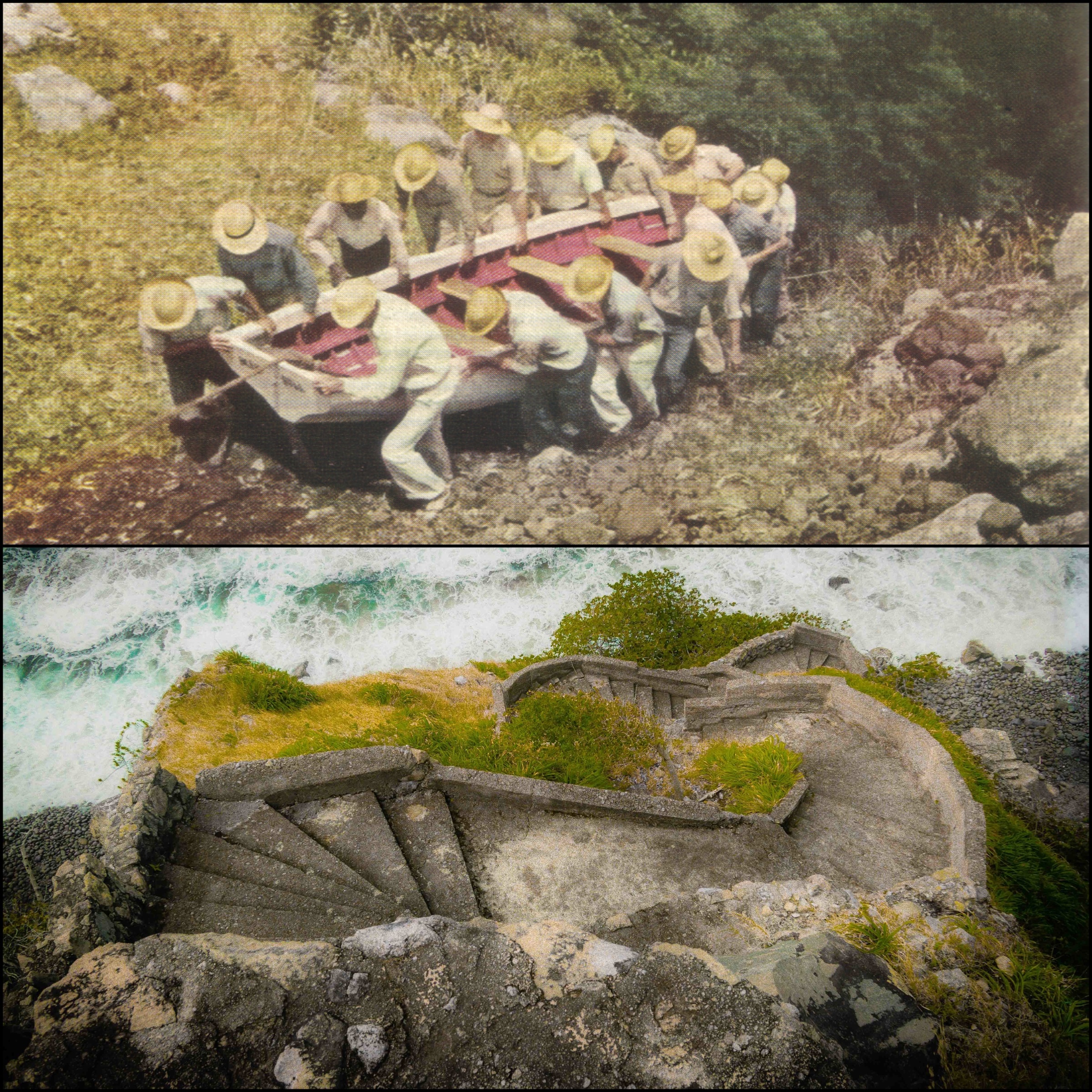
Entrance To The LadderTop: Sabans carry boat up The Ladder in 1940 Bottom: The Ladder today
The Ladder
Lets go back in time a bit on Saba…say, . Airport? Nope. Harbor? Uh, no. How about a good old road, maybe? Nada. No, the primary way that Sabans moved goods on and off the island until The Road was completed was The Ladder, 880 stone steps rising 1000 vertical feet out of Ladder Bay to the lee of the island and up to The Bottom. Sabans were famously good sailors. The picture above shows from a 1940 National Geographic article shows Sabans moving their boat up The Ladder. The picture below it is the lower part of The Ladder today, showing the parapet style steps and how vertical they are. Frankly, The Ladder is a strenuous workout today with only a backpack; can’t imagine carrying boats, sacks, and any other basic weighty commodity up and down as part of day to day life: These Sabans are tough folks. I’ve included a
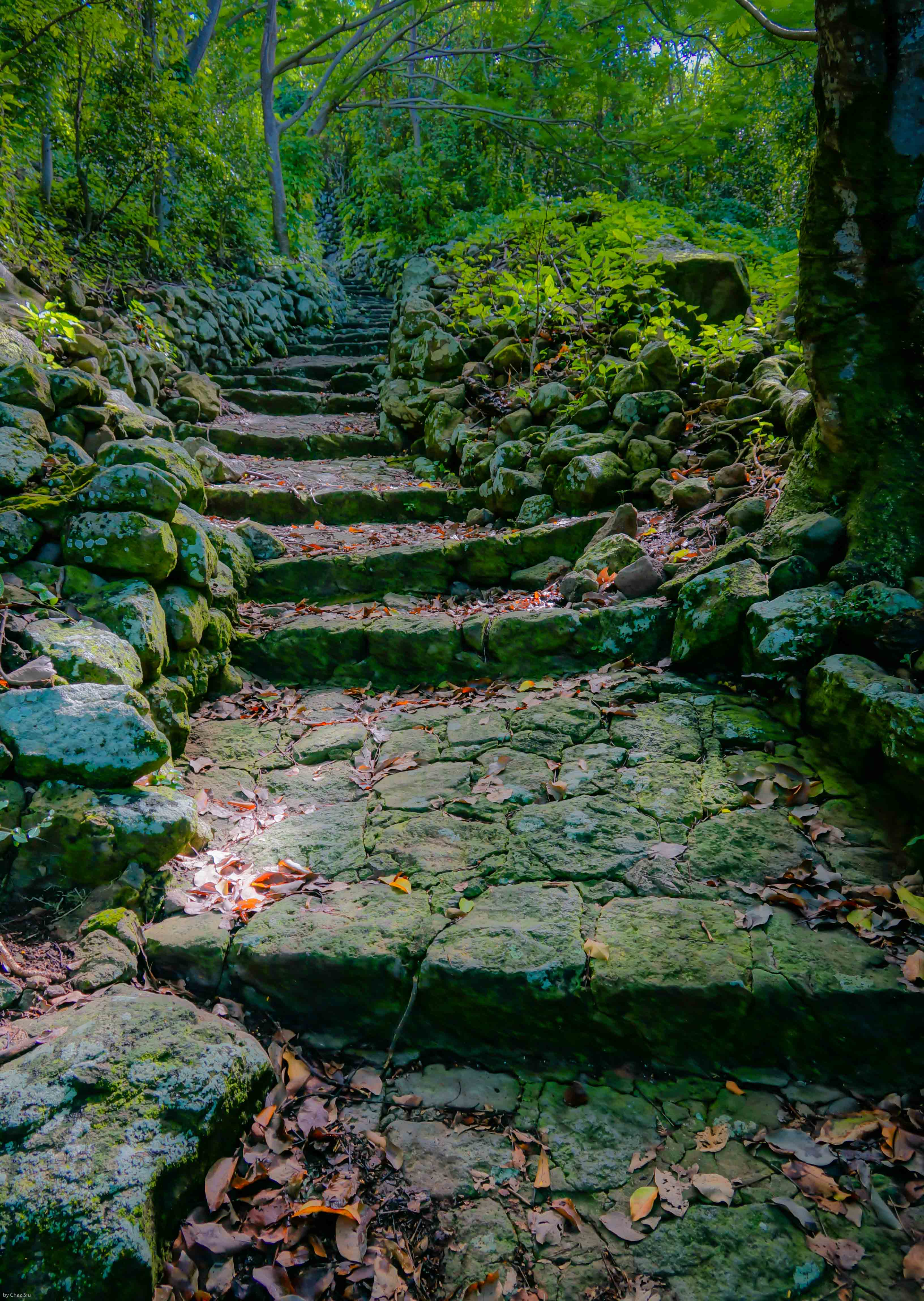
Lower steps of The Ladder.
couple more pictures here of The Ladder showing its rise into the forest. It’s still steep enough to avoid if it rains, as the steps become slippy slides of lichen. The swells down at Ladder Bay are typically fierce as you can see, but the early settlers still considered the lee of the island the only place to land your boat safely. Enjoy!
The Ladder and Ladder BayThe Ladder Ascends Into The Bottom