Clouds, clouds, everywhere, and poor ol’ Saba is still dry as a bone. At least it’s finally a little breezy up high in the villages. It’s quiet out in blog land lately….anybody out there?
Chaz Sin: One Writer's Sojourn Through An Odd Life

Clouds, clouds, everywhere, and poor ol’ Saba is still dry as a bone. At least it’s finally a little breezy up high in the villages. It’s quiet out in blog land lately….anybody out there?

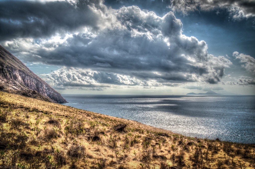
It’s tantalizing and teasing to be in the middle of a draught and extreme water conservation on the island and see storms come within three miles of Saba, and drop all their water offshore. As this picture shows, it may be beautiful to look at, but that doesn’t mean we have to like it. But then again, I did snap the photo, so there’s that consolation.

The last few days have been me getting up earlier and earlier to try and beat the dreaded heat with no wind and do a bunch of ridge hikes up from the Giles Quarter coastline midway between the St. John’s Flat and the Wash Gut up to Windwardside. Saba’s terrain is so rugged and steep, it amplifies the actual distance you’re hiking, which is usually between 3-5 kilometers, but can feel like a lot more. Regardless, even at 7:00am, the heat is beating down mercilessly as I haul my big ol’ self up this rock.
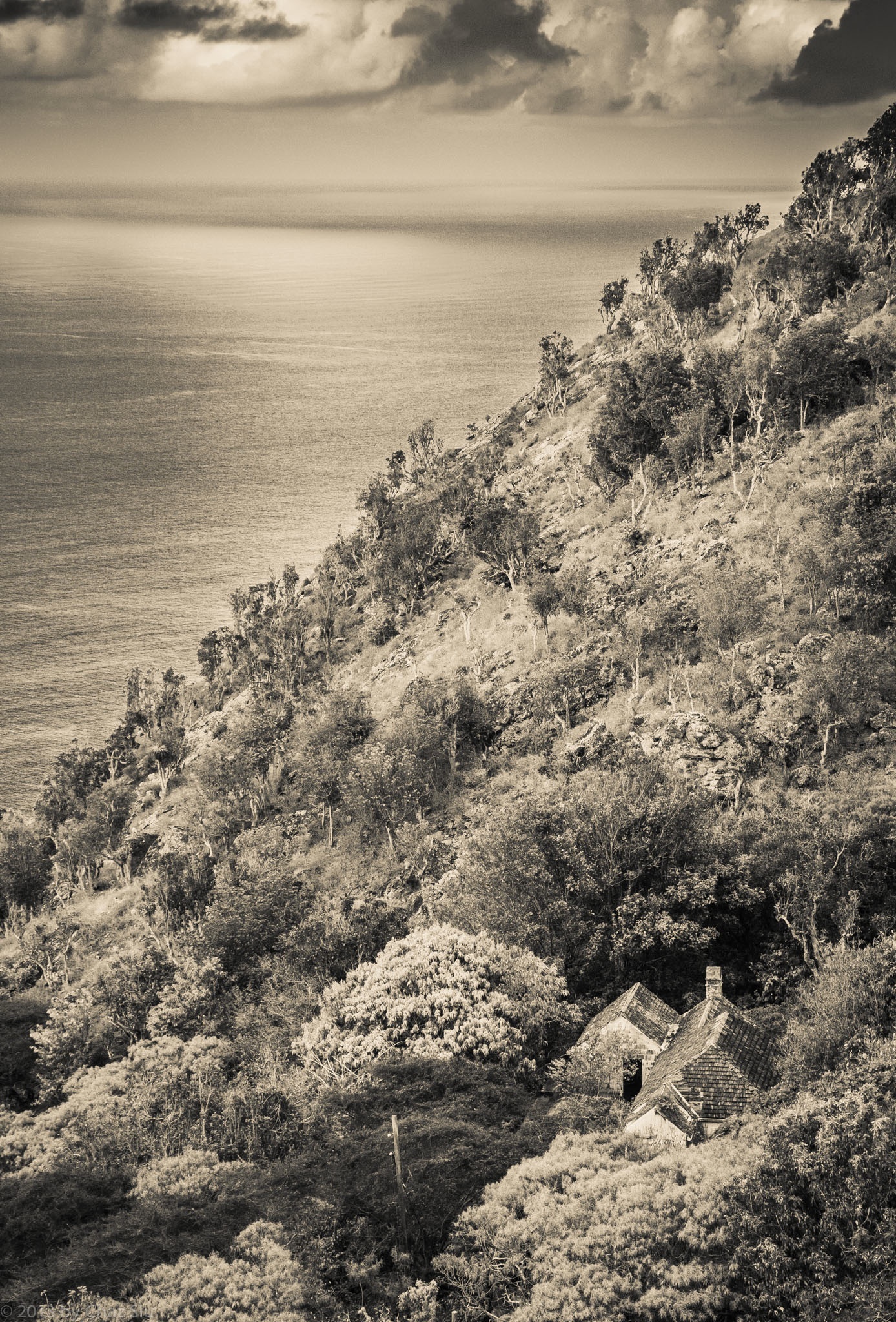
In any case, repeated trips down to Fort Bay to start these coastline-ridge excursions had me passing this little house nestled in the cleft between St John’s Flat and Thais Hill. It’s an old style house, with rare brown wooden shingles rather than the traditional red corrugated tin,though you can’t tell from my processing it in black and white. My guess is that it’s well protected from the ravages of hurricanes and tropical storms as well, but I don’t know yet who, if anyone, lives in this nostalgic little house, but it sure looks cool from above, n’est cd pas?

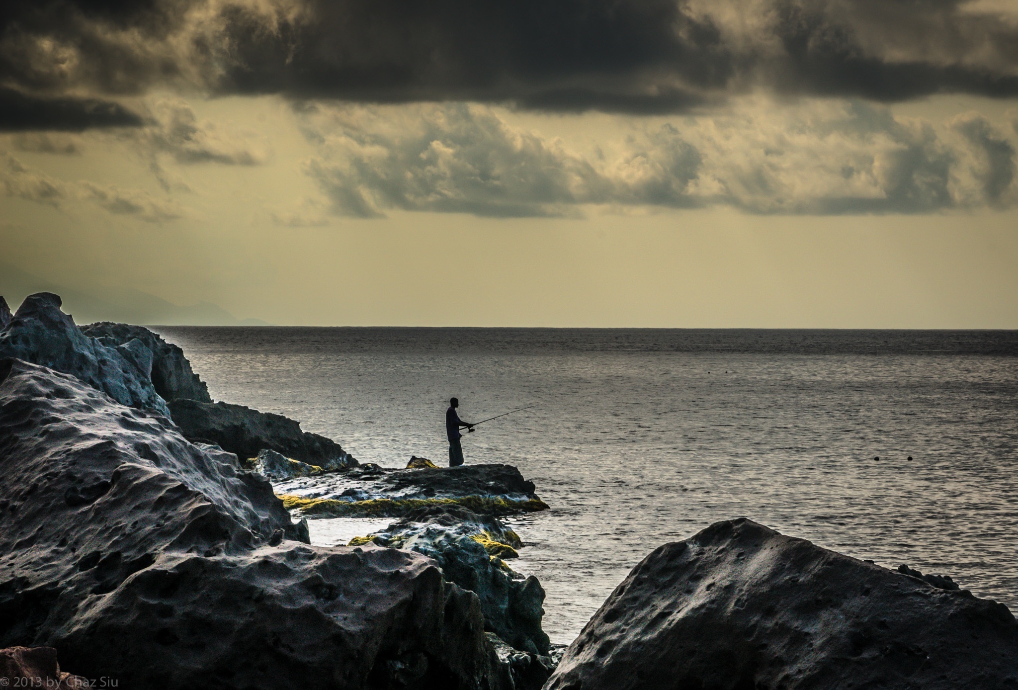
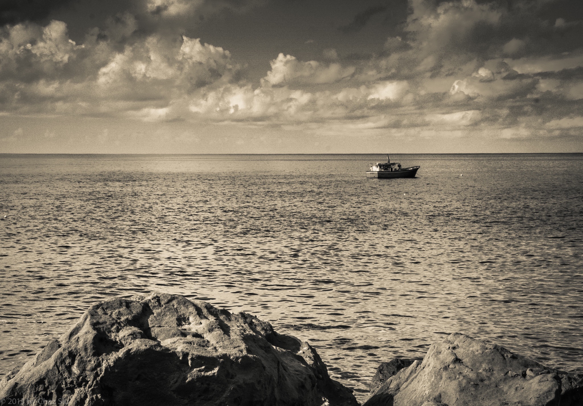
Another early morning hike down to the harbor, meander along the coastline, and voila, snapped this fellow doing what his family has been doing for more than a hundred years. Came up the Dancing Place ridge to Windwardside and started collecting boxes for shipping.
With three weeks remaining, guess I’m finally winding down. On the other hand, many folks would give an arm or leg just to have three weeks away from the frenetic pace of their lives, so no melancholy me ’til I’m off the rock and in the city once more.

“The greatest gift of life on the mountain is time. Time to think or not think, read or not read, scribble or not scribble — to sleep and cook and walk in the woods, to sit and stare at the shapes of the hills. I produce nothing but words; I consumer nothing but food, a little propane, a little firewood. By being utterly useless in the calculations of the culture at large I become useful, at last, to myself.”
― Philip Connors
Though this quote is in reference to hiking and camping on the mountain, I still think it sums up the essence of my coming here, particularly that last bit. I love the city I live in, but equally do I love this rugged rock, the peace and tranquility of its folks and its setting, above and below the water. People ask me if I miss the city, and my general answer is no, I’m focused on wringing out every bit of distraction free relaxation until the day I leave, and on the plane, I’ll get excited about where I’m going; I’m so much better at living in the moment at this stage in life, no apologies or regrets.
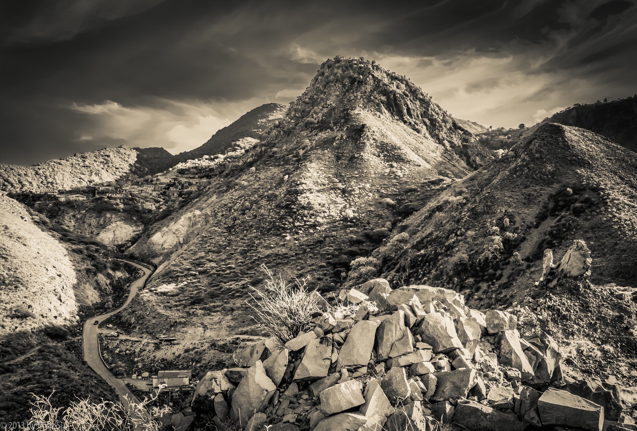
When you walk down the steep and sidewinder curves of The Road down to Fort Bay, you can take a mild detour to climb onto the hill above the harbor, across from Bunker Hill. Rather than looking towards the sea, where the Dutch Navy frigate was bringing in 60,000 liters of relief water to the hospital, the government building, and the old folks home due to our current drought, I looked back up at Thais Hill, which looms over the road, and up to the edge of the St John’s Flat, close to where I live. Never a shortage of new angles, and this one really shows off the rugged nature of this auld rock, forever subject to the wear and tear of weather, the thin wisps of stratus clouds high aloft and skimming the atmosphere. Not bad, Saba, not bad at all.


Bless any of you who actually get the bizarre reference in the blogpost subject 😉
It’s hot here in Saba, and no wind this morning made my day an exercise in sweating. I walked down to the Fort Bay harbor, climbed up the rocks above, then headed back up The Road to the The Bottom, where I frightened some people with the sheer amount of moisture dripping off of me, then took the Crispeen Track trail back up to St John’s, where this l’il guy was on my mailbox post, cool as a cucumber. He’s an anole lizard, indigenous to Saba, plus he’s an excellent poser.


Just because the fallout of 1900 metric tons of sulfur ash from the perrenially active volcanic isle of Montserrat downwind of us made for one of the best sunsets many recent locals can recall, doesn’t mean I wish for that kinda thing. Sabans tell me it happens around 3-4 times a year. The whole day, Saba was hot hot hot and a bluish haze hung over the island, smelling like rotten eggs. But when night approached, I was having dinner at Scout’s Place in Windwardside and this is one of the sunset images I captured off the terrace.

From Wikipedia:
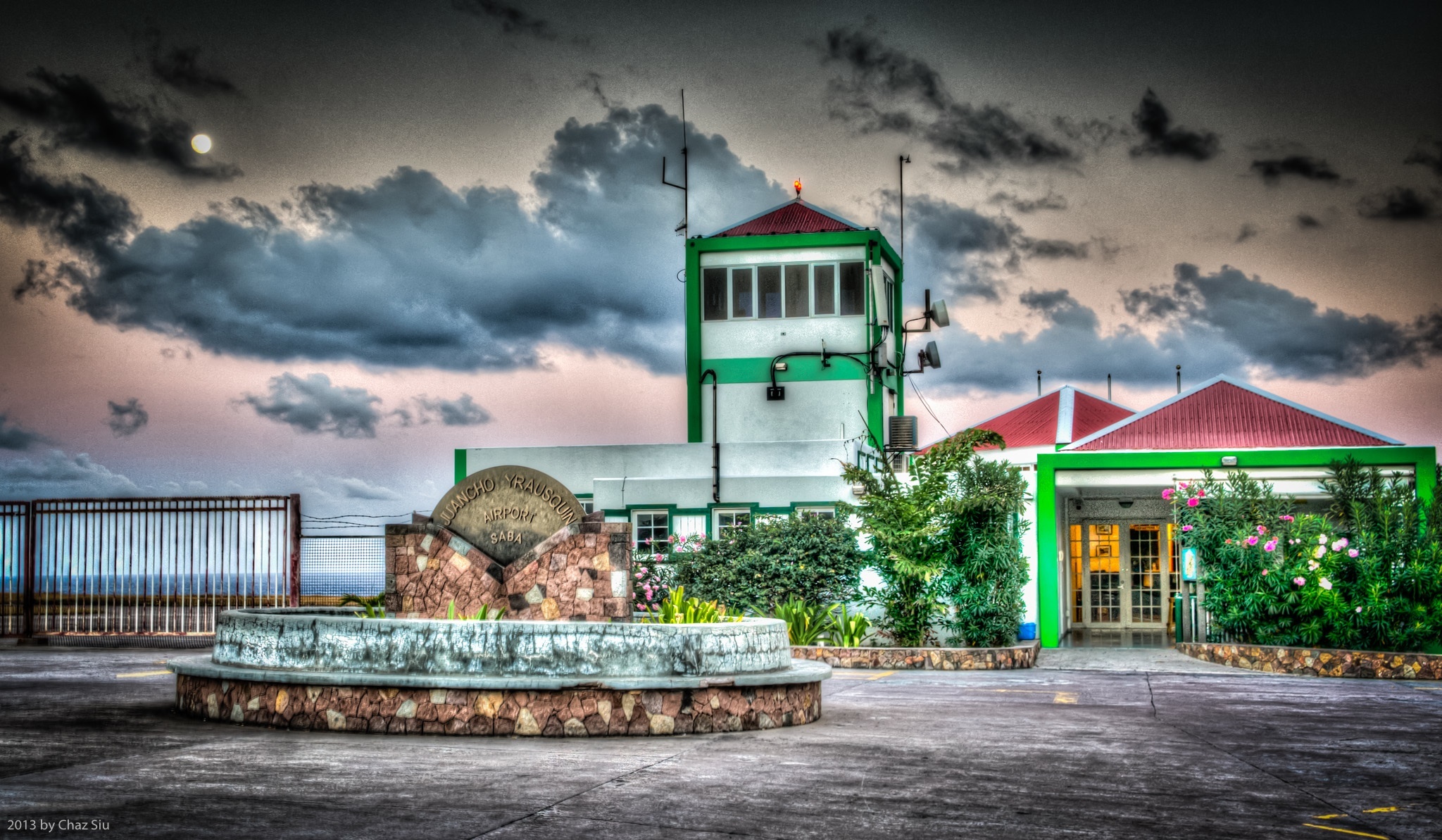
[Saba] airport’s risky reputation arises from the airport’s physical position: it is flanked on one side by high hills; and on the runway’s other side and both ends, cliffs drop into the sea. Additionally, the runway at the airport is extremely short (400m ); this creates the possibility that an airplane could under/overshoot the runway during landing or takeoff and end up in the sea or dashed on the rocky cliffs.
For those of you who saw the video blog a couple weeks ago with the plane taking off, the description above may amplify the concern about landing or taking off in Saba, but the airport’s had no fatalities or crashes in its 50 years of operation. This is the second or third incarnation of the airport, as the first couple terminal buildings blew down in hurricanes, most recently Hurricane Lenny in 1999. Flat Point was cleared of rocks by Saban folks in 1959 for a landing by pilot Remy F De Haenan to prove Saba could support aircraft, and it officially opened in 1963. Due to its length, it only supports a couple commercial short takeoff and landing (STOL) aircraft and helicopters, of course. The airport is named for Juancho E. Yrausquin, a prominent Dutch politician for the Antilles in the 1950’s.
There are normally only 4 WinAir flights a day, except during major holidays, when the students from the university fly out and they ramp it up considerably (10-12), but the net of it is, the sound of planes over Saba is generally rare, except at 7am, 10am, 1pm, and 5pm. Moreover, I can’t recall having ever heard a jet overhead. This contributes the the general peace and quiet on this isle I cherish.

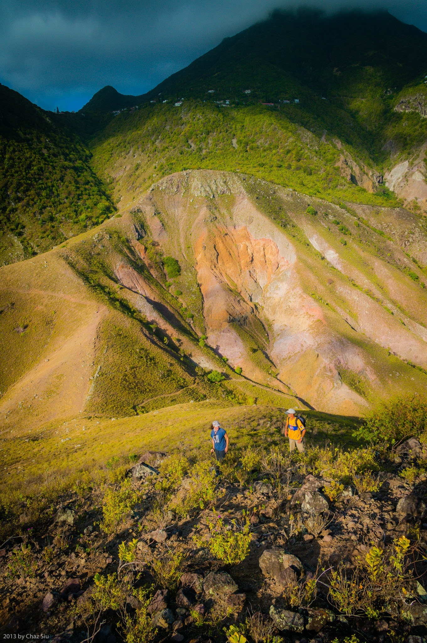
Old Booby Hill stands off on its own between the Windwardside Level and Spring Bay. It’s an absolutely wonderful diversion off trail hike from the Spring Bay trail saddle, and a mere 20 minutes of scrambling up low scrub nets you fantastic views of Saba’s south coast that you can’t see without an airplane or being on a boat offshore: a full view of Hell’s Gate all the way from the airport up to Mt Scenery, as well as the rugged sea cliffs directly below The Level. I rambled up the summit earlier this week with UK Bob the builder and his artsy crafty French wife Marie. This picture captures just a smidgeon of the many grand views from the Old Booby Hill summit, as well as the short, but steep little climb to get there. I recommend this hike strongly, as a surprising number of locals and long term expats have never done this fulfilling side excursion in the many years they’ve been here. It was Bob and Marie’s first time in the seven years they’ve been here.
By the way, New Booby Hill (simply called Booby Hill) is on the way to The Level, and has many expansive homes with fantastic views.

My commitment to a new picture each day on the blog until I leave this tiny island in the Caribbean demands a degree of photographic creativity; I’ve rejected a number of pictures that look too much like direct repeats…same color palettes and/or too similar views from a particular location. Saba is five square miles of paradise, but any creative photographer like me still needs to keep an eye out for transforming even the mundane aspects of their surroundings into something new, fresh, or dramatic for a compelling image, and that can happen in a few different ways:

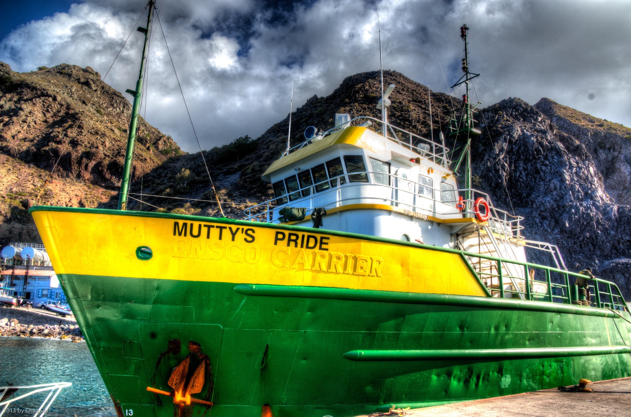
Today’s photograph takes on a mundane subject–the 60 meter 681 ton supply ship Mutty’s Pride
that arrives in Saba’s Fort Bay harbor weekly with essential food and supplies. I’ve taken a bunch of pictures of the ship over the months, but never had one that rung my bell. This time I took 3 pictures exposure bracketed for the different light…the dark mountains, the clouds, and the brightly colored ship, and combined them to create a High Dynamic Range (HDR) photo that attempts to balance the contrast that our eyes can see, but cameras can’t, then played with exposure and saturation to rebuild the true colors washed out by the intensity of the Caribbean sun. The result takes on an painting quality I like, and I hope you enjoy it as well. I won’t always yak on about process like this, but for the new and learning photogs out there, maybe this will be a helpful post. Cheers!
