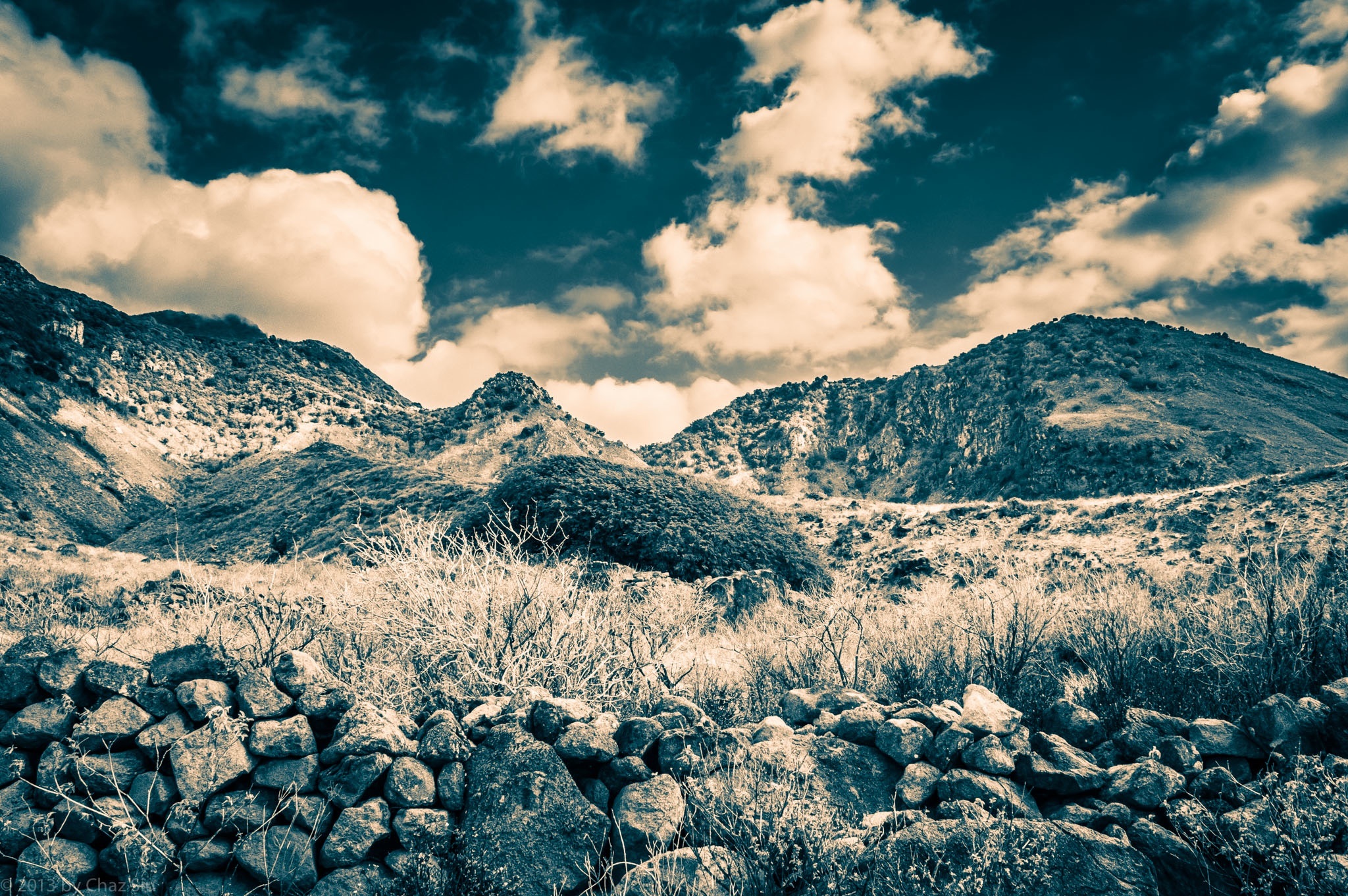
Looking Up Ridge Below Dancing Place Trail From Giles Quarter, Saba, Dutch Caribbean
This pic is from the bone dry days of early March in Saba, rambling along the Giles Quarter coastline and aiming the camera up past the ruins of the old beekeeper rocks, the cloud on the edge of Mt Scenery to the left, Peak Hill in the center, Booby Hill and The Level to the right. Note how very dry this is….it hardly even resembles the Caribbean.
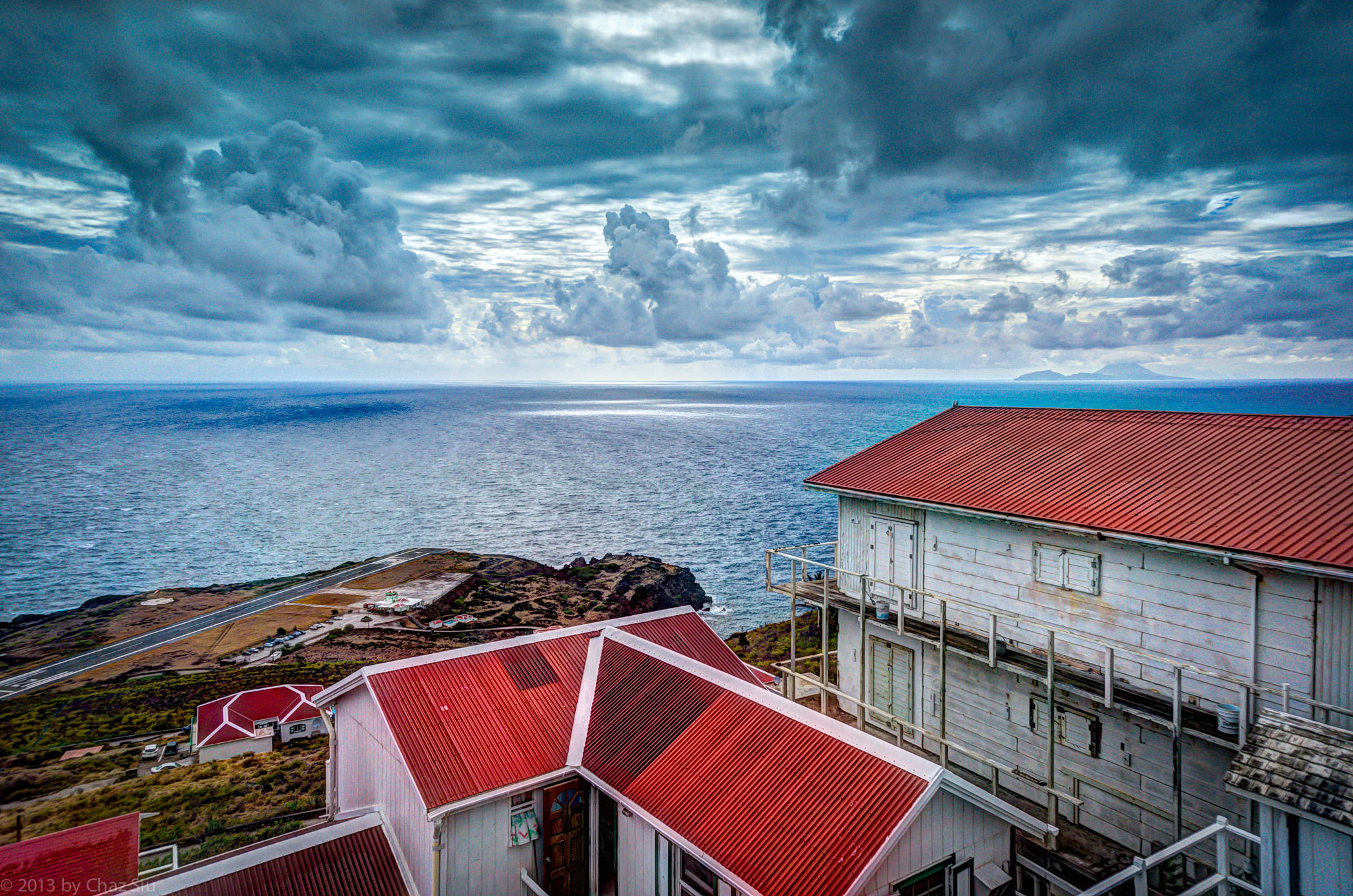
As readers of my blog know, Saba has been in a drought condition for quite a while. The day I left the island, it was raining steadily on Easter Sunday, as it had the day before, some respite to the parched little Caribbean isle. I snapped my last shots from the balcony of Tricia and Michael Chammaa’s apartments in Lower Hell’s Gate, and managed to get this gorgeous and dramatic horizon.
Here’s to many more rainy days like this for my Saban friends. April showers and all that good stuff.
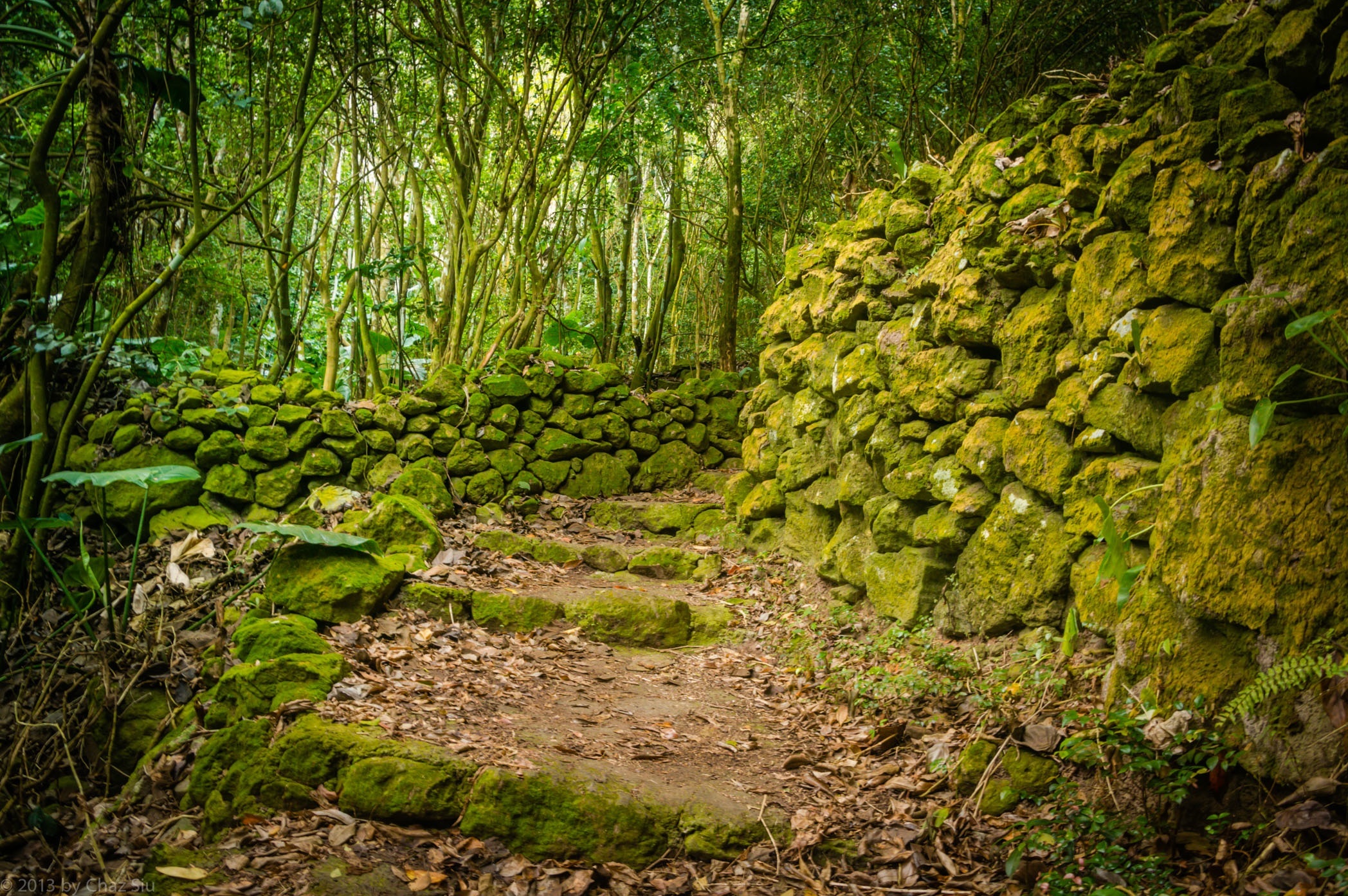
Generally speaking, for Saba jungle images I took while I was there, I have to reduce the saturation of the color green, because it’s so incredibly green on your way up, it tends to blow out your eyes ability to pick out detail. I let the green be in this picture, so you can really get a sense of the kinds of jungle flora around you, on trees, ferns, plants, and the man made volcanic stone walls that line some of the hike to Mt Scenery. It’s the most strenous official trail on Saba, and I summited ten times during my four months there. I always discovered something new and delightful.
For those of you who’ve summited Mt Scenery, this particular structure is very distinct and unique on the scenery path. Care to guess where on the path it is?
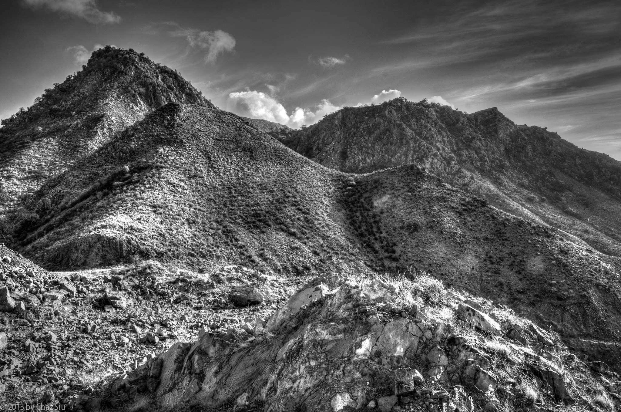
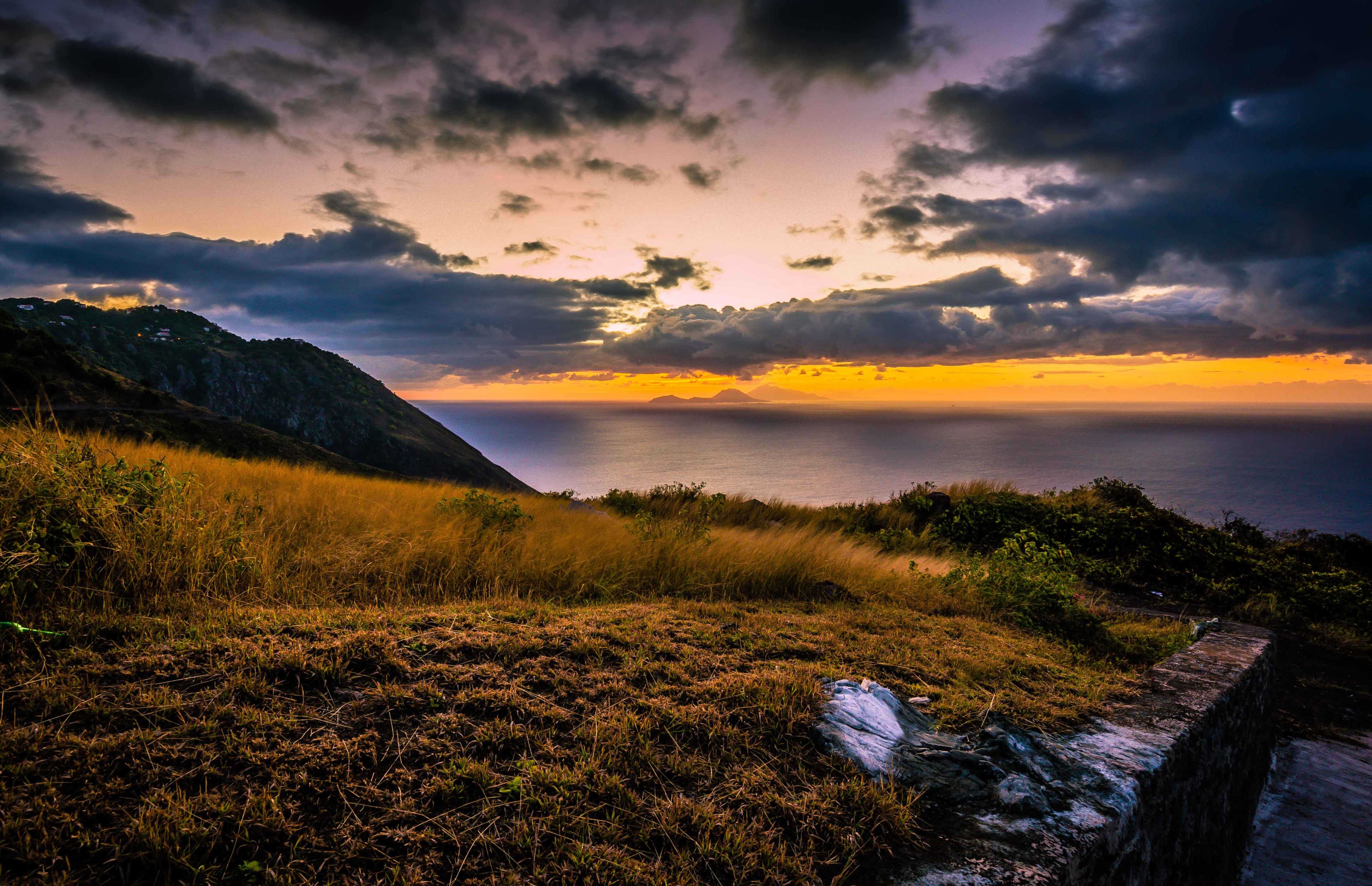
Thais Hill And The St John’s Flat From Fort Hill, Saba, Dutch Caribbean
Now that the April rains have come at last to slowly refill bone dry cisterns, lets give a pictorial nod to Saba’s rugged side during the drought, the intimidating cliffs and contours from below, the high and wispy stratus clouds with no moisture, the tough beauty that caused Columbus to skip trying a landing at the island after circumnavigating it.
Interesting to note: they are now clearing the foreground spot in this picture with an eye towards wind turbines. Alt energy on Saba? If true, most excellent.
With this repost of a Saba sunrise from the St. John’s flat, I’ve got a little something special for you all, courtesy of my brother Michael. Saturday nights on Saba can, on occasion, be remarkably quiet. We were walking home from Windwardside at 9:30pm one night–prime time–and my brother recorded the ubiquitous teeny singing tree frogs whistling in the night, instantly familiar to those who’ve been there, slightly haunting and sweet to those who haven’t. Take a listen. Let me know what you think. Click the link below to hear.
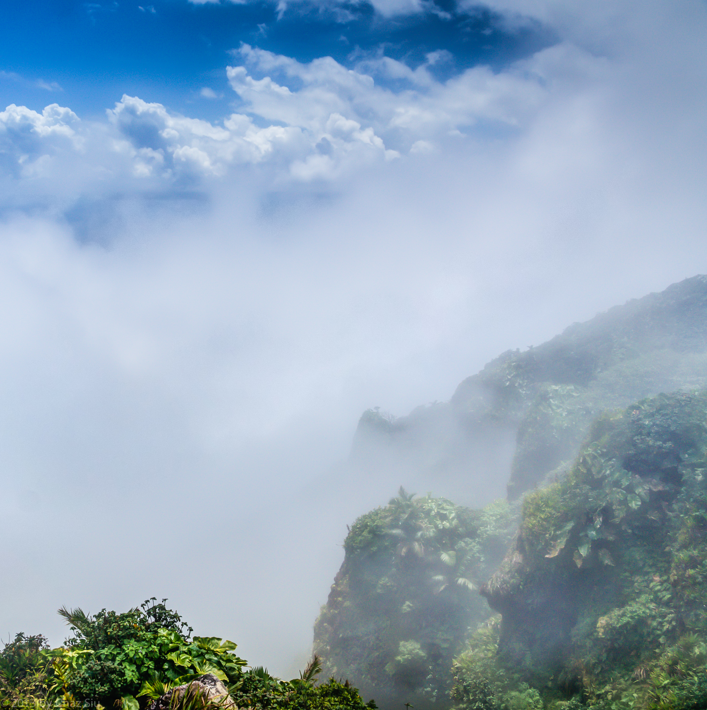
Angel Clouds and Cliffs, Mt Scenery Summit, Saba, Dutch Caribbean
My last hike on Saba was an easy ramble up Mt Scenery with my island amigo Fred Bower, who in his five and a half years on the island, hadn’t made it up the mountain. We stopped plenty for photographs, and although it was cloudy up top so views were curtailed, it was still otherworldy enough to afford Fred the views everyone else had referenced. Now he’s off to Costa Rica with his wife Kelly (a longtime Sea Saba boat captain and dive instructor) for some more craziness, of which I confess I am jealous. Kudos for them!
I dig this photograph not because it’s a great photograph, but while I stood there with the clouds racing over the cliffs, and just a peak view of the ocean and Statia and the green cliffs from the Scenery summit, I felt like it was the kind of cloud view the movies so often portray, and eventually an angel or some otherworldly creature (Avatar?) pops out, flies around, freaks everyone out, then everyone watches in awe as the beast zooms and zigzags around. Ah, well. There goes my imagination again. Enjoy! I’m back in San Francisco, but still going through my archives for worthy pix. Not many more, I promise.
One of the most stunning diving sites on the island of Saba lies literally in view of the harbor. A five minute boat jaunt out of Fort Bay gets you to Tent Reef, which has dynamic swim through channels, overhangs, deep walls, and abundant, brilliant beautiful reef and aquatic life. It remains a favorite of many of Saba’s dive instructors.
Saba itself shows its dry, rugged cliff sides from the Tent Reef dive boat; clicking to see the full sized picture, from left to right, you can see the triangular Tent Rock peaking above Great Hill, Paris Hill, Bunker Hill (the dominant foreground hill), a peak view of Thais Hill, the St John’s Flat with houses on the cliff, and finally, the lower Fort Hill above the harbor. You can also see the utility road that winds around from the harbor to the corner of the reef, the southwestern corner of the island. This is rugged, lovely country, constantly changing with the effects of wind, water, and other weather.
T-3 days, and not counting, honest. A final ramble up Mt Scenery via Bud’s Mountain Trail….it rained yesterday…a light long drizzle that didn’t fill cisterns, then harder last night, albeit a short rain. Bridge water until the rains of April, odds are.
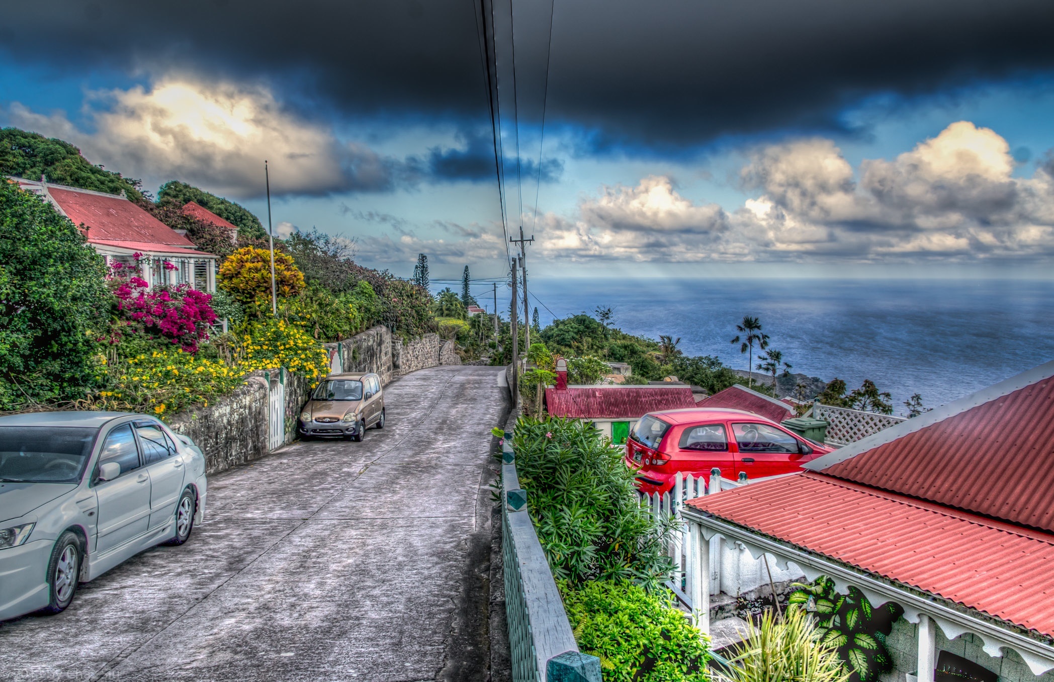
T-5 and I’m headed home to San Francisco. 82 pages to the novel in progress. Scars from numerous hikes here….but happy to have’em. This cartoon-like picture of The Road leading to the English Quarter section of Windwardside has vehicles in it, which is usually a no no, but hey, it’s real life in Saba. As you can see, colors are vibrant in the village still, though they’re quite brown on the slopes, guts, and ridges below as a result of the drought. Even looking at my Dec-Jan photos of the island reminded me how dry it is here now vs how green it was in Dec. Brutal.
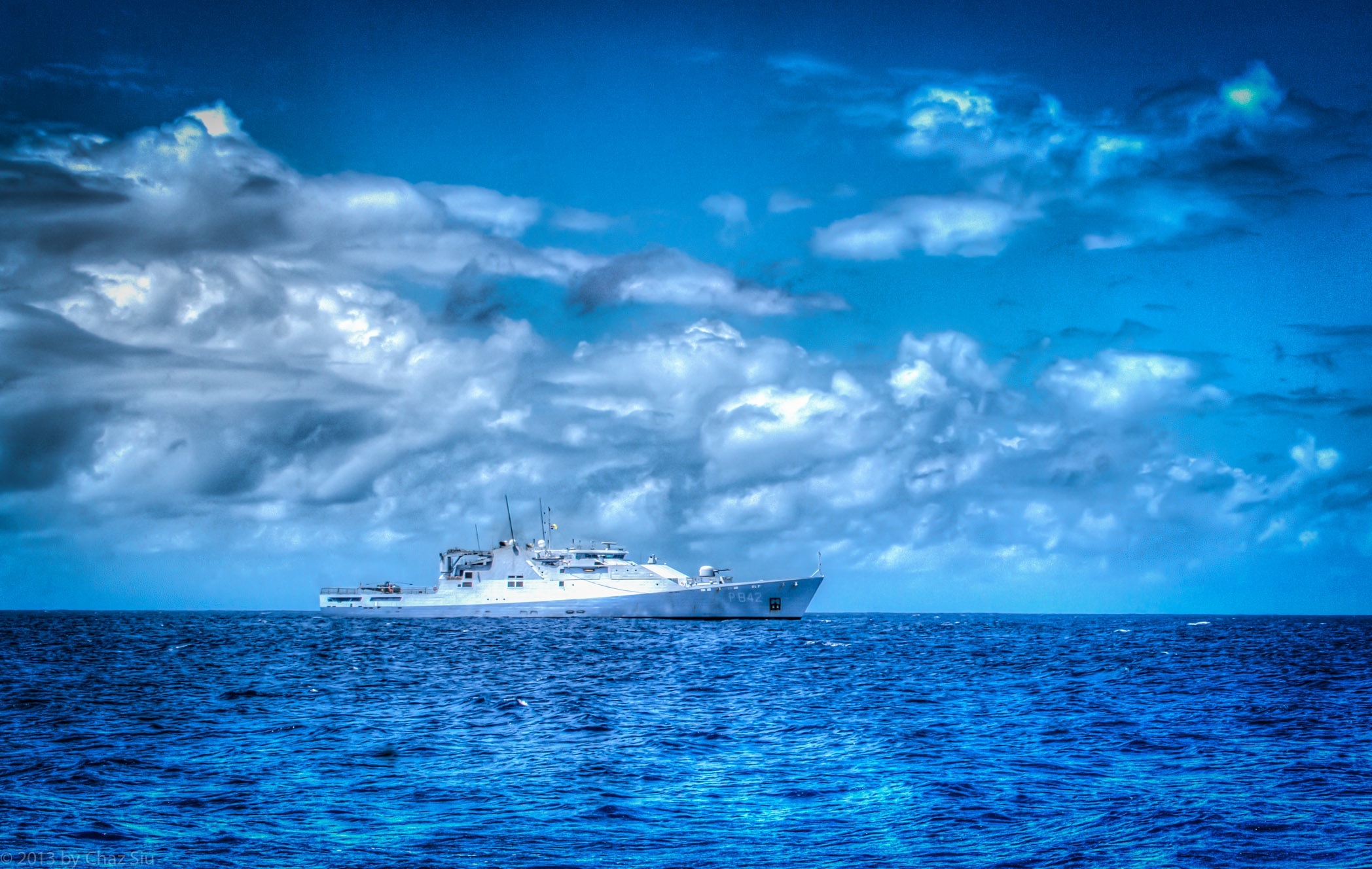
The Dutch Coast Guard frigate HMS Friesland visited the island the past few days on a routine drug interdiction pass through the Caribbean Netherland islands; yesterday it dropped off around 40 hyper fit Marines to visit Saba, they all chose to walk or run up the steep road to Fort Bay, through The Bottom, St John’s, and into Windwardside.