I’m overhauling the site to accommodate pictures from locations beyond Saba I’ve taken, folks, hence the extraordinary amount of time between blogposts. But with the ramp up of daily life in the city, it’s slugging along a lot slower than I’d like. Ah well. Hang in there. More good stuff to come.
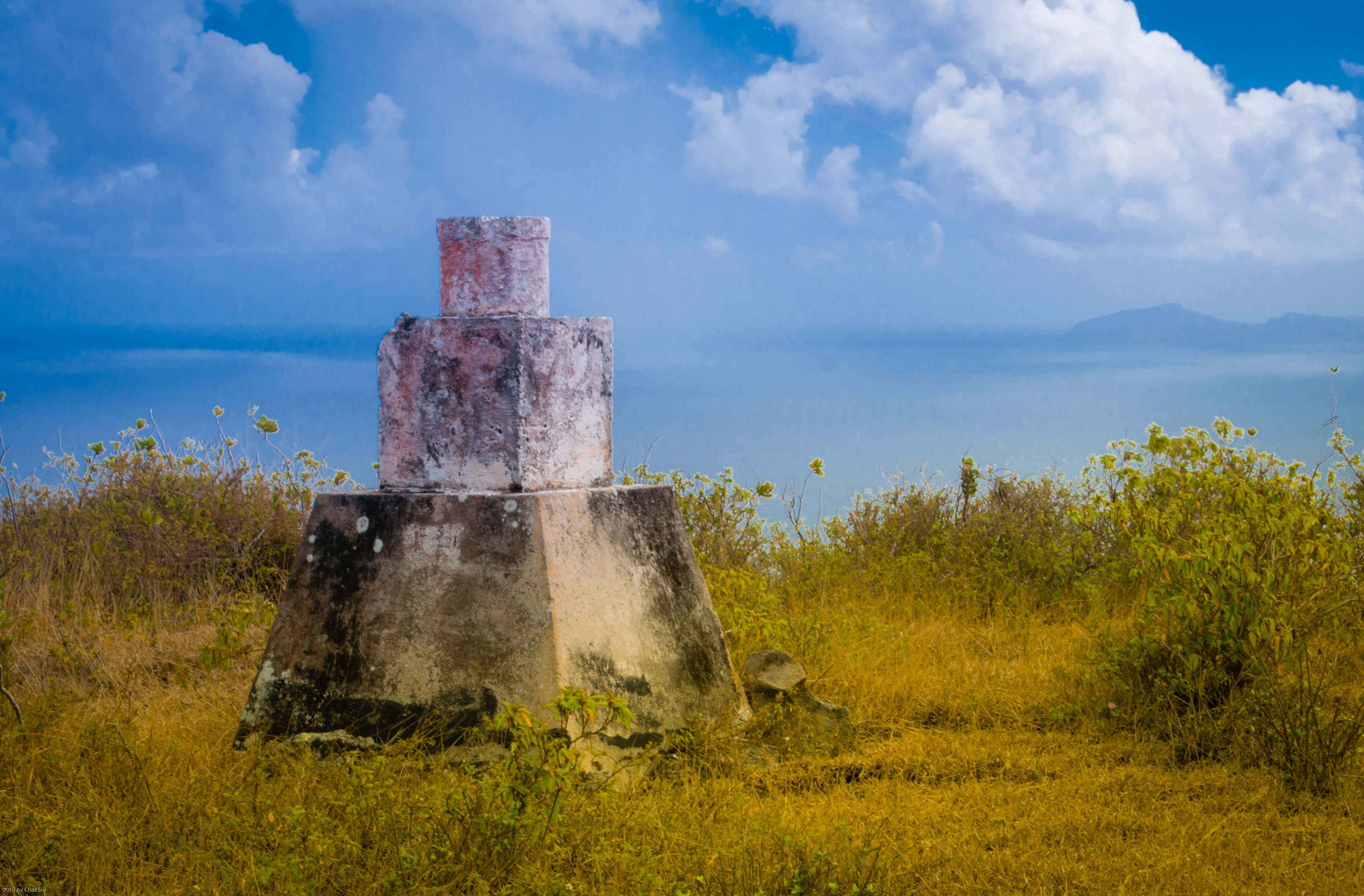
Any Saban worth their salt does a ramble up Thais Hill, looming over The Bottom, St John’s, and the twisting Road to Fort Bay. But I’ve still no idea hwat exactly this marker is. There’s a couple of them starting at the base from St John’s. Any ideas?
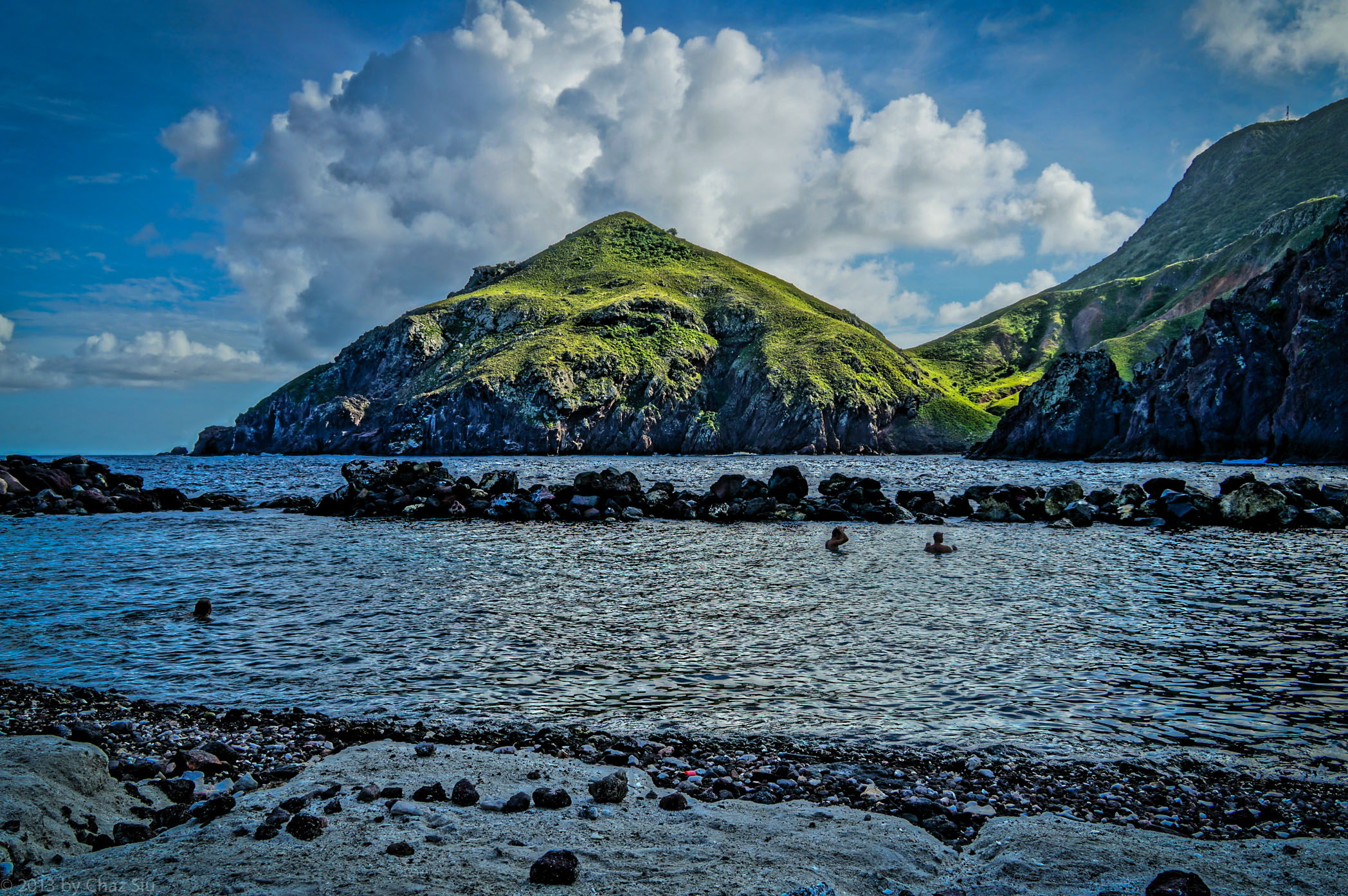
Cove Bay and Old Booby Hill, Saba, Dutch Caribbean
Hey folks…long time, no post, eh? The site is undergoing a reorg now that my remaining Saba pictures have dwindled down to nothing, so that you can enjoy other pictures of the world I inhabit and image. So postings may be a bit scarce for a little bit until I finish that exercise, which involves recategorizing all my Saba posts.
This view from the Cove Bay “beach”–temporarily replaced now that the Wells Bay disappearing beach has reappeared for a bit on the western side of Saba–was the first view of Saba I saw when I arrived on Dec 2012, as it lies a short walk below the airport. You’ve seen pictures in earlier blogposts of the climb up Old Booby Hill, and even the long exposure shot of Cove Bay without the little rock barrier shown here.
Cheers to the new Dutch King, by the way. Seems like a well intentioned royal.
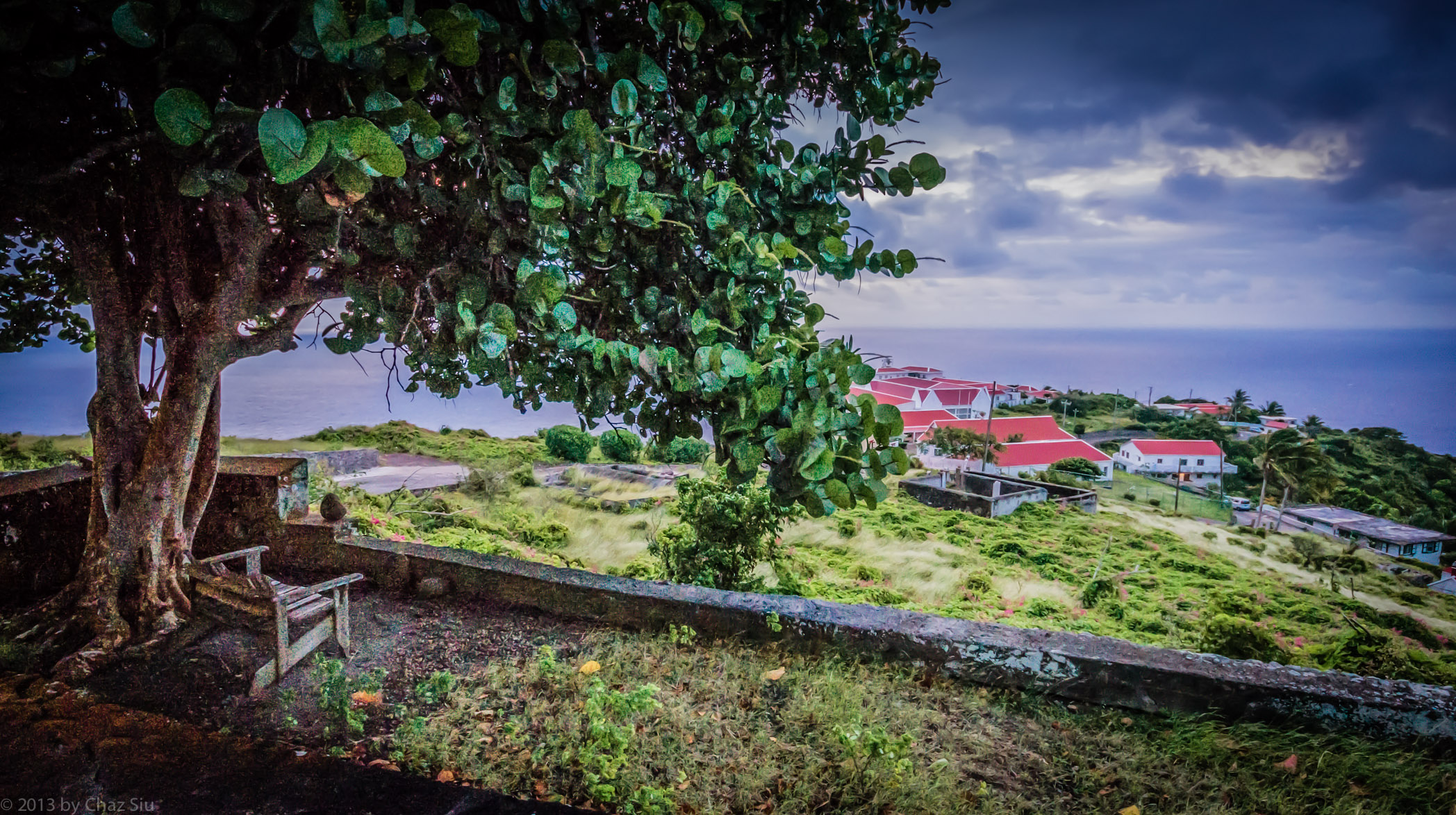
In greener times in 2012, my morning ritual was to pop my sandals on, cook up some bacon & eggs, and sit outside on the stone steps to the cottage, and this view was typical on stormy mornings that would always turn out to be sunny by early afternoon. I’d type a little of my story out on the iPad and inhale the fresh air. It didn’t suck.
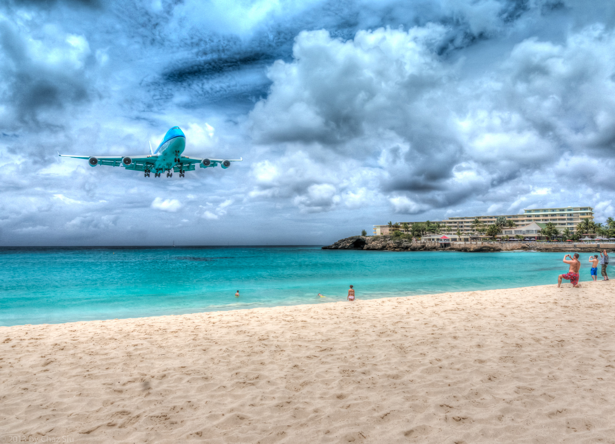
Many tourists on Sint Maarten like cram themselves into a small stretch of beach across the street from the airport landing strip, where large jet planes come in over the water and land dramatically. Moreover, it’s even crazier to see them line up to align with the jet wash from planes taking off, and get blown all over the sand and into the turquoise waters like human beach balls, kinda like that scene from the movie Pushing Tin, where Billy Bob Thornton entices John Cusack’s character to get thrown into the air by jet wash.
It was a stormy, overcast Easter day when I left Saba, which is a 12-15 minute prop flight over to Sint Maarten. Since i had a few hours before my plane took off, I walked over to this a beach cafe with the Canadians Ingrid and Harry (they come to Saba to help Crocodile James maintain the trails), who were also on their way home, and we sat back and watched the fun.
Oh, I loves me the Ray Bradbury quote that makes up this blogpost subject line. I’d like to think that the four month sabbatical I took on Saba and the months around it comprise a crossroads of sorts, and after a few discussions with my closest friends, it certainly has that possibility.
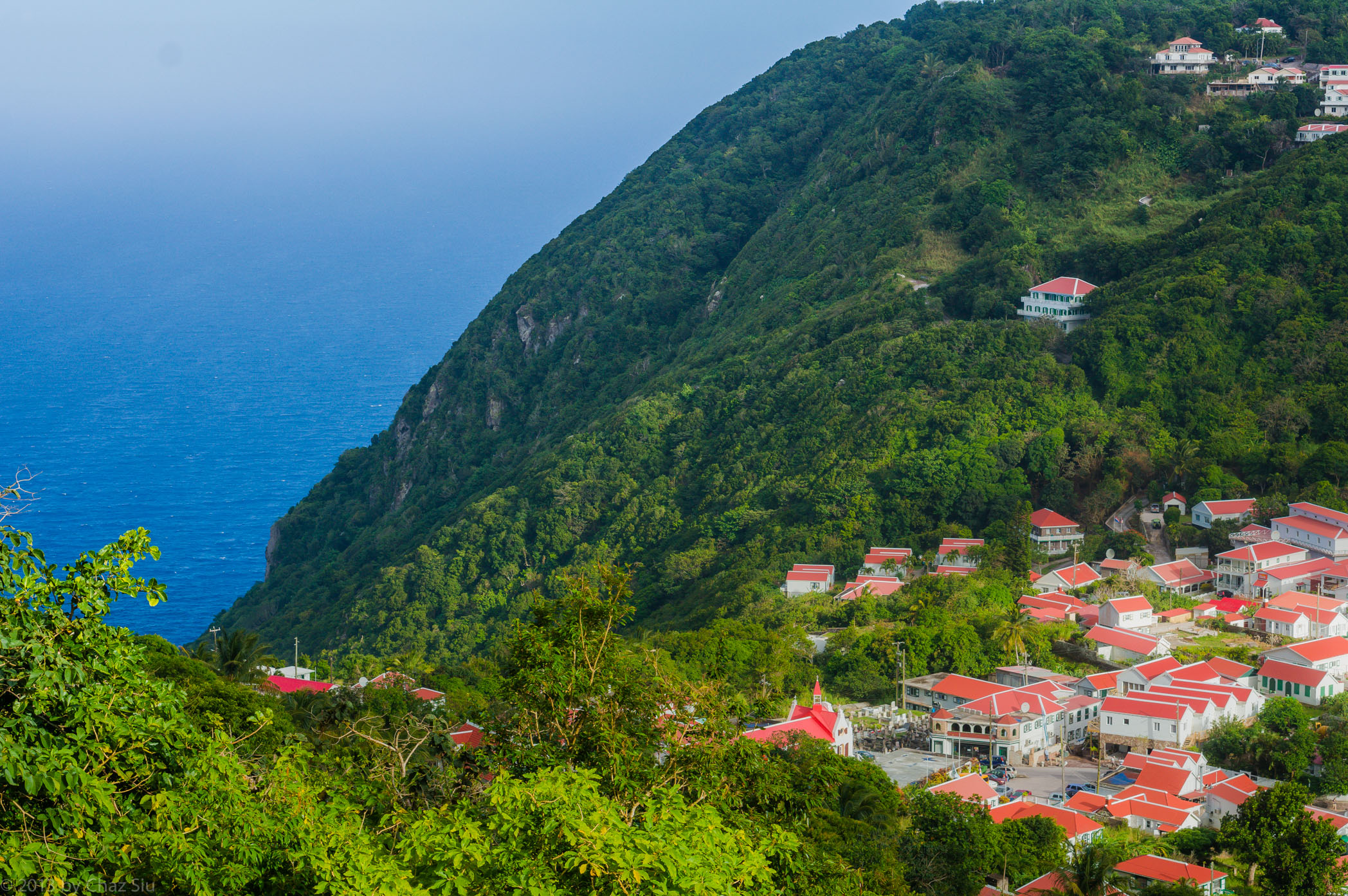
It’s not that easy to get to the dropoff in this picture, due to the dense vegetation that surrounds the occupied core of Windwardside village. You have to ramble down the winding rolling Road until you get to the English Quarter (the eastern settlement side of Windwardside), where you can make some cut throughs or paths you can take OR you have to have friends in cottages perched on the tops of the cliffs, which are many, relative to the general population. Regardless, the views from virtually anywhere in Windwardside range from the benign to the spectacular, typical of this l’il island that could.
Saba’s power plant, looking like a relic from the dawn of the Industrial Age, up close and personal an desaturated to a grayish black and white, with the color of the cliffs behind it. It continues to chug along its diesel self, except when it doesn’t, and then the island goes eery black if its night time, or just a little quieter if its daytime. It works.
Victor is a well known face to Saban locals, hitching rides back and forth between his house in St John’s (shown here), The Bottom, and Windwardside. He’s related to Eddie Hassell of Swinging Doors back through generations, and he has an fascinating history on Saba that’s a story in itself, tangled up in dark mystery and rumors, and a long stint in a mental home (he’s been out for many years). I got the sense that the island looks after Victor in a subtle way. In all my conversations with him–and there were many–I never found him the least bit violent, odd or strange. He’s a very low key fellow, smiling and generally happy, remarkably articulate in one on one conversation, friendly, and openly talks about his past if asked. The one memory he does continue to bring up is that of a lost love he had and was engaged to marry, only to have it dissolve through events out of his control. Of course, all of this is his recollection, but I tended to believe him, as he was remarkably consistent on the details. Victor’s house sits below Thais Hill, at the start of the switchbacks that descend to The Bottom. If you visit Saba, you are almost certain to run into him…wave and say hi, and he will wave back, as so many friendly Sabans will.
On the final jaunt up Mt Scenery before I left the island, rambling up Bud’s Mountain Trail on the way to Mt Scenery, there was a break in the canopy and a couple palm trees stark against the sky. Don’t ask me why I processed this in this color, probably desire for variety more than anything.
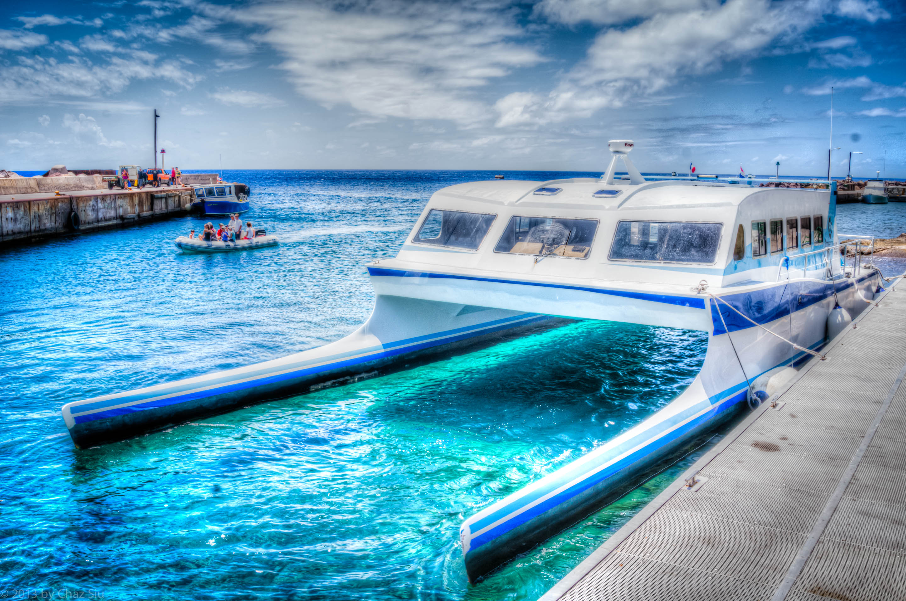
The Edge Docked At Fort Bay Harbor, Saba, Dutch Caribbean
Missed you, blog amigos, but I’ve got very few quality pictures left of Saba, so figuring out how to transition this to a general photo blog and archive off just the Saba pictures so they’re still accessible.
In the meantime, here then is The Edge, one of two ferries that shuttle folks between Saint Maarten and Saba.
Looking Up Ridge Below Dancing Place Trail From Giles Quarter, Saba, Dutch Caribbean
This pic is from the bone dry days of early March in Saba, rambling along the Giles Quarter coastline and aiming the camera up past the ruins of the old beekeeper rocks, the cloud on the edge of Mt Scenery to the left, Peak Hill in the center, Booby Hill and The Level to the right. Note how very dry this is….it hardly even resembles the Caribbean.