The north of Iceland is a moody, stormy show of Mother Nature’s irritable side. We clambered out of the tour mini-bus greeted with a sheet of rain that smashed our faces, sprinted past the church and into Glaumbær farm historic turf house, which although dank and musty inside, was surprisingly warm, cozy,and insulated …or maybe it was just the contrast of the weather outside. Two dozen turistas and unsmall me shuffling down hallways meant for one individual at most was an exercise in mild claustrophobia, but the preserved history inside the rooms was so tangible–the pottery, the looms, the skates, the cookware, the beds, the wooden ladders and beams, all shockingly roomy for a fully enclosed warren; a time machine visit to what it might have been like for 3 or 4 families to live in such a place dating from the settlement of Iceland in 870 to the mid-20th century. We stepped outside chattering about it…faceful of rain in the teeth again. Some things are constant here.
Goðafoss, waterfall of the Gods. Typically don’t include tourists in my shots but there was no shaking these dudes they stood in front of everyone taking pics, oblivious, but hey, it’s their trip, too. Moreover, I’m not inclined to try and Photoshop out their turista bright colors against such a craggy outpost.
The tour minibus drove up and down and around the northern fjords of Iceland, somewhere west of the fishing village of Akureyri, beyond lunar landscapes and into these pleasing patterned landscapes that felt like models for black and white images, but I bleached them cool and let them be. We looked at blacked volcano cinder cones on the horizon, but this little field was littered with sleepy sheep, and the snow came down twirling on the random gusts and stuck to our faces. An Iceland moment? Maybe. It could’ve been anywhere that snows, I s’spose, but I cherished it anyway.
Námafjall geothermal area, Northeast Iceland, vents steaming out of every crease in the land, indigo and blue bubbling mud ponds and bathes. That pile of rocks in the forefront–there were many–was hissing like a snake and the gusts were so hard, the steam blew out sideways and not up. An overwhelming stench of sulfur. Just over that steaming red Martian looking hill lies the Mývatn Nature Baths….an unevenly heated 1 acre pool that the locals hit up cheerfully and have since the time of the Vikings, knowing the entire place could go up any time this angry earth feels like it, but hey…hot spring plus cool pool plunge equals “less inflammation,” so say the locals.
Alliteration with -sh-. The irony wasn’t lost on us as we dined on the best lamb of my life in this tiny hotel in South Iceland, as we looked out the restaurant’s picture window at this spectacular sunrise the next morning. One of the sheep seemed to be saying, “‘Arold’s being eaten!” True, but he was delicious. There are more sheep than people in Iceland, so thinning the herds a bit isn’t the worst. Plus that sunrise!
We strapped on the crampons, swung the ice axes, ambled up Falljokull, the lava dirt outlet glacier of the mighty Vatnajökull glacier and looked deep into the valley of the mountain’s throat, its tiny meadow-like green patch that would make for difficult golf, the slopes in the far background that seemed almost Shangri-la, with a kind of mist that hung over them in the on an off sprinkle of rain. It was a contrast in earthtones, so I snapped it. Think I’m happy. “The glacier melts are always cycling forward and back,” said our UK glacier guide, “but in the past 5 years since I’ve been leading these hikes, they’re receding much much faster than any of us have ever seen before.” He paused, nimbly avoiding the hot stone topic of why. “It’s kind of sad, really.” You have to be here, in Iceland, in the Himalayas, in Tanzania–anywhere outside–and be surrounded on all sides by this kind of landscape to feel dread at the possibility that it might slip away in ours or our children’s lifetime.
Deceptive, I was, tagging this picture with things like “waterfall” when, in fact, it’s clearly L’il House On the Prairie. But my point–and I do have one–is that sometimes when you’re visiting Iceland focused on waterfalls, you should turn around a bit a look behind you. The waterfall in this case was Seljalandsfoss in southern Iceland, the infamous falling water you can walk behind. I waited my turn in a long muddy line of tourists dressed in bright unnatural hues and and getting soaked. When I walked behind the falls, I looked out and saw this lonely farmhouse, looking like an obscured 19th century oil painting beyond the moving water. And I saw the odd, tall grass. And in the very far distance I saw glaciers and knew I wasn’t in Kansas.
We unloaded the minibus to 30-50 mph wind gust hammering rain sideways into our faces, and as we tromped a couple kilometers through a flat lava debris field, we could hear mighty Dettifoss of northeast Iceland, said by Icelanders to be the most powerful waterfall in Europe. A waterfall that incidentally had a notable cameo in the opening of the movie Prometheus as the Engineer swallowed some bad alien juju that ate him from the inside out standing over Detti’s waters. The water was roaring beneath the gloomy canopy of clouds, and I took some super telephoto shots of people who made the trek down slippery rocks to get sheeted by the falls down on the cliff closest to them ; I chose to go the high-looking-down route. Wunnerful watery stuff, people. Get to Iceland.
REMINDER: I strongly encourage you to click on the panos to see the full enchilada images. Seriously, the views on Kili were almost too epic to capture in a straight 4:3 photo frame, even with wide angle lens (See FAQ at post bottom for camera deets).
DAY 3 HIGHLIGHTS
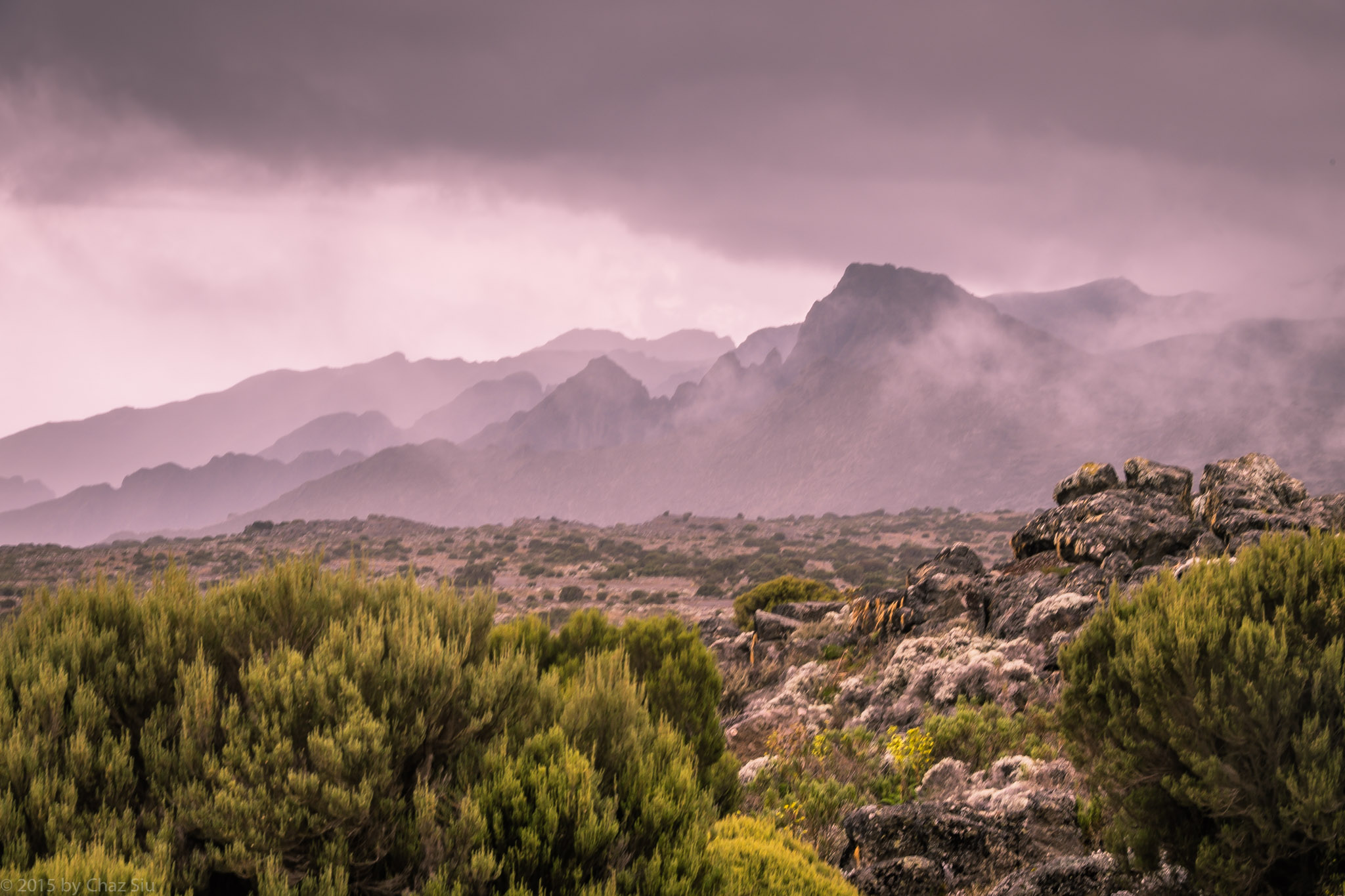
Mist Reveals The Drop At Shira Cathedral Saddle
Rained and hailed nearly all night, but the hard patter on the tent ends up serving as white noise here at 11,000 feet. Not that I’ve ever had issues sleeping, but I manage about 4-6 hrs a night, not withstanding the fact that altitude induces an incessant need to pee… hydrating the full day morning to night means popping outside the tent 3-4 times a night to hit the Internet Cafe…or occasionally nearby rocks, as sleepy laziness overtakes any mountain modesty. Speaking of which, this is not a trip for those who have an aversion to dirt, insects, or need daily creature comforts like baths or showers (we get a pair of washtubs of warm water each morning brought to the tent with the happy proclamation “time for washy washy” but that’s really hands, face, other reachable bits…otherwise, Baby Wipes rule most days.
7am sharp it’s breakfast, and as we look across the camp, we see multiple summiting groups here at Shira One, maybe 20-30 tents…not bad, but they’ll dwindle in coming days as we go higher and higher on the rarely used Northern Circuit route.
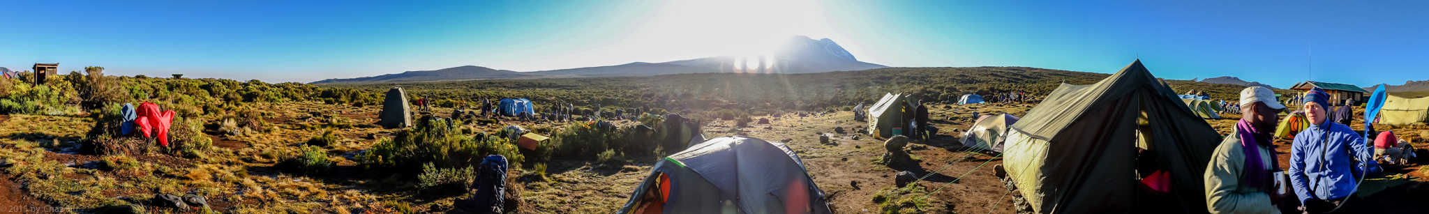
Sunrise At Shira One Camp With Kili Framed
The sun is shining brightly, framing the western side of Kilimanjaro. 8am and we’re pole pole once again, marching on the relatively flat Shira Plateau through scrub. The line of porters starts passing us about a half hour later, and while they beeline directly up to The foothills of Kili to the Shira Hut camp, we’re taking a detour to the Shira Cathedral formation about 3-4 miles dead ahead, for our first direct acclimatization effort.
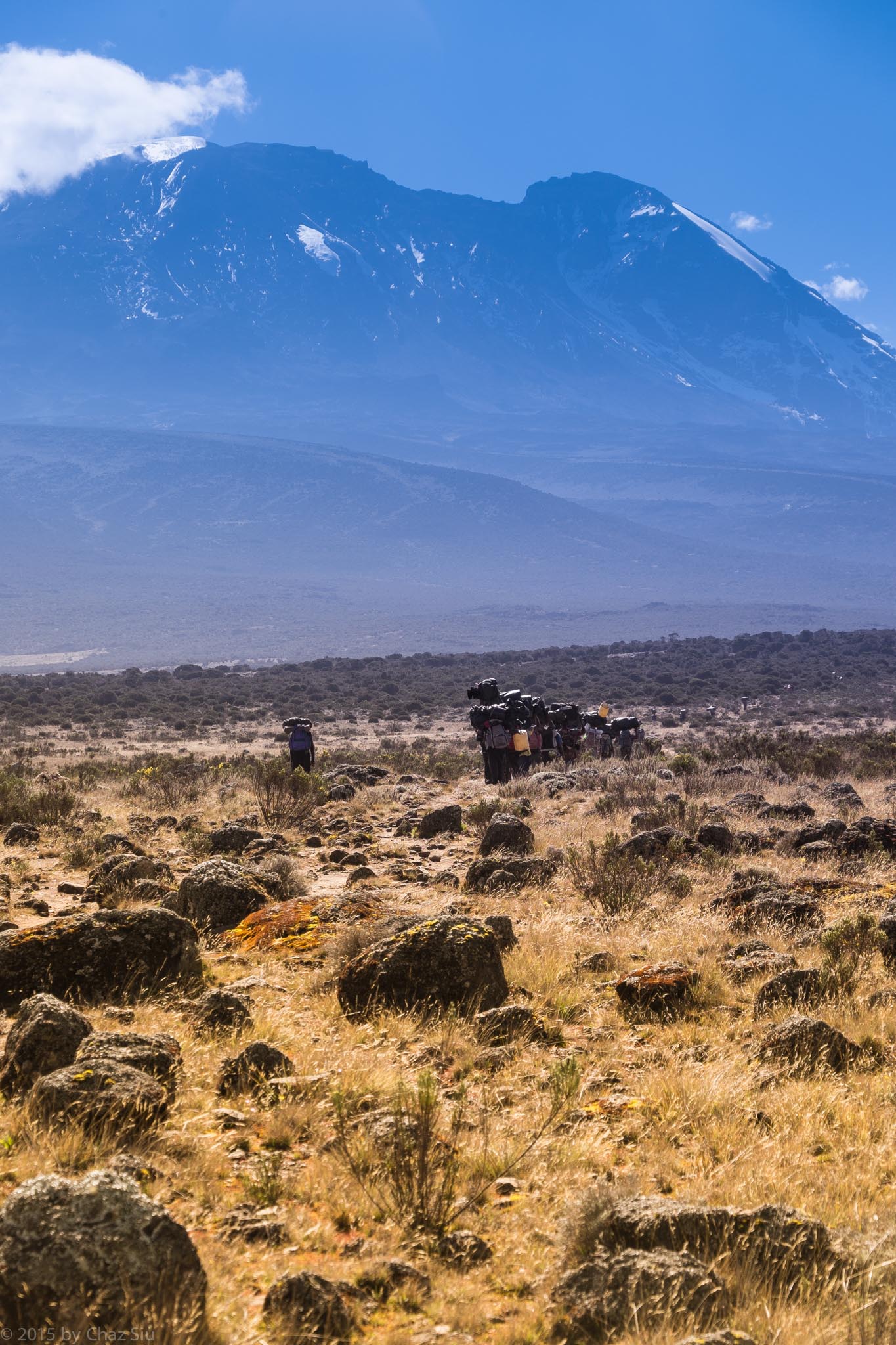
Our Porters March To Shira Hut With Kilimanjaro Chewing Up The Horizon
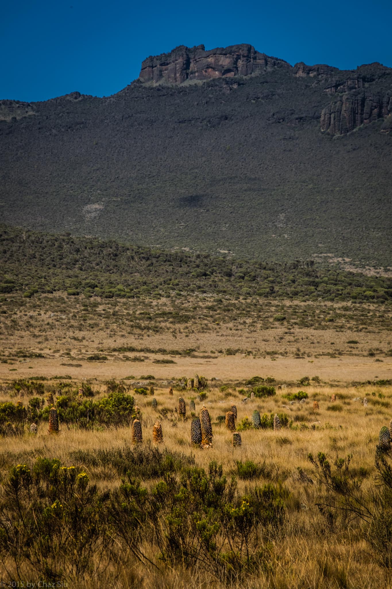
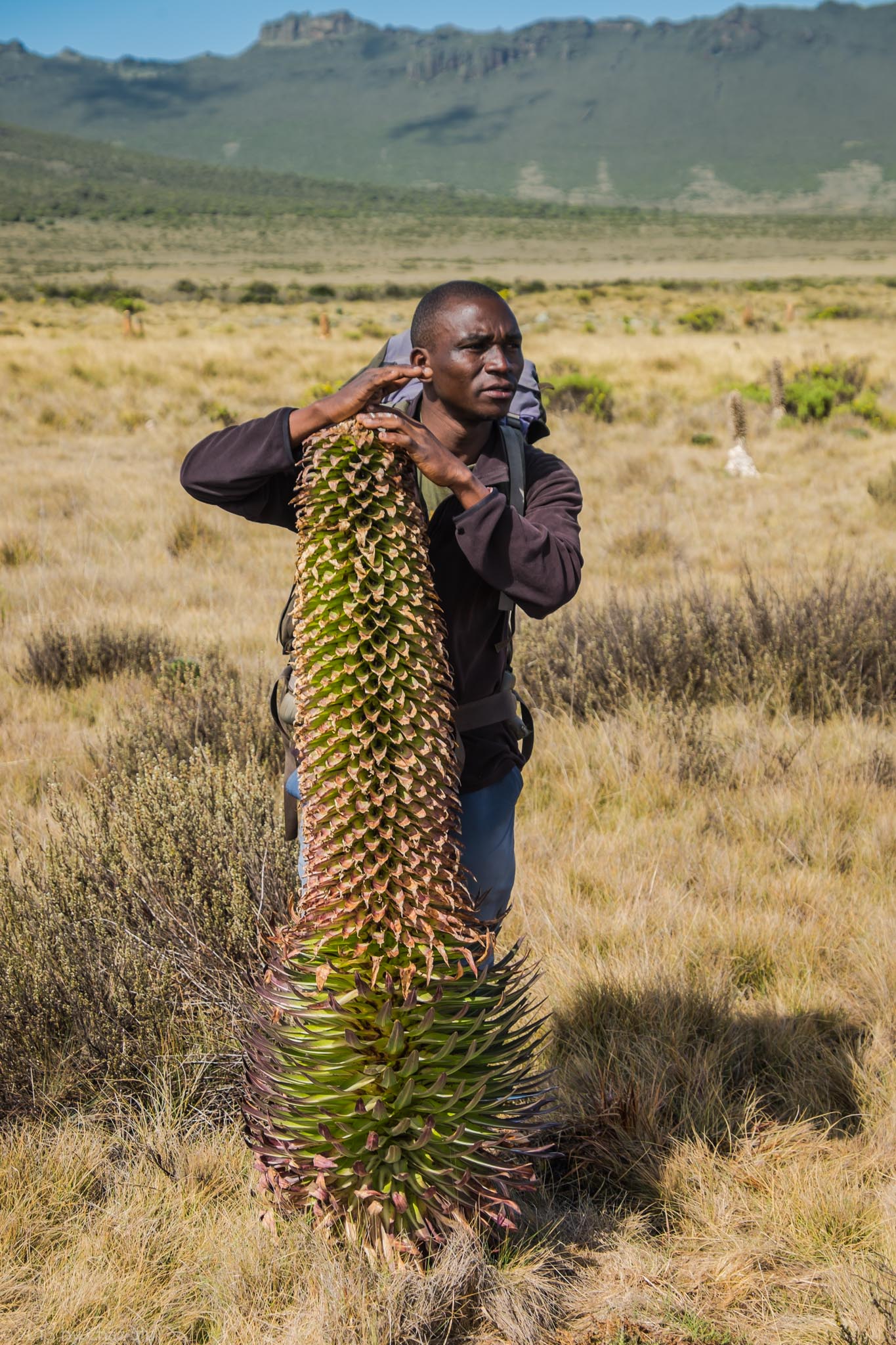
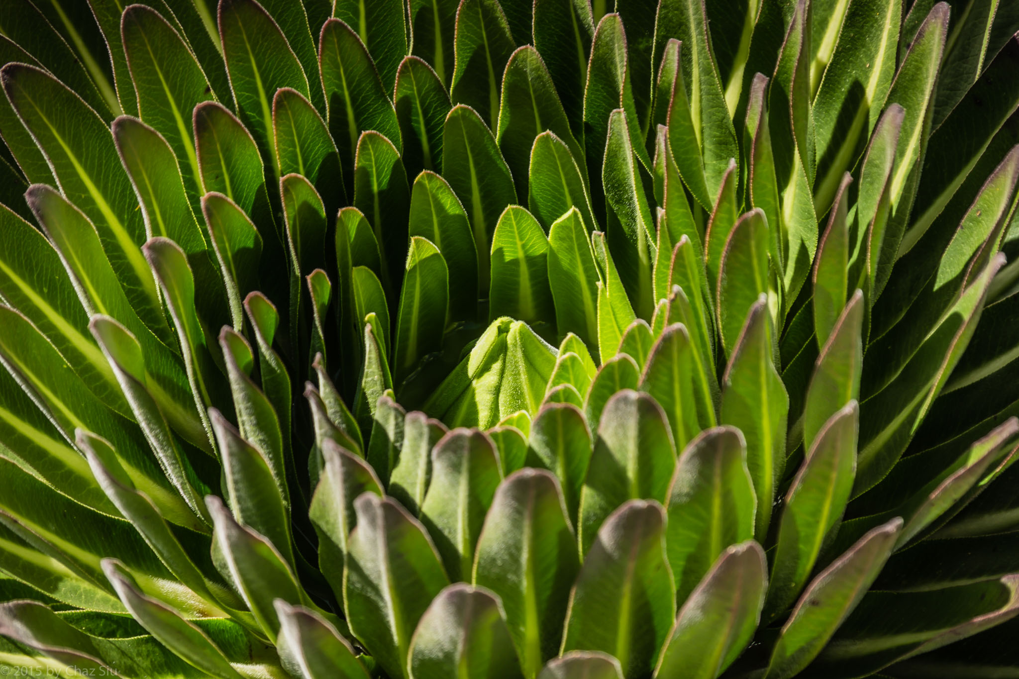
One striking plant we keep seeing dotting the plains of the steppe resembles a 5 foot giant pineapple in cactuslike form. Our guide today is Said, with Viviano bringing up the rear, and Said tells us this plant is the giant lobelia (officially lobelia deckenii), one of many species of everlasting flowering plants found on Kilimanjaro. Unfortunately, we’ve missed its flowering phase by weeks.
Fields of Giant Lobelia on the Shira PlateauSaid and the Giant LobeliaGiant Lobelia Closeup
The steppe starts to angle upwards and the Flora change is almost immediate, walking out of high desert scrub and into higher green spike bushes.
Pano: Ascent From Shira Plateau to Shira Cathedral
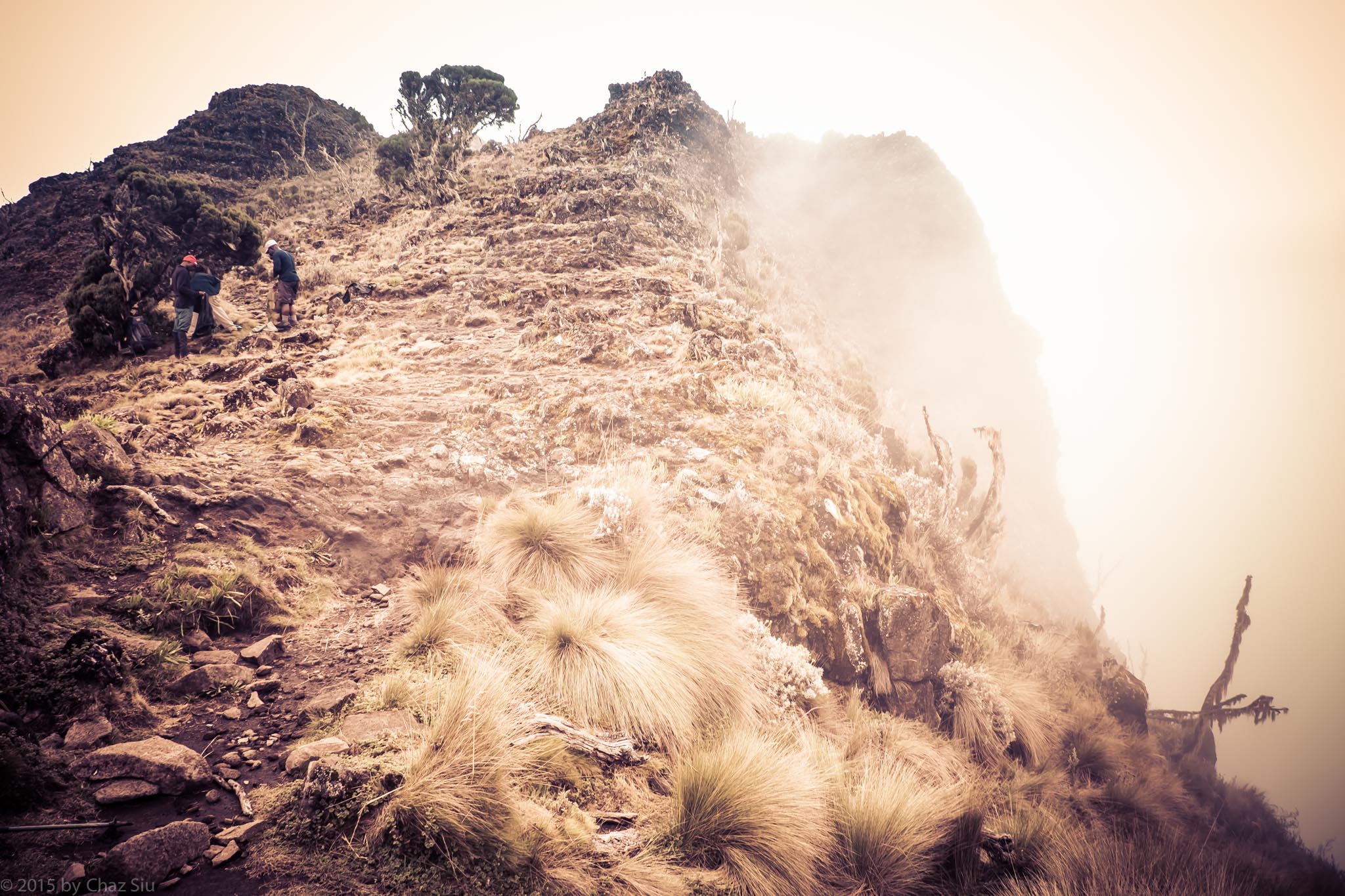
In about an hour, we climb a hundred feet up to a saddle leading up to Shira Cathedral. JT has magically appeared again, and points up to what looks like a heavy misted Boulder scramble. “Today is your first peak!”
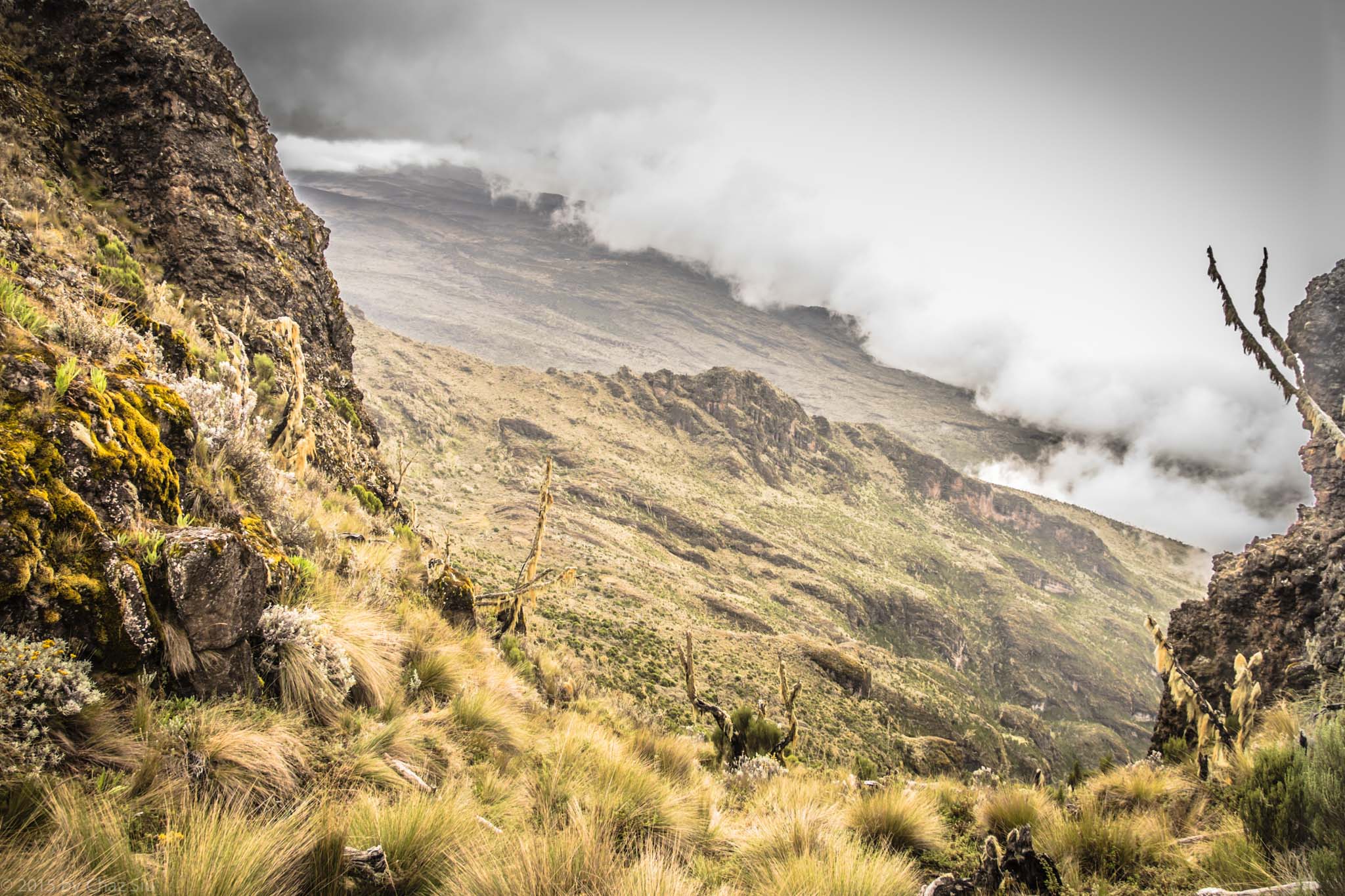
Saddle Below Shira Cathedral..No Idea How Far Down It Goes Below That Mist
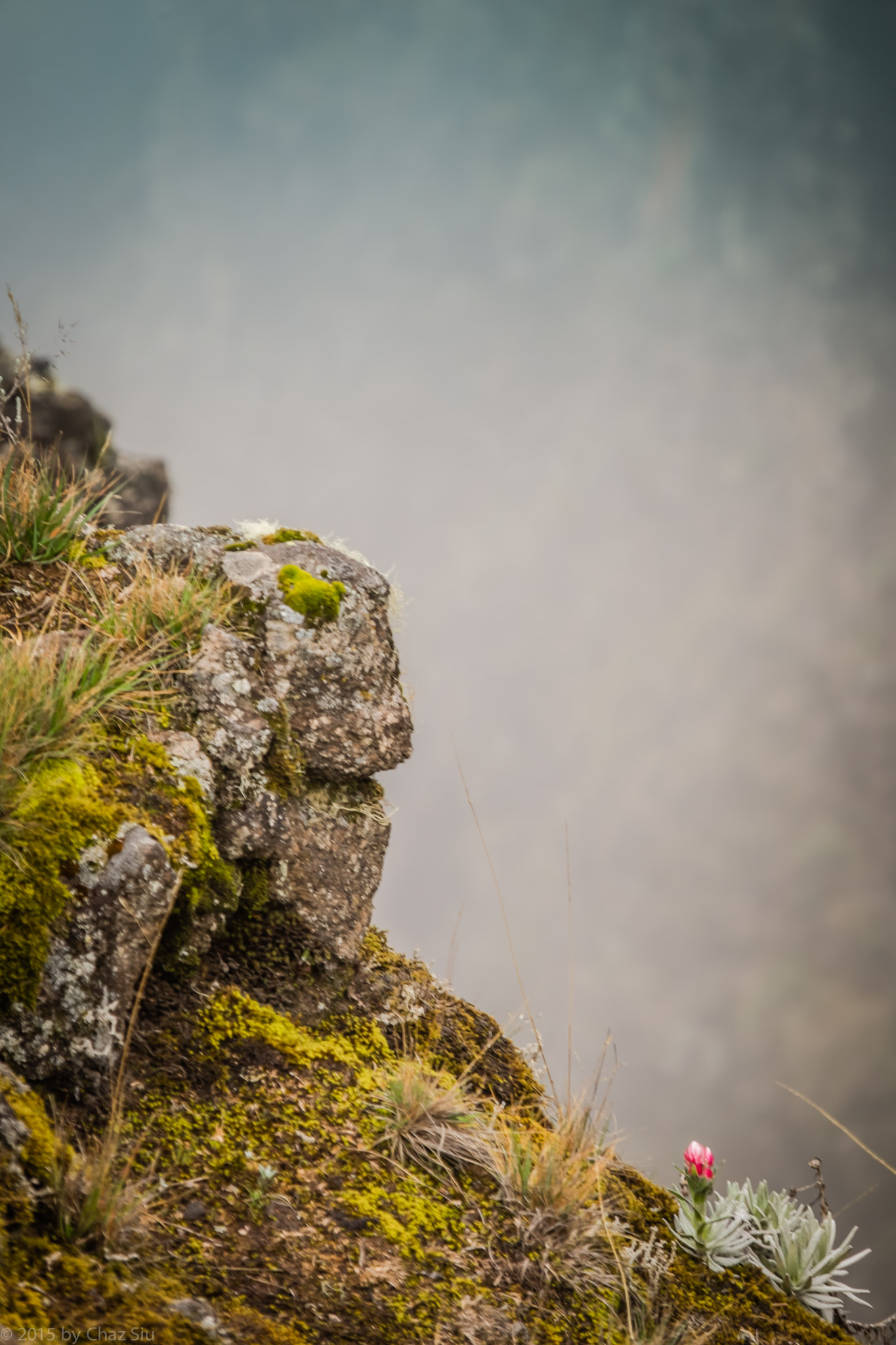
Lone Flower Above the Mist At Shira Cathedral Saddle
It’s starts to rain a little off and on, so I, still without my missing gear, make the assault with an unwieldy and flapping full length rain poncho. It’s a half hour of steep scramble complete with loose scree, handholds on wet rock, and hoisting yourself up on loam dirt and gravel, but we all make it, and it’s pretty damn cool.
Pano: Atop Shira Cathedral, Unseeable Mist To The Left, Shira Plateau to the Right.
Looking to the East we see the miles of plateau we just traversed spread before us, while mist floats so heavy up top, we can’t see just how far and deep the other side of the Cathedral is (all the way down to the plains below, we see later from Shira Hut). First group photo, and we head back down to the saddle.
Summit Team Atop Shira Cathedral. (L to R) Paul, Caryl, Rhys, Alex, Me, Cort, Kitt, Irina
Halid takes over in getting us up to Shira camp, an undulating pathway that ascends to 13,000 feet. The cruel teaser here is that we can see our destination camp two hours before we get there. Here then, is where Halid takes on his “Speedy Gonzales” moniker, pole pole pace becomes haraka haraka (fast), and when Alex announces he’s burned through 3 liters of water, The guides don’t have backup (though Irina has some), and Halid picks up the pace even faster to get us into camp. We tell Halid about Speedy “Riba Riba!” But without the cartoon, the reference may be lost on him a bit. We scramble through the scrub and come into camp just as the rain picks up intensity. We sign in, and hide in our tents. Lunch is another stomach warming soul lifting soup–potato, cucumber, whatever, it’s warm–and we enjoy it to the fullest.
Almost To Shira Hut, Looking Back At Shira Cathedral.
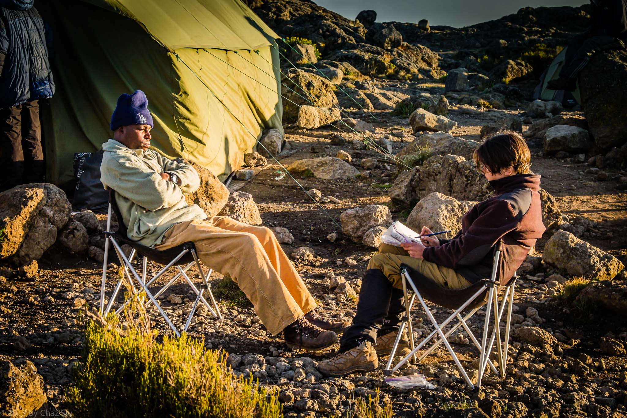
After lunch, JT indicates we’re making an afternoon acclimatization run up about 500 feet above the camp. Rhys stays down and keeps warm in his tent, sure it will rain, but the rest of us follow Viviano up – it’s about an hour round trip and not too bad, and the sun is in and out of the clouds the whole way. When we get back down, it’s full sunny before dinner, so I pull out the solar charger and charge up my GPS, JT does the same for his guide’s cellphones..I guess local service is available here and there at points on the mountain. We’re enjoying this respite from rain, and Irina sketches Viviano…with her iPhone battery gone, she draws and sketches the whole way up the mountain when we have the time.
Irina Sketches Viviano At Shira Hut
At sunset, Kili presents herself in all her glory, a red top with a white crown of snow, the way we’d all seen it in photos. Rhys, Paul (who is doing much better on Diamox), Cort, Alex and I are snapping away. Keep this picture in mind, and wait til you see what we wake up to the next morning…..Another fairly epic, active day, and we’re definitely spent. Alex is having the worst of it, being dehydrated, and eventually, in the middle of the night, JT puts him on the Diamox as well. Rain hammers the tents most of the night…at this point, we’ve presumed it will be that way the whole way up, though we dread it. JT, for his part, simply states the obvious: “The mountain is unpredictable.” So it is.
Kilimanjaro Sunset At Shira Hut
RANDOM FAQ: I’ll add to this as the blog posts continue… How did you book this epic journey?
Through Peak Planet, the best reviewed agency we found. Researching the Kili guiding is an exercise is due diligence – but something to consider is the treatment of porters and guides helping you up the mountain. The cheaper operators have a reputation for porters and guides with tattered clothing, substandard shoes, and not getting paid for the many days away from their families. From all testimonials and references, Peak Planet is the opposite of that, working with the African Walking Company to ensure good treatment while keeping the prices reasonable. I have zero stake in Peak Planet, but the blog should speak for itself – the guides and porters were excellent, friendly, helpful, courteous, etc. all you could ask for on such a comprehensive undertaking. What camera did you use?
The Fuji XT-1 mirrorless APS-C with an 18-135mm lens. All of it heavily weather resistant, unstopped by rain, freezing cold, sleet, or altitude. I did bring 4 extra batteries, kept warm in a wool sock…which proved to be good for the whole 9 day mountain journey.