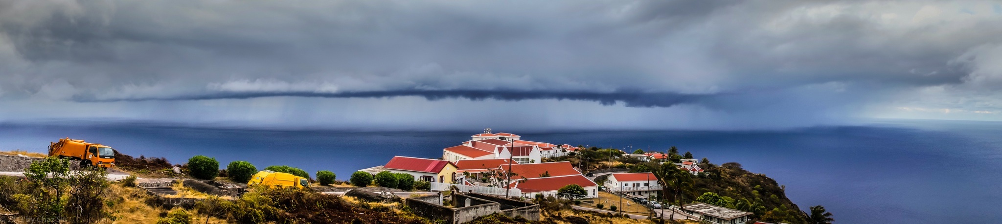
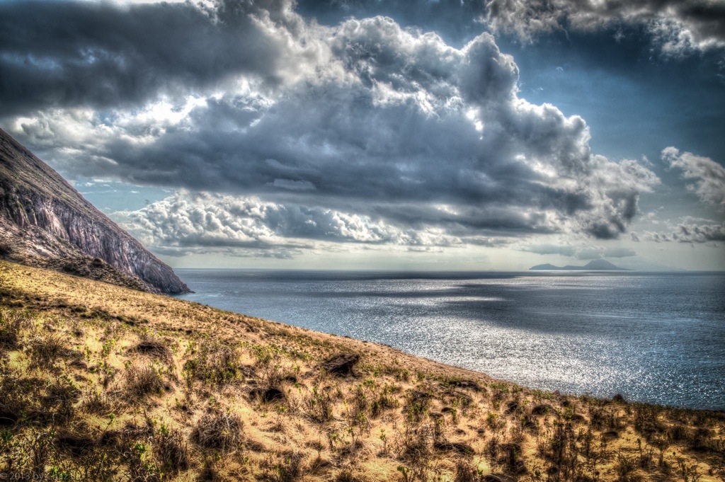
In recent days, I spoke about watching rainstorms drop massive water a few miles offshore while Saba struggles with draught conditions. Here’s the most compelling photo yet (click to make larger, if you’d like) to show you what Sabans see. We ended up getting about 15 minutes of light light sprinkle from this beastie, barely enough to cover an extra hand wash, but something is better’n nothing, unless that something is an angry honey badger.
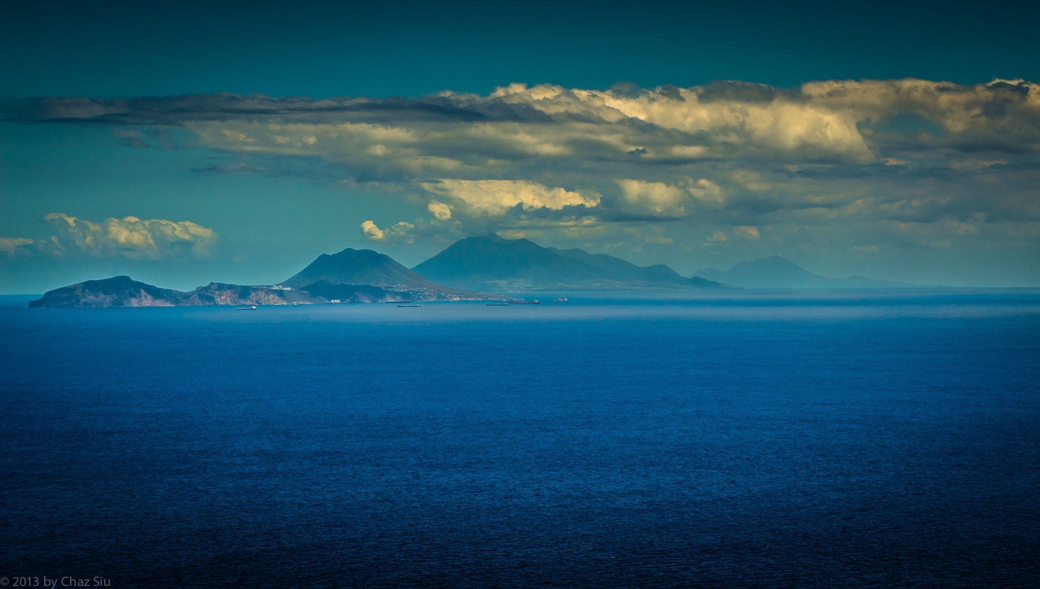
Exceptionally clear and blue day today with a horizon that went to forever. Click the picture to enlarge it and see the oil tankers lined up waiting on oil products from Statia’s refinery on the hill that faces Saba. I thought about posting the picture of the white bull being led by hand and rope out of St. John’s Flat for slaughter, but this seemed a bit more tranquil, which is my mood.
Just got home from late night karaoke at Scout’s Place and we walked outside and celebrated the rainy wet pavement. Hard to tell if it rained very long, but it was enough to leave the streets and buildings wet…that’s a few millimeters of precious cistern water for the parched Sabans.
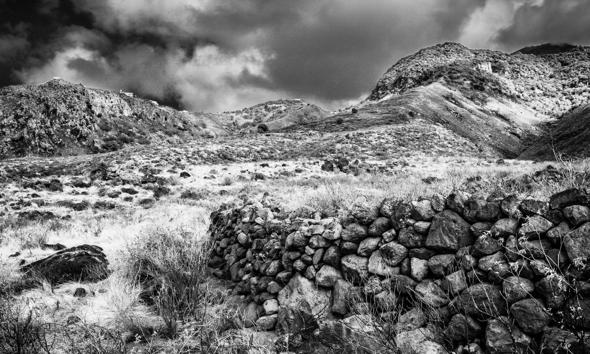
Stone Wall Remains, Giles Quarter, Saba, Dutch Caribbean
The Beekeepers of Saba
Spending a lot of time down on the Giles quarter coastline lately, coming up ridges and checking out the unique flora and fauna down there, as well as unusual and unique ruins. I showed this picture to the locals, asking what this big stone wall was for. It extends in a big circle, so I figured it for a pasture or remains of the sugar cane plantations in the late 1800’s (BTW, Saba no longer grows sugar cane…the dry climate can’t support it natively, either).
But oddly enough, folks told me it was for some kind of beekeeper’s colony, which puzzled me, as I’m not sure what good the stone wall encircling a bee haven would do. I’ll inquire around a little further to see what the scoop is.
Clouds, clouds, everywhere, and poor ol’ Saba is still dry as a bone. At least it’s finally a little breezy up high in the villages. It’s quiet out in blog land lately….anybody out there?
It’s tantalizing and teasing to be in the middle of a draught and extreme water conservation on the island and see storms come within three miles of Saba, and drop all their water offshore. As this picture shows, it may be beautiful to look at, but that doesn’t mean we have to like it. But then again, I did snap the photo, so there’s that consolation.
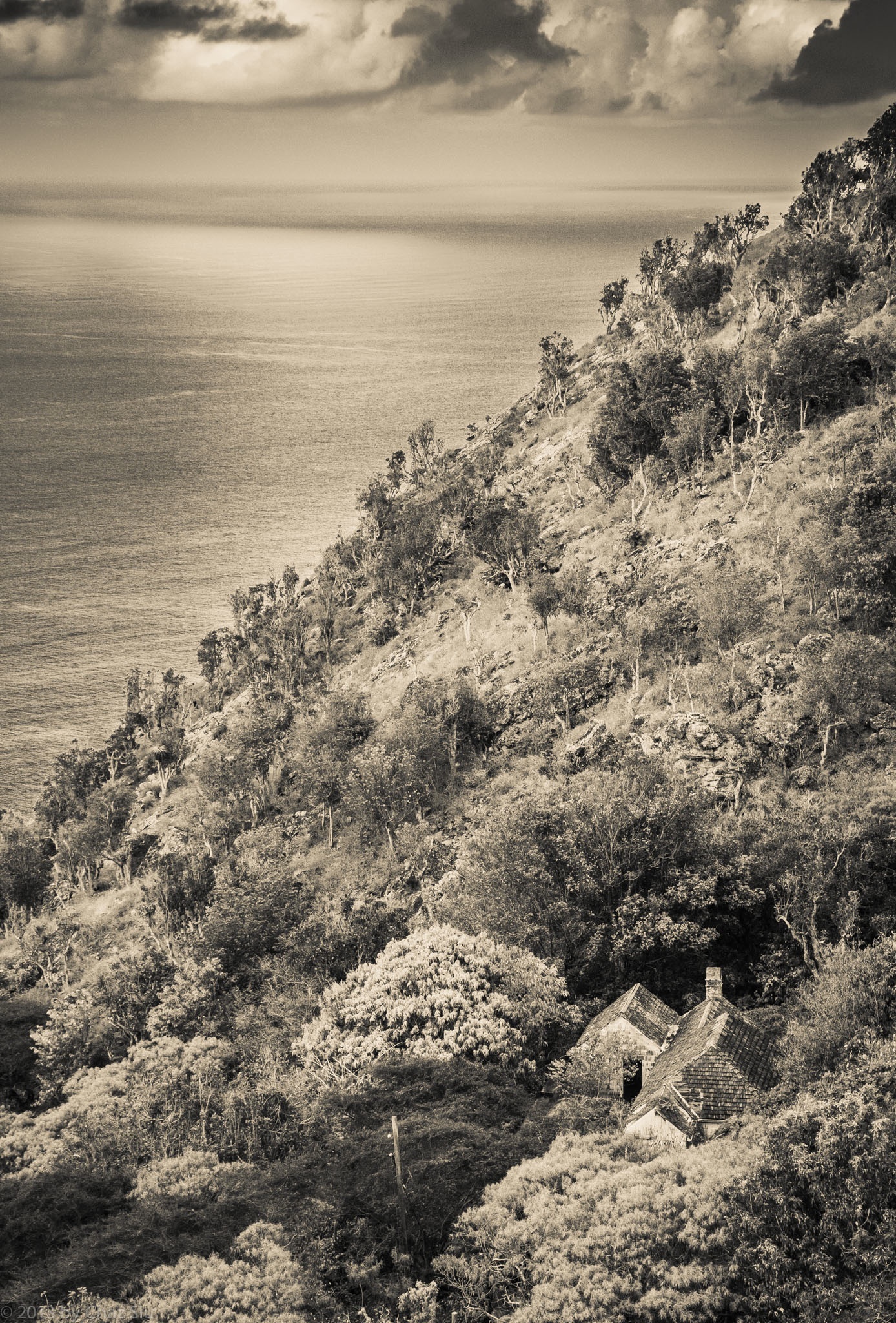
St. John’s House At The Base Of Thais Hill, Saba, Dutch Caribbean
The last few days have been me getting up earlier and earlier to try and beat the dreaded heat with no wind and do a bunch of ridge hikes up from the Giles Quarter coastline midway between the St. John’s Flat and the Wash Gut up to Windwardside. Saba’s terrain is so rugged and steep, it amplifies the actual distance you’re hiking, which is usually between 3-5 kilometers, but can feel like a lot more. Regardless, even at 7:00am, the heat is beating down mercilessly as I haul my big ol’ self up this rock.
In any case, repeated trips down to Fort Bay to start these coastline-ridge excursions had me passing this little house nestled in the cleft between St John’s Flat and Thais Hill. It’s an old style house, with rare brown wooden shingles rather than the traditional red corrugated tin,though you can’t tell from my processing it in black and white. My guess is that it’s well protected from the ravages of hurricanes and tropical storms as well, but I don’t know yet who, if anyone, lives in this nostalgic little house, but it sure looks cool from above, n’est cd pas?
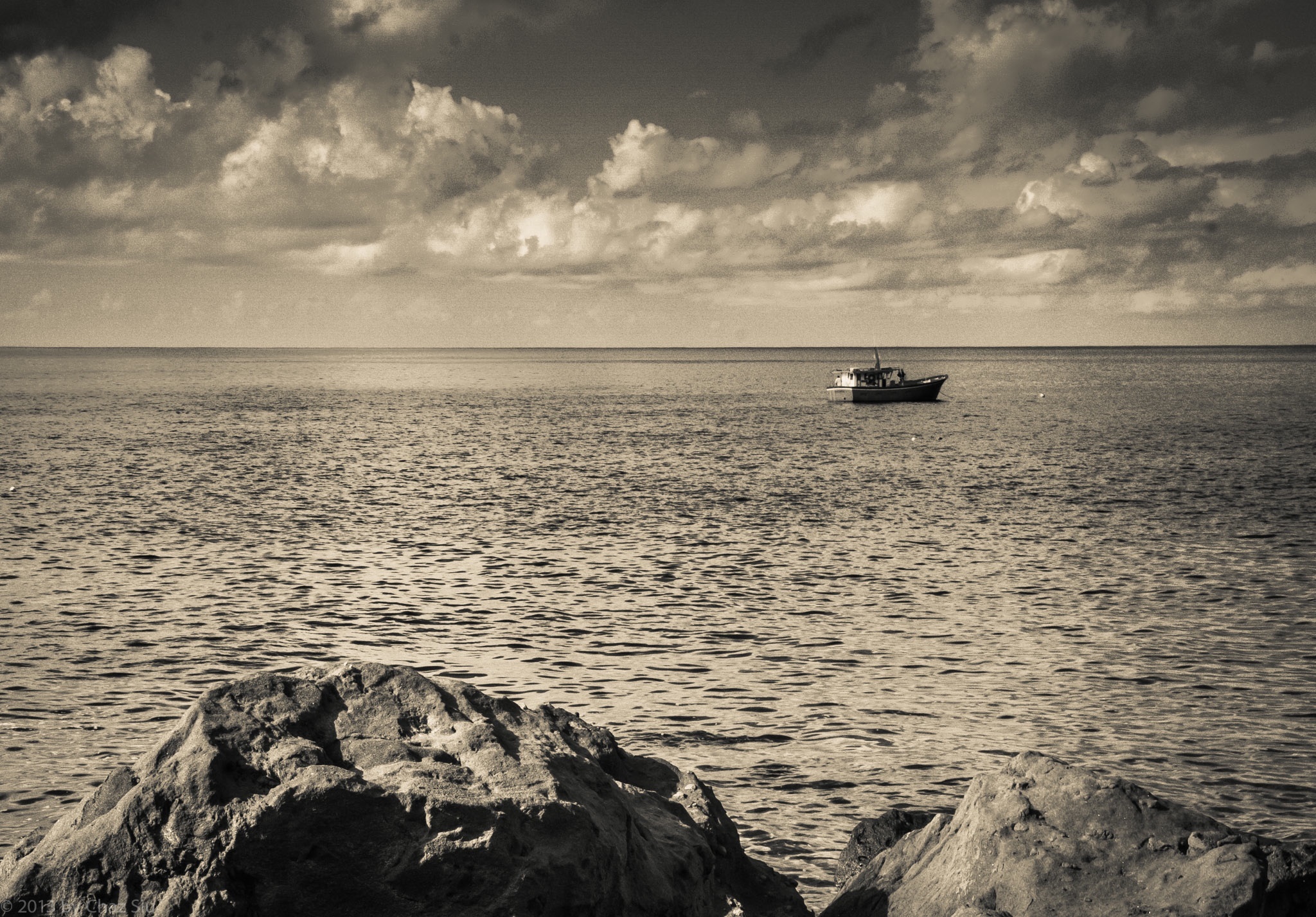
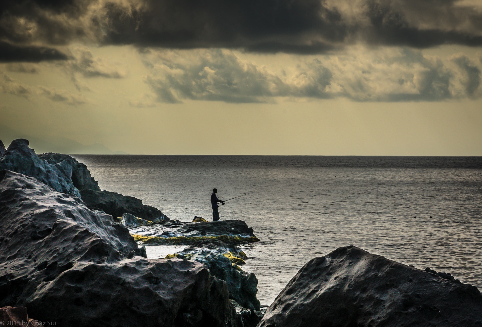
Local Fisherman Off Giles Quarter, Saba, Dutch Caribbean
Another early morning hike down to the harbor, meander along the coastline, and voila, snapped this fellow doing what his family has been doing for more than a hundred years. Came up the Dancing Place ridge to Windwardside and started collecting boxes for shipping.
With three weeks remaining, guess I’m finally winding down. On the other hand, many folks would give an arm or leg just to have three weeks away from the frenetic pace of their lives, so no melancholy me ’til I’m off the rock and in the city once more.
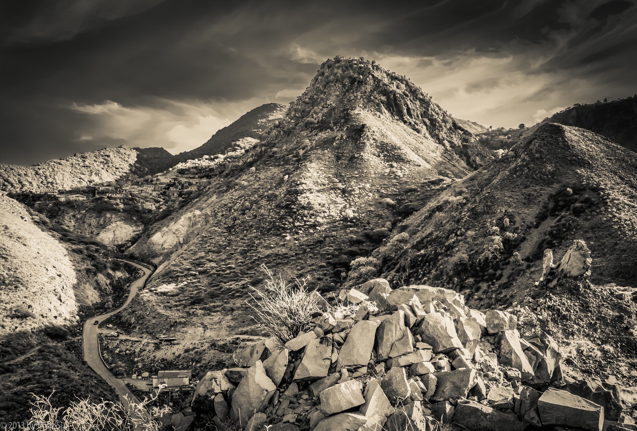
Road To Fort Bay Winds Down Below Thais Hill, Saba, Dutch Caribbean
“The greatest gift of life on the mountain is time. Time to think or not think, read or not read, scribble or not scribble — to sleep and cook and walk in the woods, to sit and stare at the shapes of the hills. I produce nothing but words; I consumer nothing but food, a little propane, a little firewood. By being utterly useless in the calculations of the culture at large I become useful, at last, to myself.”
― Philip Connors
Though this quote is in reference to hiking and camping on the mountain, I still think it sums up the essence of my coming here, particularly that last bit. I love the city I live in, but equally do I love this rugged rock, the peace and tranquility of its folks and its setting, above and below the water. People ask me if I miss the city, and my general answer is no, I’m focused on wringing out every bit of distraction free relaxation until the day I leave, and on the plane, I’ll get excited about where I’m going; I’m so much better at living in the moment at this stage in life, no apologies or regrets.
When you walk down the steep and sidewinder curves of The Road down to Fort Bay, you can take a mild detour to climb onto the hill above the harbor, across from Bunker Hill. Rather than looking towards the sea, where the Dutch Navy frigate was bringing in 60,000 liters of relief water to the hospital, the government building, and the old folks home due to our current drought, I looked back up at Thais Hill, which looms over the road, and up to the edge of the St John’s Flat, close to where I live. Never a shortage of new angles, and this one really shows off the rugged nature of this auld rock, forever subject to the wear and tear of weather, the thin wisps of stratus clouds high aloft and skimming the atmosphere. Not bad, Saba, not bad at all.
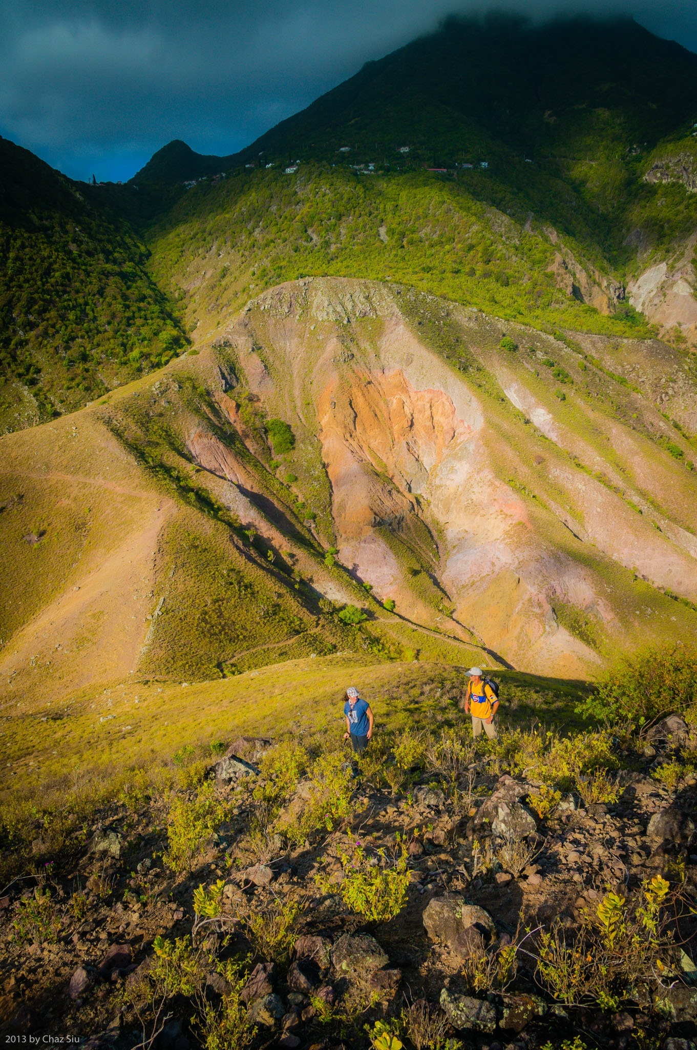
Old Booby Hill stands off on its own between the Windwardside Level and Spring Bay. It’s an absolutely wonderful diversion off trail hike from the Spring Bay trail saddle, and a mere 20 minutes of scrambling up low scrub nets you fantastic views of Saba’s south coast that you can’t see without an airplane or being on a boat offshore: a full view of Hell’s Gate all the way from the airport up to Mt Scenery, as well as the rugged sea cliffs directly below The Level. I rambled up the summit earlier this week with UK Bob the builder and his artsy crafty French wife Marie. This picture captures just a smidgeon of the many grand views from the Old Booby Hill summit, as well as the short, but steep little climb to get there. I recommend this hike strongly, as a surprising number of locals and long term expats have never done this fulfilling side excursion in the many years they’ve been here. It was Bob and Marie’s first time in the seven years they’ve been here.
By the way, New Booby Hill (simply called Booby Hill) is on the way to The Level, and has many expansive homes with fantastic views.
Though it may not look like it, I took this image in near darkness at a sunset BBQ. The shutter was open 30 seconds, which turns the water into an aqua pond, the waves against the shore into a misty swirl, and the clouds into a blue purple glass.
We’re in March, and the clock is finally ticking down on my time here on beautiful Saba. Cliche, but damn, time goes so fast, and there’s nowhere to hold onto to try and reign it in or slow it down. Let’s see what else remains in these final weeks for my lens, for my novel in progress, for music I compose, for great times with friends on Saba. I’ve accumulated such a wealth of images I like, I’m considering pulling together a limited run coffee table picture book. Sound interesting?