Everywhere on Saba lie these ubiquitous stair steps made of volcanic rock hewn from the isle, including the Mt Scenery trail and countless other pathways in the four villages. Of course, they often lead to nowhere, formerly to terraced farms that have long since overgrown. C’est la vie. They are still uniquely Saban.
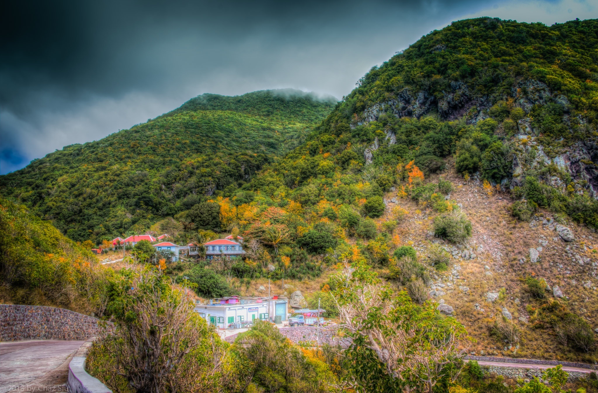
The Road Out Of St John’s Bends Around Past Old GEBE
My time is ticking, running out here on Saba, and just when I think I’ve run out of images to show, I confront The Road I take to Windwardside from St John’s every day, often 3-4 times a day, and see an artistic perspective I didn’t catch before. That’s today’s pic, the descent out of St John’s after I climb out of the Flat, and bend around past the old GEBE station, where the plaintive bleats and brays of goats on the ridges and cliffs continues, the wind sometimes moans in the cleft between the mountains, and the fog tops Mt Scenery. I dig this place, I really do. Guess I’ll be back in a few years…
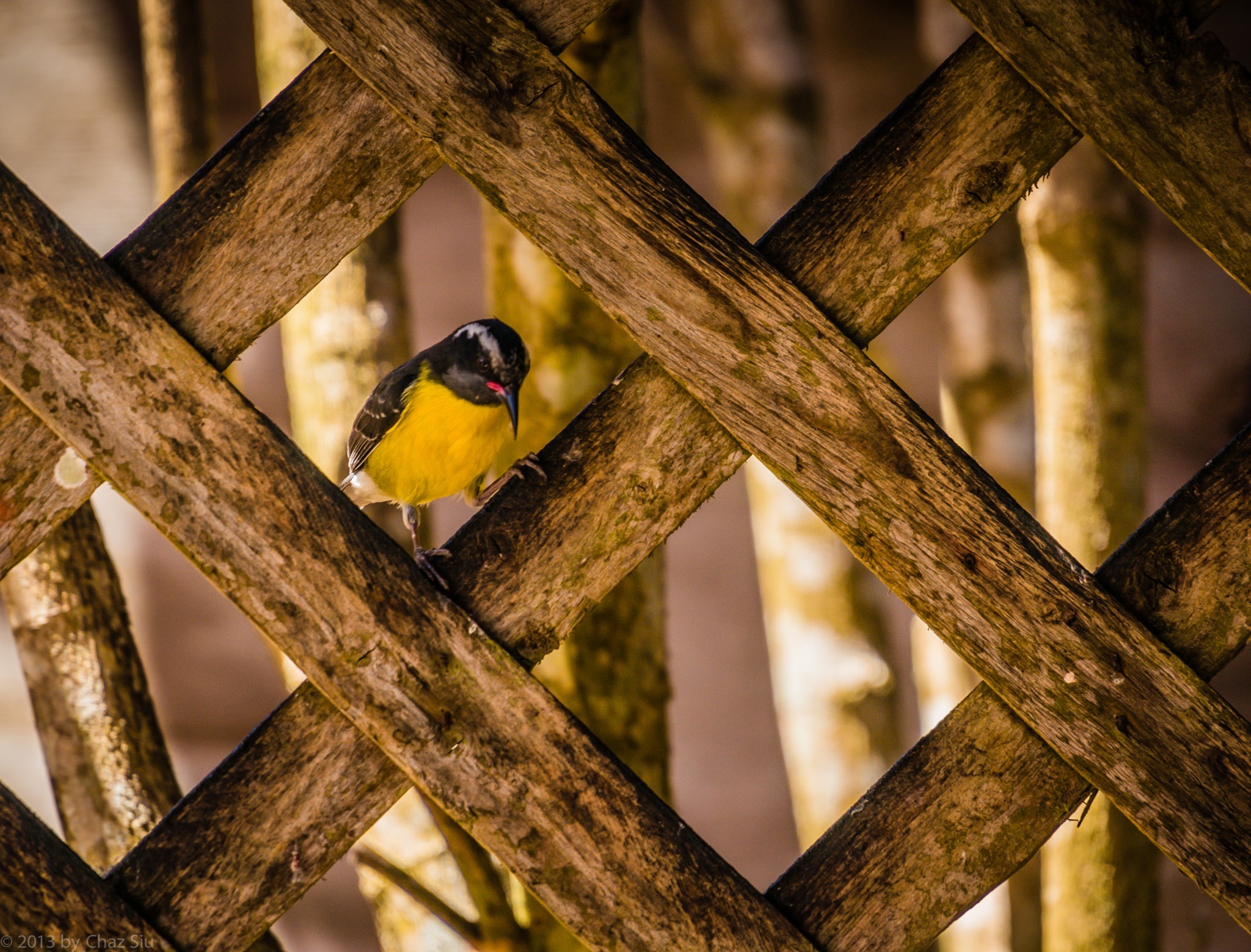
Yellowbreast In Latticework, Saba, Dutch Caribbean
Well, these ADD l’il guys may be everywhere on Saba, but this was the first chance I had to actually have one sitting still long enough to snap a focused picture. Now that I did, I think they’re kinda purty thangs…all them colors and such. Wonder if they taste good with in a wild mushroom/red wine demi-glacé? Did I write that out loud? Jus’ kiddin’….testing to see if anyone actually reads this blurb 🙂 Cute Tweetie can go be his hyper self with his squeaky family all in the yellow flower trees.
Light rain in the forecast on and off the next couple days, so everyone who’s not here in Saba cross your respective fingers for us. The cisterns–nay, the island–need it…big time.
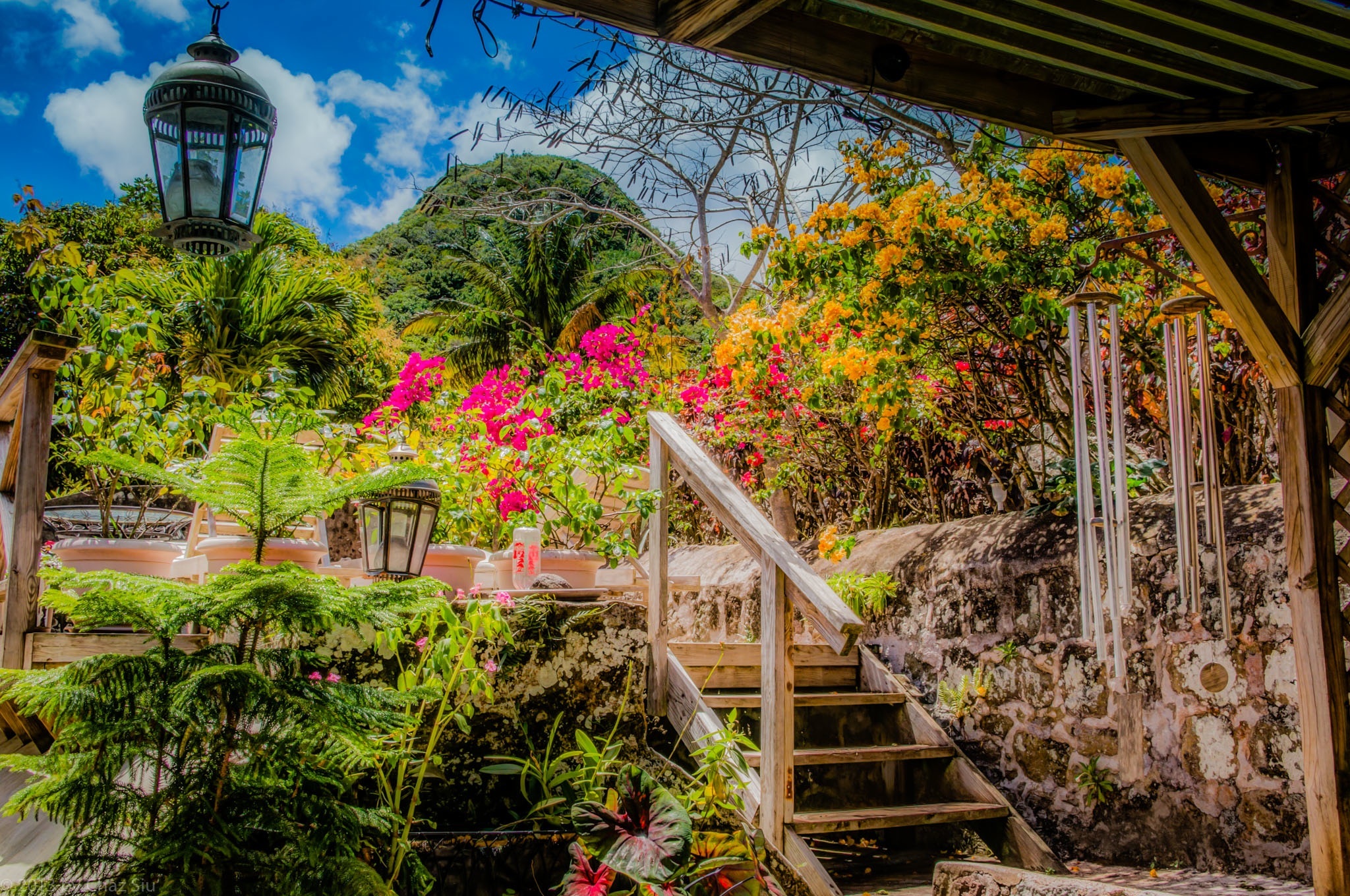
Yeah, I s’pose this could be any nice garden in the tropics, with bougainvillea, roses, and other plants, shrubs, and trees–whose names I remain blissfully ignorant of–lookin’ pretty. But no, this is Saba where such well tended gardens are rare. Scout’s Cottage is built into the hills of Windwardside below Mt. Scenery, a venerable cottage still visible in photos of Saba from late 1800’s/early 1900’s, and the current owner has really done it up, inside and out. Note that the wooden deck here is actually built around and on top of the main cistern for the house. That’s actually Maskehorne Hill in the background, whose views of Windwardside you may recall from this earlier blogpost.
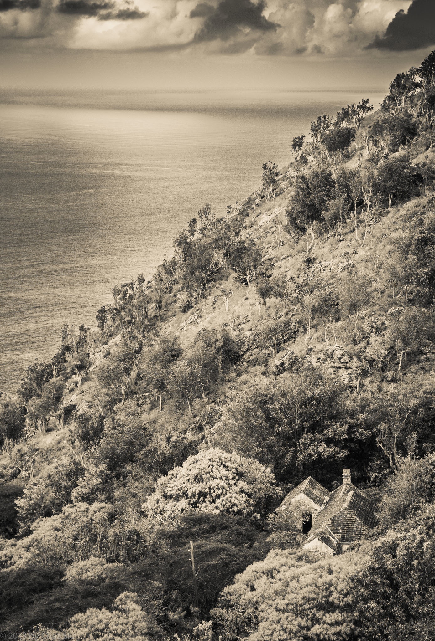
St. John’s House At The Base Of Thais Hill, Saba, Dutch Caribbean
The last few days have been me getting up earlier and earlier to try and beat the dreaded heat with no wind and do a bunch of ridge hikes up from the Giles Quarter coastline midway between the St. John’s Flat and the Wash Gut up to Windwardside. Saba’s terrain is so rugged and steep, it amplifies the actual distance you’re hiking, which is usually between 3-5 kilometers, but can feel like a lot more. Regardless, even at 7:00am, the heat is beating down mercilessly as I haul my big ol’ self up this rock.
In any case, repeated trips down to Fort Bay to start these coastline-ridge excursions had me passing this little house nestled in the cleft between St John’s Flat and Thais Hill. It’s an old style house, with rare brown wooden shingles rather than the traditional red corrugated tin,though you can’t tell from my processing it in black and white. My guess is that it’s well protected from the ravages of hurricanes and tropical storms as well, but I don’t know yet who, if anyone, lives in this nostalgic little house, but it sure looks cool from above, n’est cd pas?
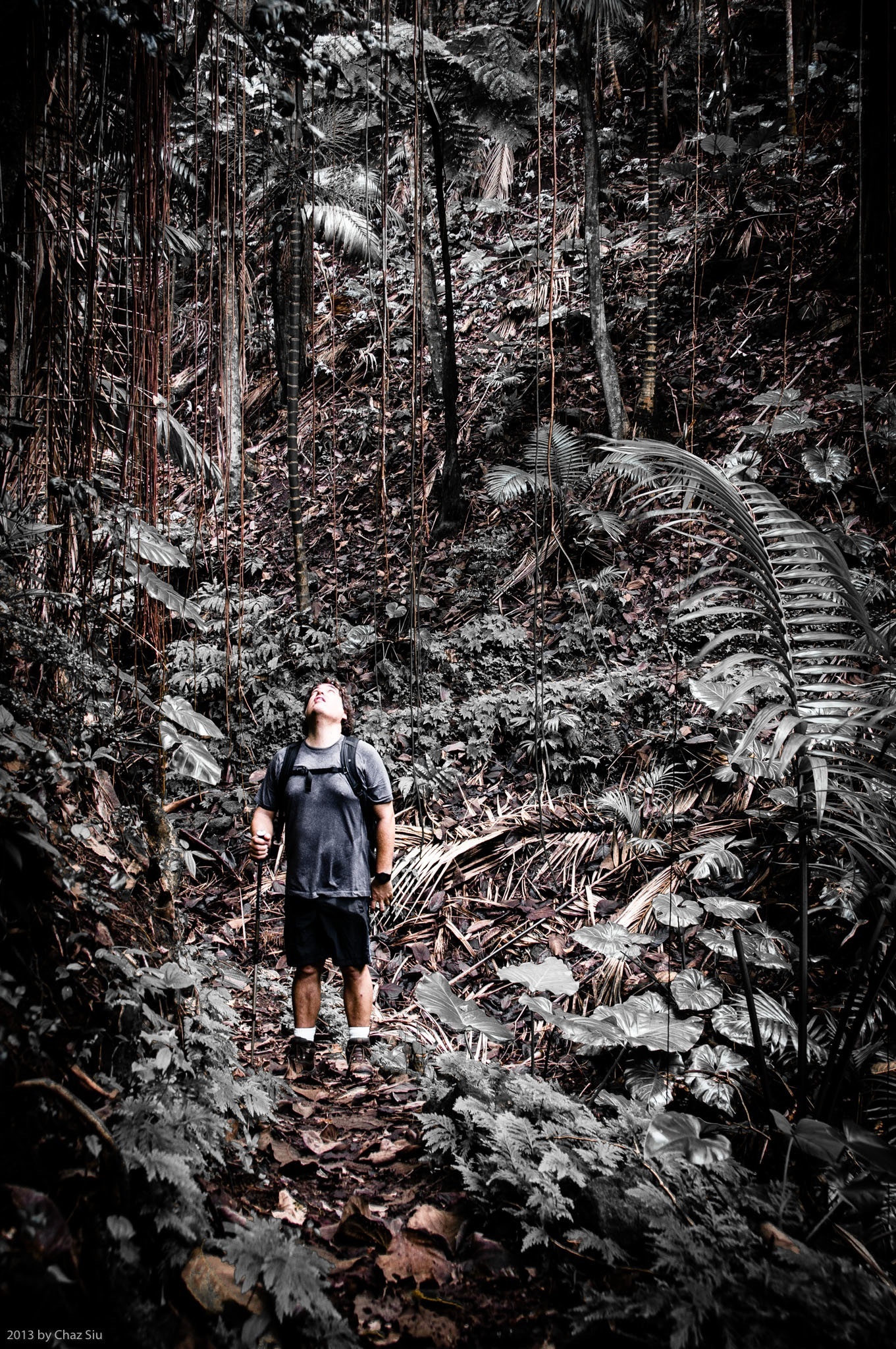
Michael Siu On The Sandy Cruz Trail, Saba, Dutch Caribbean
The Joy of Hiking The Rainforest
The locals and expats who live on the island of Saba often cite the Sandy Cruz trail as their favorite. Sandy Cruz traverses the north side of the island across several guts, and does so almost entirely under the cooling canopy of rainforest flora, excepting one short breakout strip that has a 180 degree vantage point to the wide Caribbean.
The other thing about hiking the trails of Saba other than Mt Scenery is that they are more often than not lightly traveled; its possible to spend a couple hours out and see no one, just the chirping of tropical birds, the wind in the giant leaves, the chatter of occasional rain onto the canopy above. On Sandy Cruz, there’s very few biting insects as well and it tends to be cooler, so it’s all the benefits of a jungle atmosphere to love without the mosquito kill slaps to the neck.
If you’ve read my Saba blogposts, I rarely have people as part of my landscape photos, but I caught my visiting brother Michael looking up as we were crossing one particular gut; reminding me not concentrate so hard on the trail that I forget to look up in the rainforest. Some gorgeous interplay of giant ferns, elephant ears and some of the amazing trees on Saba make for a beautiful canopy. You also get a sense of scale in this wet, wonderful wilderness.
In post processing for this picture,I desaturated the overwhelming green of the rainforest to get the red browns of the trail and the swinging vines to pop out around my brother. Michael is an exceptional photographer himself–check out his photos here–and we both dug the result, so here it is for your viewing pleasure.
Novel Update
Forty pages in and a plot line bubble sheet that resembles the doodle drawings of an asylum patient, the book effort continues to form as I forge forward each morning, getting my 500-1000 words in before heading outside for the day. I try not to re-read what I’ve written too much so as to avoid the infinite editing loop and/or get discouraged…this is still the precious draft period, so gotta get it all out of the muse first.
Have a glorious day, folks! It’s back to the ocean depths for my bro and I today.
My brother has arrived on Saba isle for a brief visit and brought a rescue camera so I can continue to bring you my shots of this lovely Caribbean paradise. Three cheers for him!
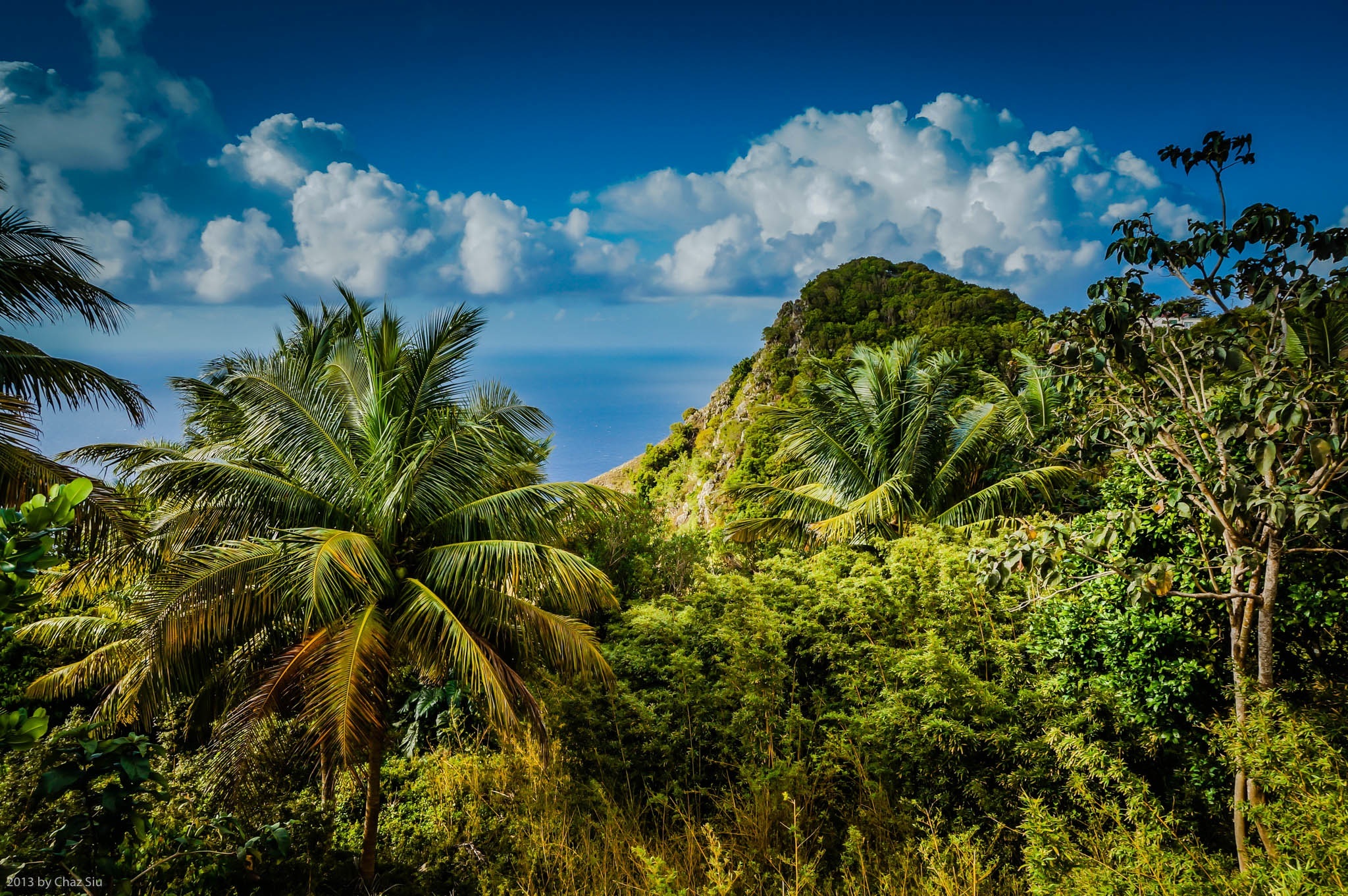
Today, some stunning cumulonimbus clouds stack like cotton candy above Peak Hill In Windwardside, with a view to the top of the Wash Gut that I climbed up with the scientist last week