Everywhere on Saba lie these ubiquitous stair steps made of volcanic rock hewn from the isle, including the Mt Scenery trail and countless other pathways in the four villages. Of course, they often lead to nowhere, formerly to terraced farms that have long since overgrown. C’est la vie. They are still uniquely Saban.
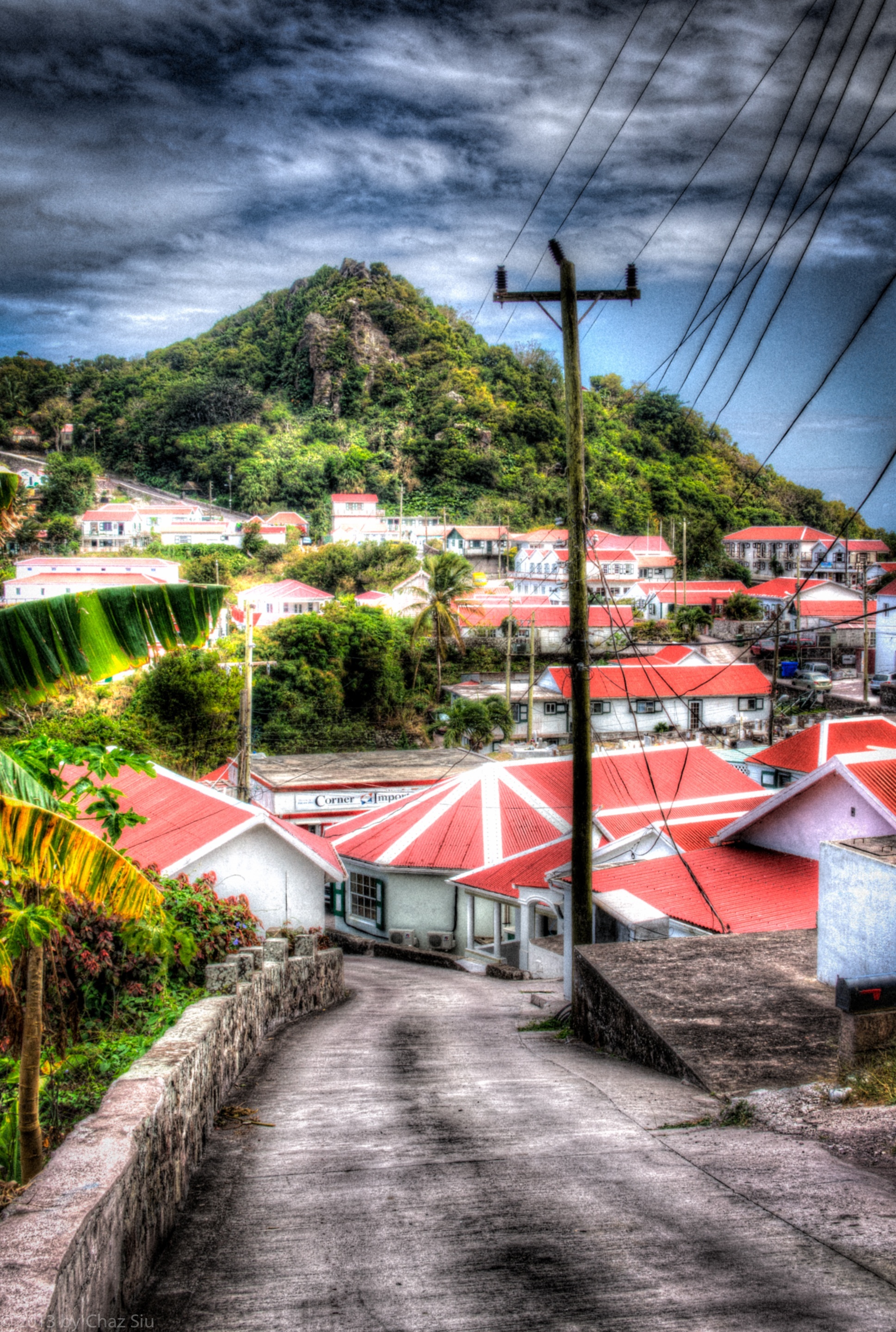
The rise of Instagram on the Web has been interesting to me. The program allows ordinary folks to take their digital smartphone pictures and rough them up to look like old Instamatic or Polaroids, so its retro throwback all the way. In that vein of thinking, I kept looking at this picture of a Windwardside road with the telephone lines strung haphazardly to every house, which poses an artistic challenge. My final Jeopardy answer was to rough the picture up, heap some good old film grain on it, and now I’m pleased with the sort of surreal picture that results. If you click on the picture to enlarge it, you’ll see it’s definitely a real picture, but when you pull back on it…this unusual image of the village emerges. In the end, its undeniably Saba, which is what I wanted. It could be nothing else in the world with this combo of colors, cottages, and tropical contours.
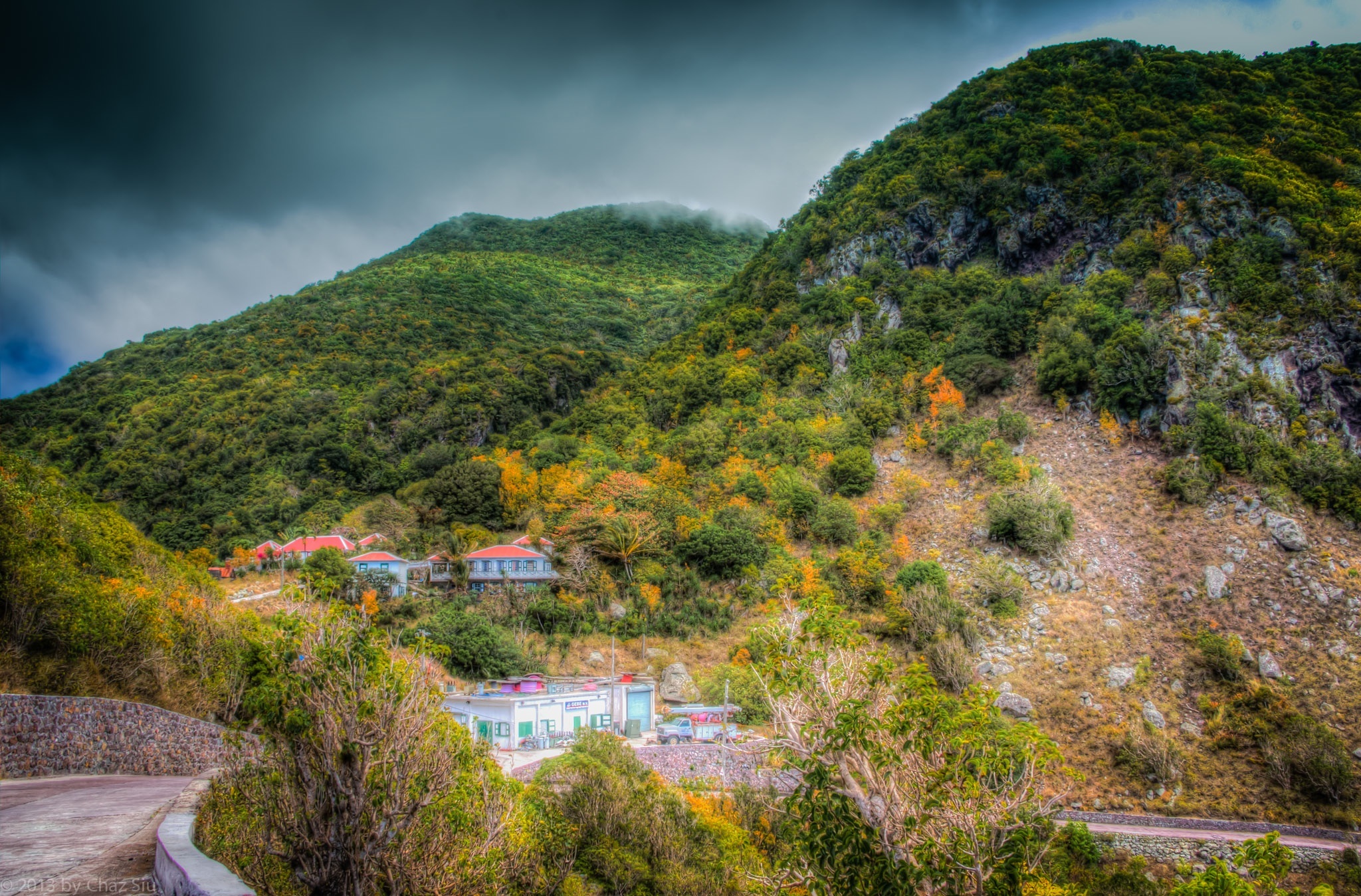
The Road Out Of St John’s Bends Around Past Old GEBE
My time is ticking, running out here on Saba, and just when I think I’ve run out of images to show, I confront The Road I take to Windwardside from St John’s every day, often 3-4 times a day, and see an artistic perspective I didn’t catch before. That’s today’s pic, the descent out of St John’s after I climb out of the Flat, and bend around past the old GEBE station, where the plaintive bleats and brays of goats on the ridges and cliffs continues, the wind sometimes moans in the cleft between the mountains, and the fog tops Mt Scenery. I dig this place, I really do. Guess I’ll be back in a few years…
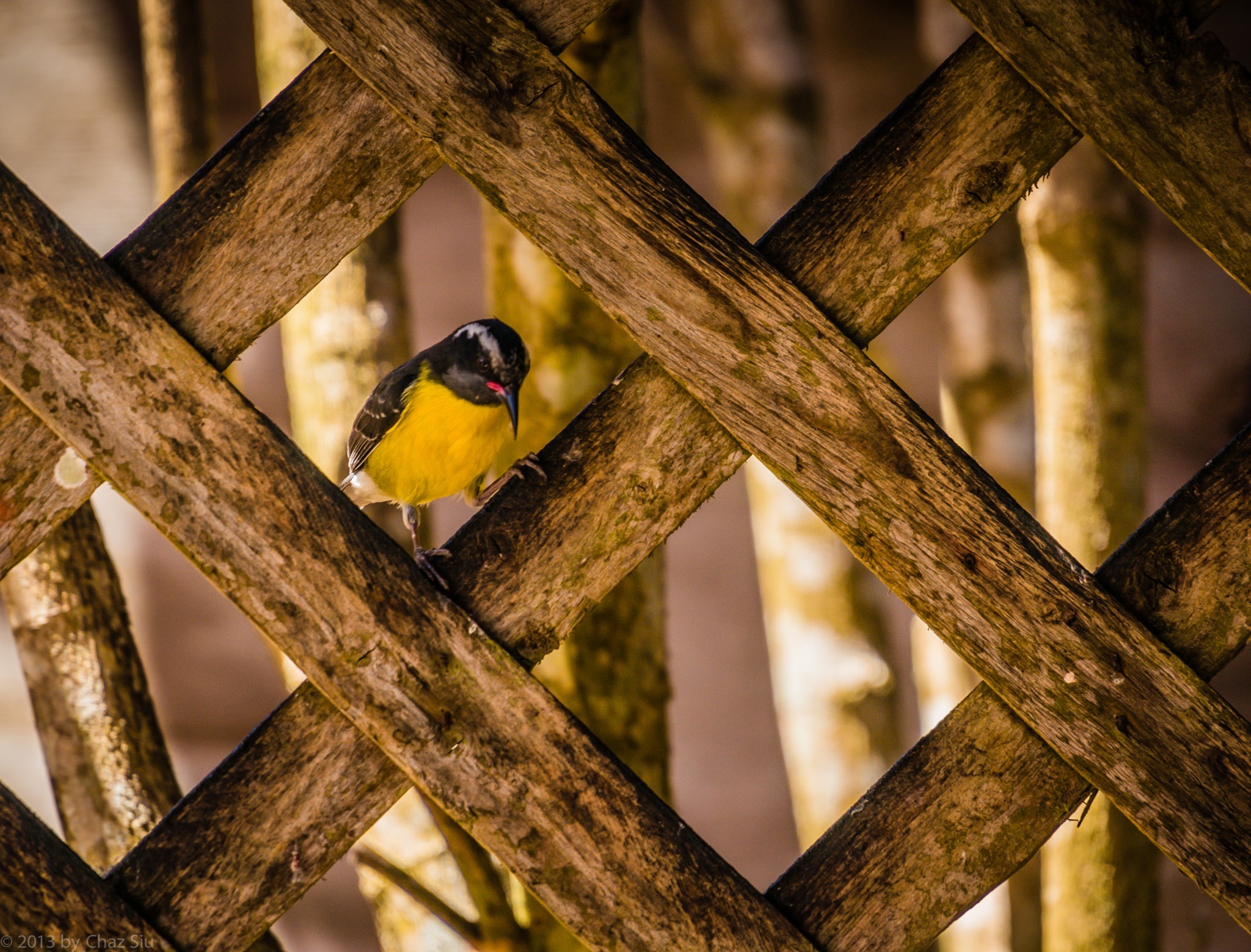
Yellowbreast In Latticework, Saba, Dutch Caribbean
Well, these ADD l’il guys may be everywhere on Saba, but this was the first chance I had to actually have one sitting still long enough to snap a focused picture. Now that I did, I think they’re kinda purty thangs…all them colors and such. Wonder if they taste good with in a wild mushroom/red wine demi-glacé? Did I write that out loud? Jus’ kiddin’….testing to see if anyone actually reads this blurb 🙂 Cute Tweetie can go be his hyper self with his squeaky family all in the yellow flower trees.
Light rain in the forecast on and off the next couple days, so everyone who’s not here in Saba cross your respective fingers for us. The cisterns–nay, the island–need it…big time.
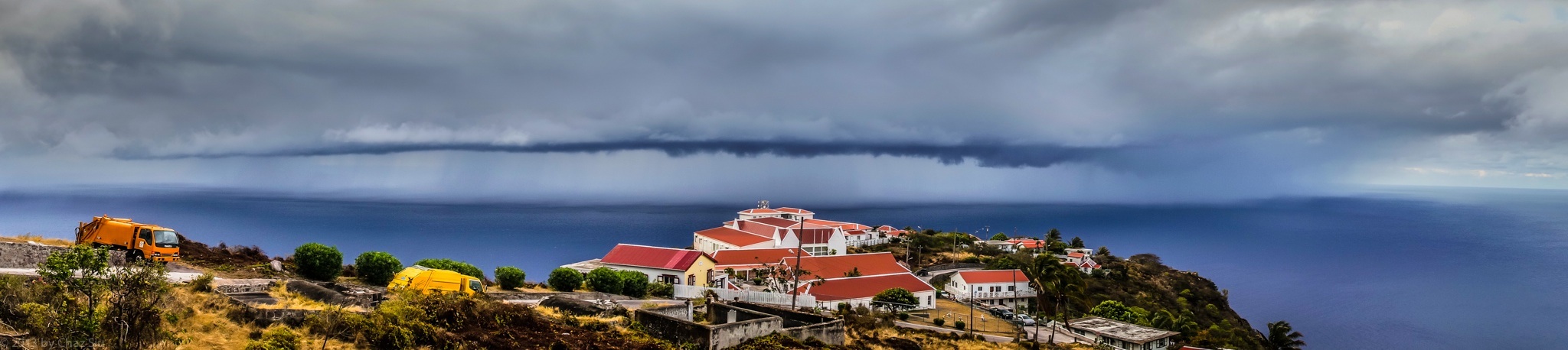
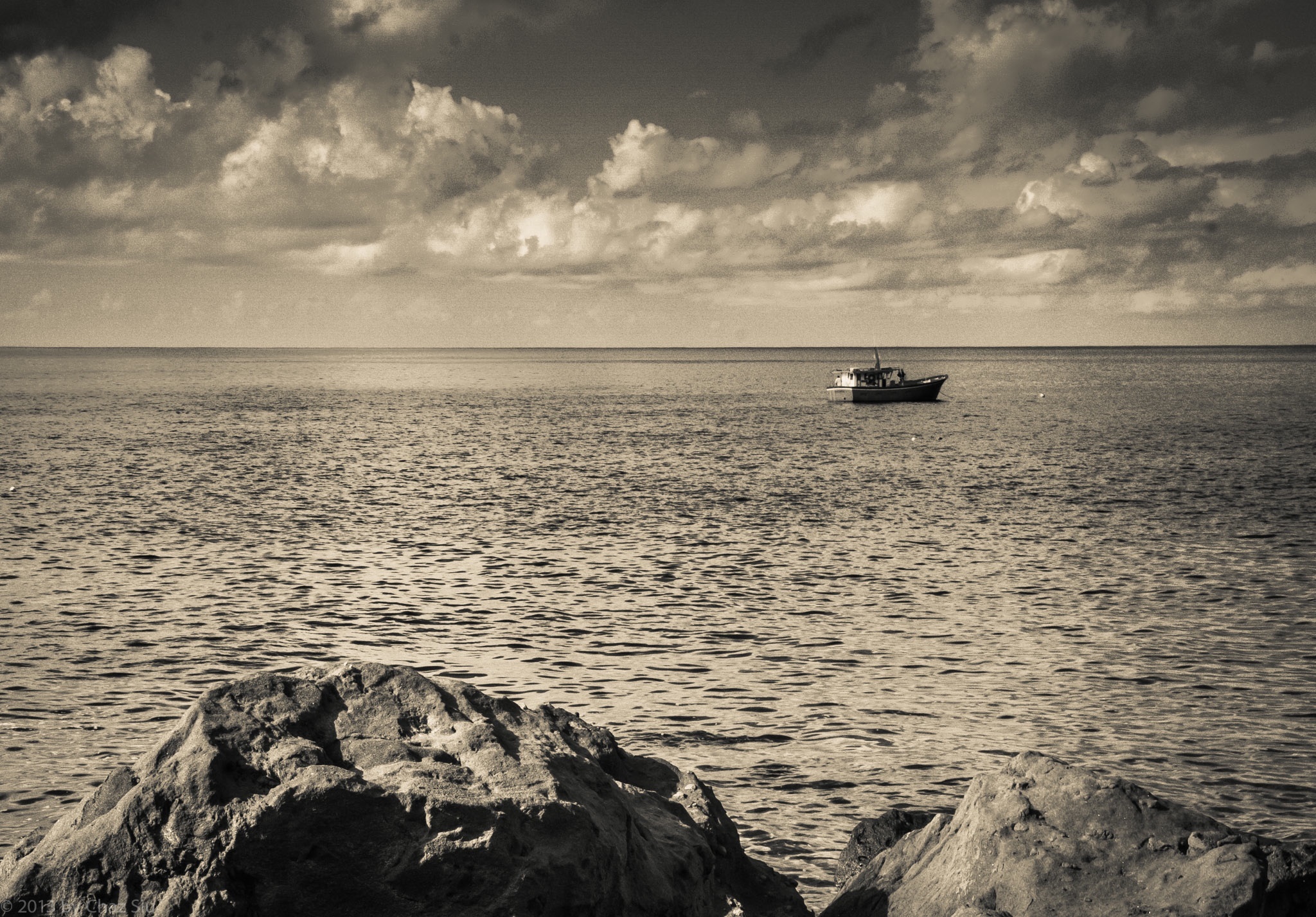
In recent days, I spoke about watching rainstorms drop massive water a few miles offshore while Saba struggles with draught conditions. Here’s the most compelling photo yet (click to make larger, if you’d like) to show you what Sabans see. We ended up getting about 15 minutes of light light sprinkle from this beastie, barely enough to cover an extra hand wash, but something is better’n nothing, unless that something is an angry honey badger.
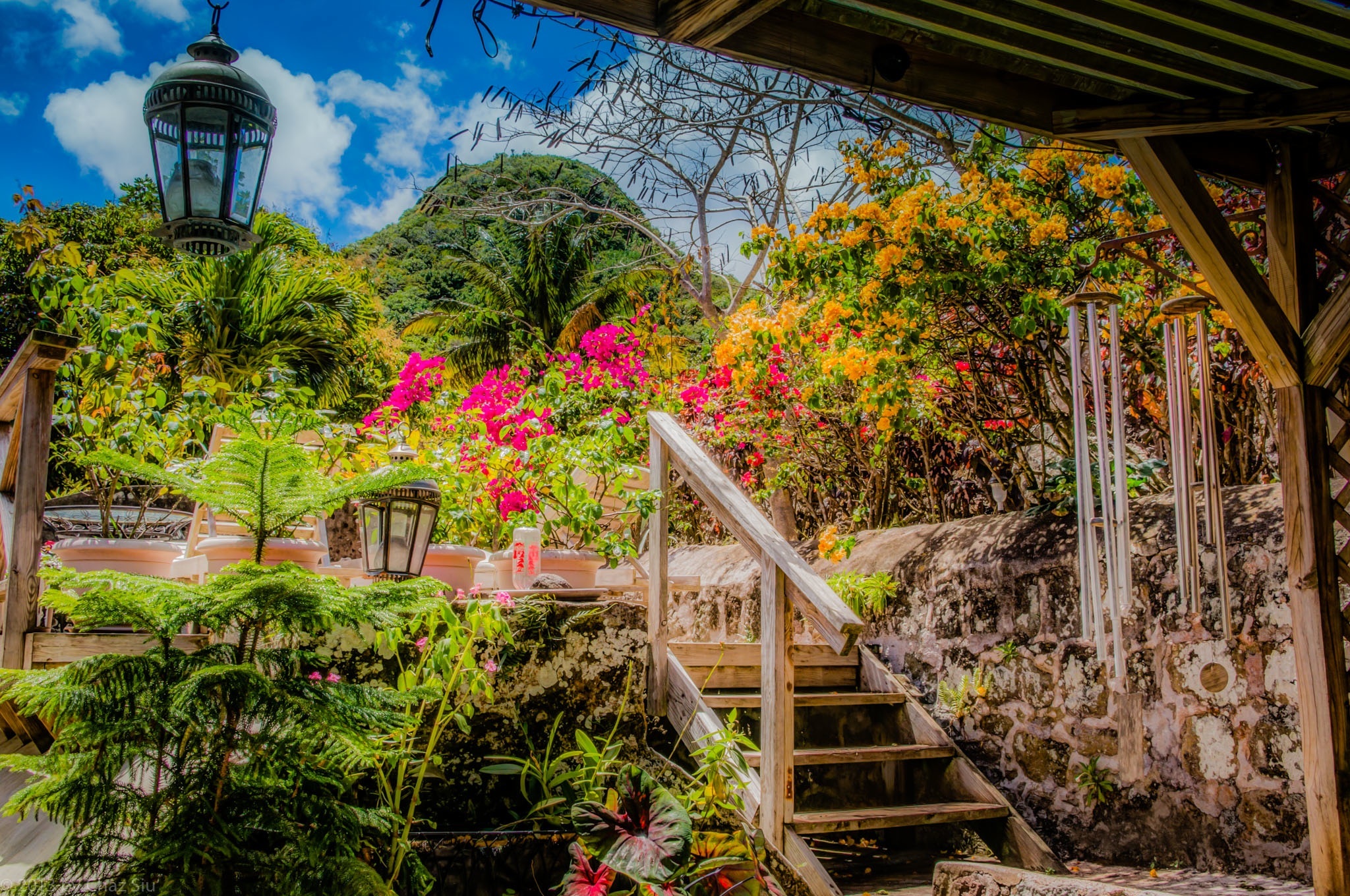
Yeah, I s’pose this could be any nice garden in the tropics, with bougainvillea, roses, and other plants, shrubs, and trees–whose names I remain blissfully ignorant of–lookin’ pretty. But no, this is Saba where such well tended gardens are rare. Scout’s Cottage is built into the hills of Windwardside below Mt. Scenery, a venerable cottage still visible in photos of Saba from late 1800’s/early 1900’s, and the current owner has really done it up, inside and out. Note that the wooden deck here is actually built around and on top of the main cistern for the house. That’s actually Maskehorne Hill in the background, whose views of Windwardside you may recall from this earlier blogpost.
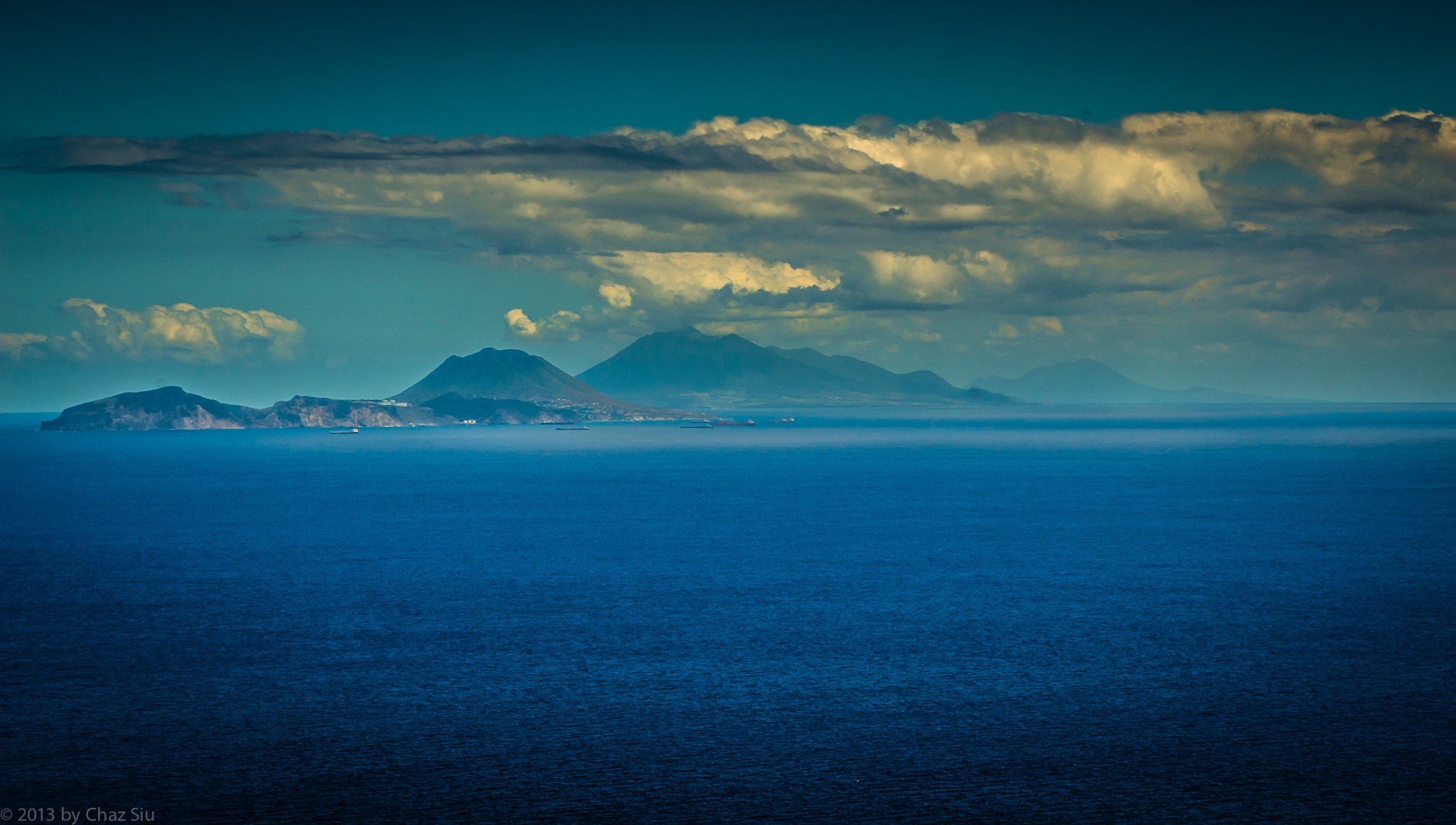
Exceptionally clear and blue day today with a horizon that went to forever. Click the picture to enlarge it and see the oil tankers lined up waiting on oil products from Statia’s refinery on the hill that faces Saba. I thought about posting the picture of the white bull being led by hand and rope out of St. John’s Flat for slaughter, but this seemed a bit more tranquil, which is my mood.
Just got home from late night karaoke at Scout’s Place and we walked outside and celebrated the rainy wet pavement. Hard to tell if it rained very long, but it was enough to leave the streets and buildings wet…that’s a few millimeters of precious cistern water for the parched Sabans.
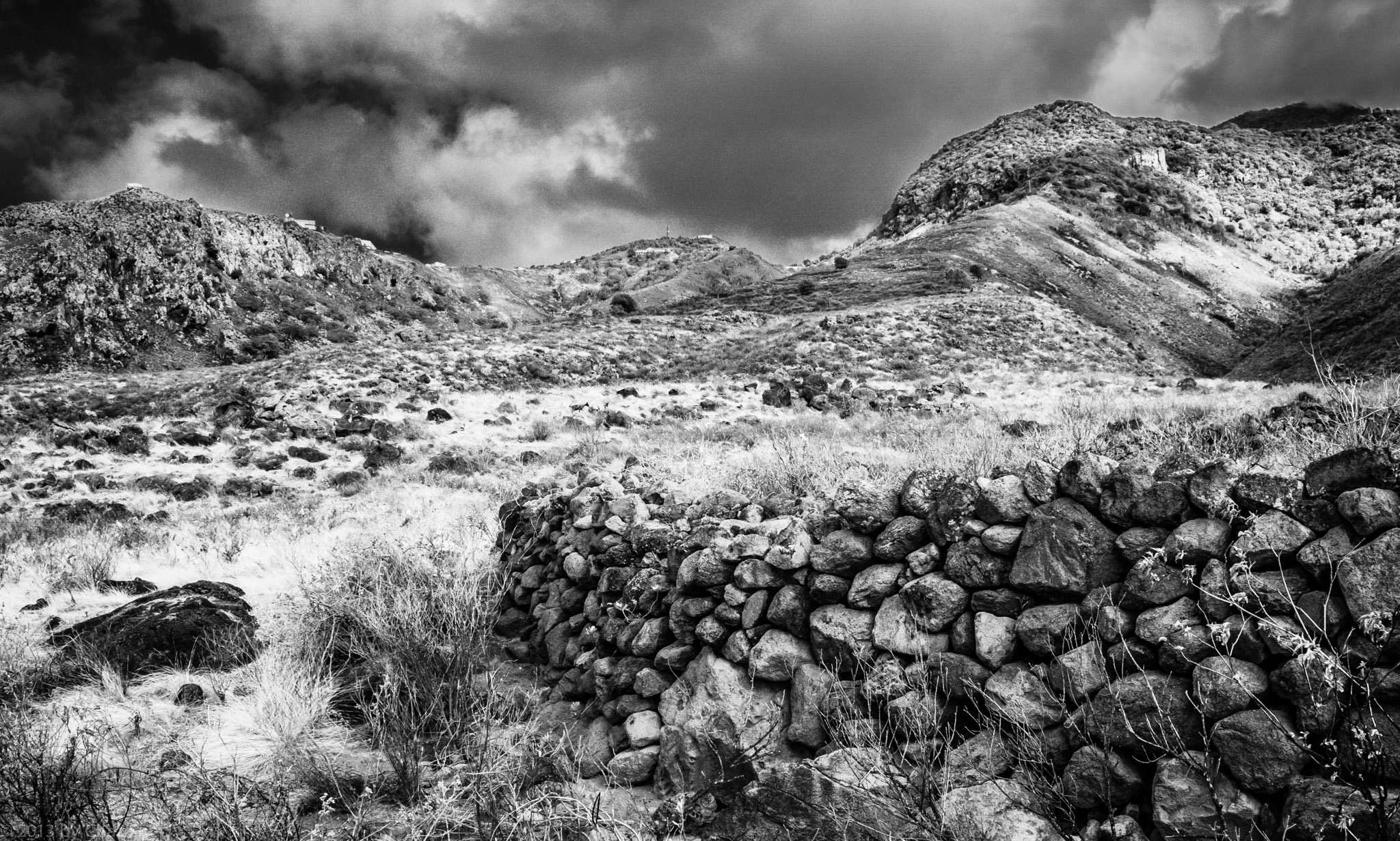
Stone Wall Remains, Giles Quarter, Saba, Dutch Caribbean
The Beekeepers of Saba
Spending a lot of time down on the Giles quarter coastline lately, coming up ridges and checking out the unique flora and fauna down there, as well as unusual and unique ruins. I showed this picture to the locals, asking what this big stone wall was for. It extends in a big circle, so I figured it for a pasture or remains of the sugar cane plantations in the late 1800’s (BTW, Saba no longer grows sugar cane…the dry climate can’t support it natively, either).
But oddly enough, folks told me it was for some kind of beekeeper’s colony, which puzzled me, as I’m not sure what good the stone wall encircling a bee haven would do. I’ll inquire around a little further to see what the scoop is.
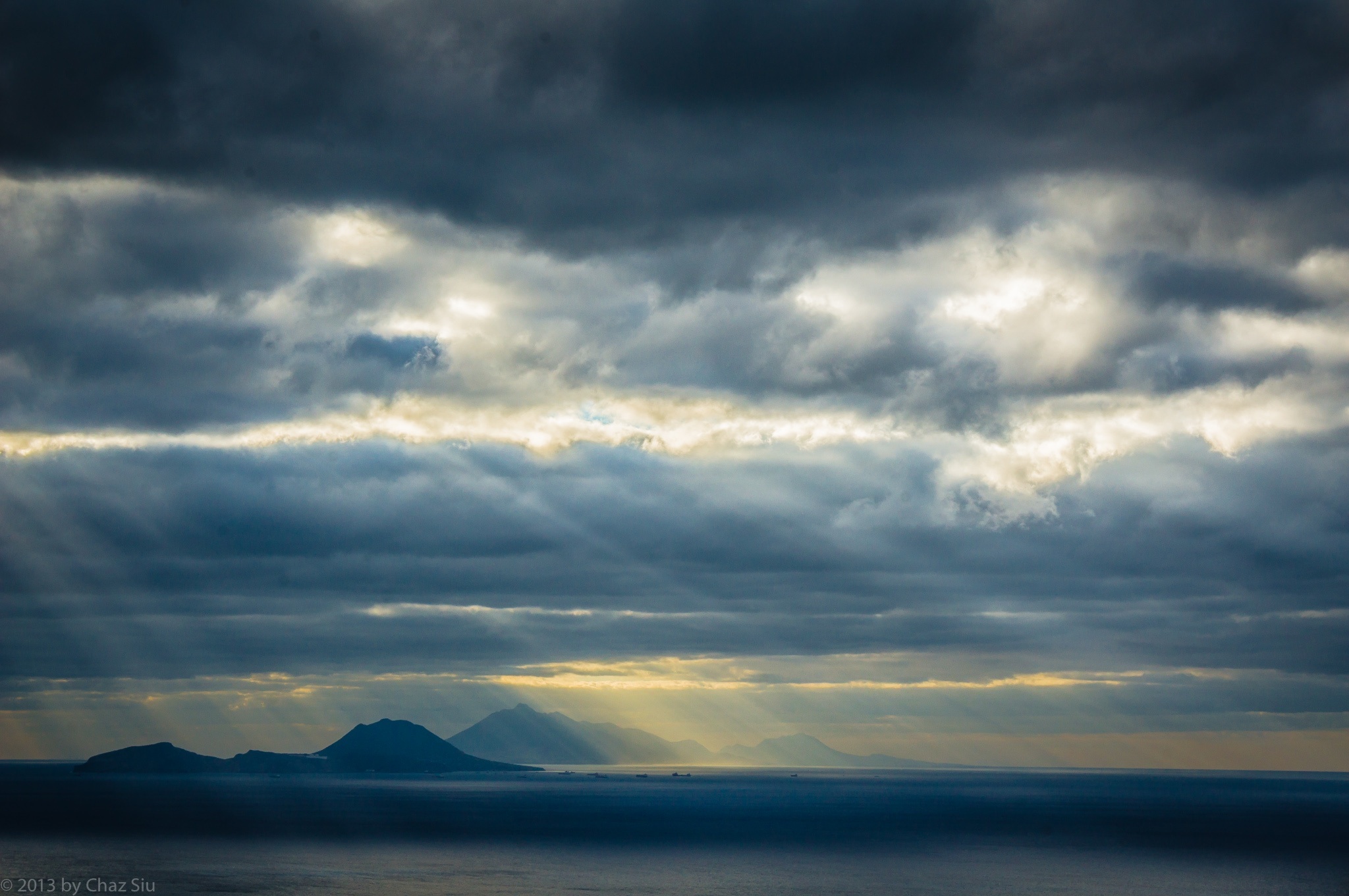
Sunbeams On Statia, St. Kitts, and Nevis, Saba, Dutch Caribbean
In part 9 of “What? Another sunrise picture, Chaz?”, I walked outside this morning, all ready to ramble down to the harbor for my morning dives, then saw these beams shooting out onto the nearby islands of Statia, St. Kitts, and Nevis. Opportunity knocked, I answered.
Clouds, clouds, everywhere, and poor ol’ Saba is still dry as a bone. At least it’s finally a little breezy up high in the villages. It’s quiet out in blog land lately….anybody out there?